
Media Alert: The Wyoming State Geological Survey and U.S. Geological Survey announce low-level helicopter flights in Central Wyoming
Scientists with the Wyoming State Geological Survey (WSGS) and the U.S. Geological Survey (USGS) are partnering to image geology using airborne geophysical technology
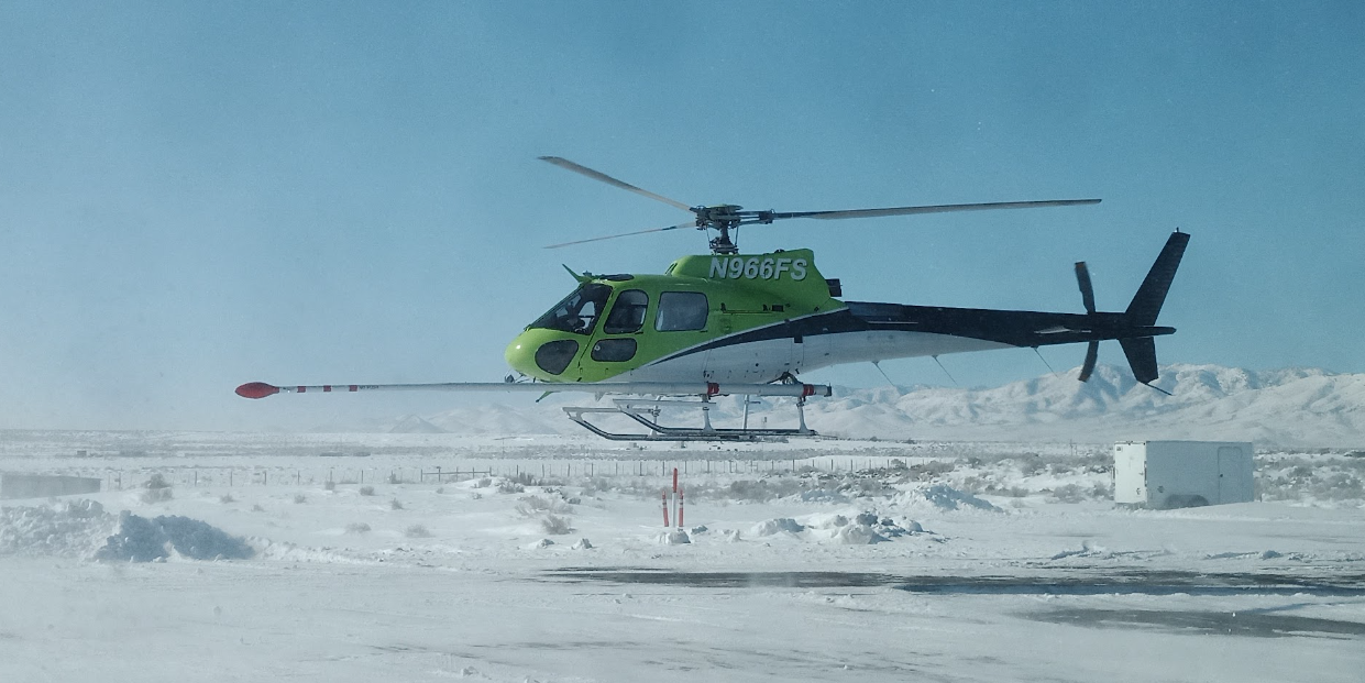
The new airborne geophysical survey data will be collected using a helicopter and will fly over parts of central Wyoming, weather permitting. The survey will begin in mid-May and be completed in about four months.
The purpose of the survey is to support mapping to understand the regional geology of central Wyoming. The geophysical survey will focus near South Pass at the southern end of the Wind River Range and on the Granite Mountains west of Pathfinder Reservoir. The region is known for historic and current mineral exploration, and there are several areas that are of high interest for their mineral potential. This region also has incompletely understood earthquake hazards.
Covering more than 3,300 square miles, the new geophysical survey will use the latest technological developments that will allow scientists to develop high-resolution three-dimensional representations of geology to depths over 3200 feet (1 kilometer) below the surface.

The 3D models and maps produced from the survey will help understand the distribution of groundwater, mineral and energy resources, as well as the potential for natural hazards. Data collected as part of this effort will be made public and used by the WSGS and the USGS to guide more detailed geologic mapping at local scales.
The helicopter will fly along pre-planned flight paths relatively low to the ground at more than 300 feet (100 meters) above the surface. The ground clearance will be increased to about 1,000 feet (300+ meters) over populated areas in order to comply with FAA regulations. Flight line separation will be more than 600 feet (200 meters) throughout the survey area.
Instruments on the helicopter will measure variations in the Earth’s magnetic field and natural low-level radiation created by different rock types. This information will help researchers develop geologic maps in three dimensions.

The USGS is contracting with New Sense Geophysics Ltd. and Merrick-Surdex Joint Venture to collect data.
The scientific instruments on the helicopter are completely passive with no emissions that pose a risk to humans, animals, or plant life. No photography or video data will be collected. The data collected will be made freely available to the public once complete. The aircraft will be flown by experienced pilots that are specially trained and approved for low-level flying. The companies work with the FAA to ensure flights are safe and in accordance with U.S. law. The surveys will be conducted during daylight hours only.
This survey fits into a broader effort by the USGS, the WSGS and many other state geological surveys, and other partners, including private companies, academics and State and Federal agencies to modernize our understanding of the Nation’s fundamental geologic framework and knowledge of mineral resources. This effort is known as the Earth Mapping Resources Initiative, and it includes airborne geophysical surveys like this one, geochemical reconnaissance surveys and geologic mapping projects.
For more information related to this survey see the project announcement.
Related Content

Earth Mapping Resources Initiative (Earth MRI)
Related Content
- Science
Earth Mapping Resources Initiative (Earth MRI)
The goal of Earth MRI is to improve our knowledge of the geologic framework in the United States and to identify areas that may have the potential to contain undiscovered critical mineral resources. Enhancement of our domestic mineral supply will decrease the Nation’s reliance on foreign sources of minerals that are fundamental to our security and economy. - News
Get Our News
These items are in the RSS feed format (Really Simple Syndication) based on categories such as topics, locations, and more. You can install and RSS reader browser extension, software, or use a third-party service to receive immediate news updates depending on the feed that you have added. If you click the feed links below, they may look strange because they are simply XML code. An RSS reader can easily read this code and push out a notification to you when something new is posted to our site.