

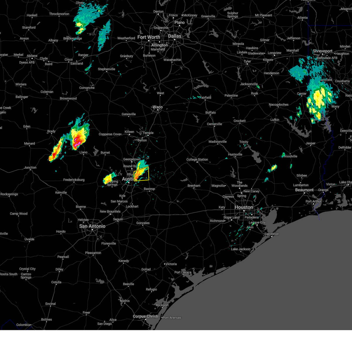
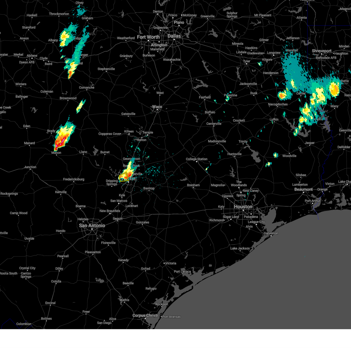
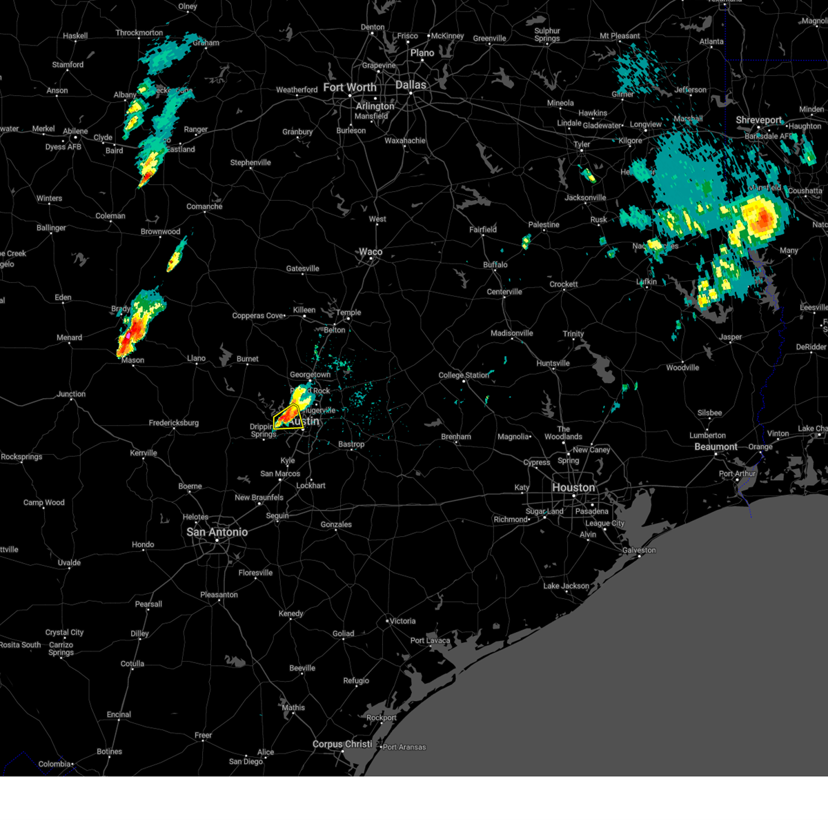
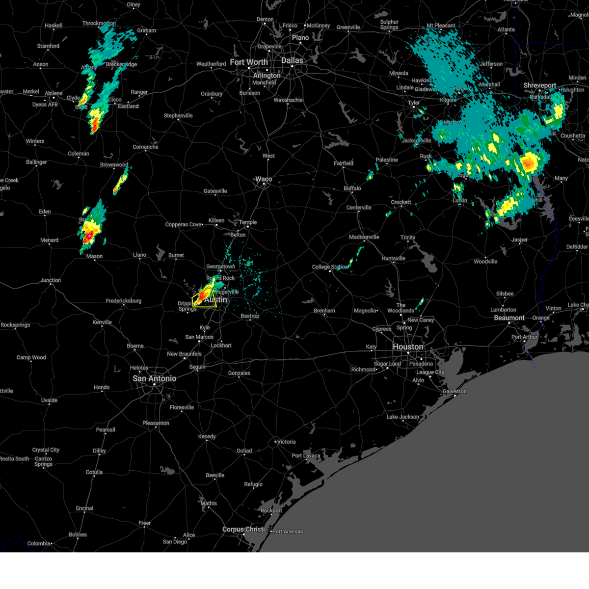
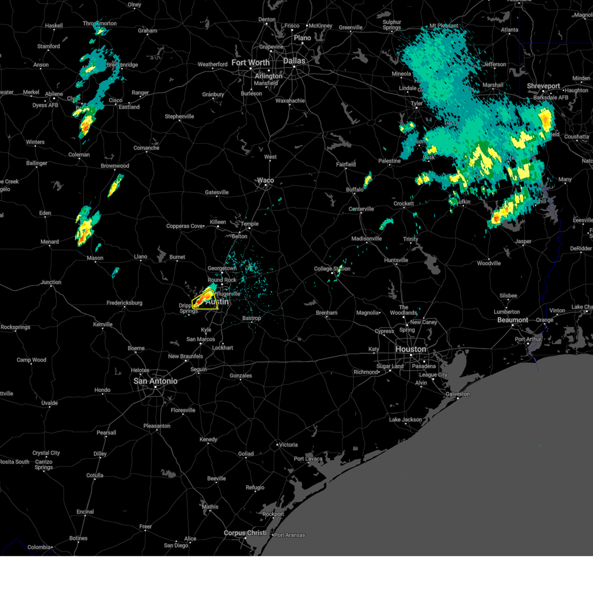
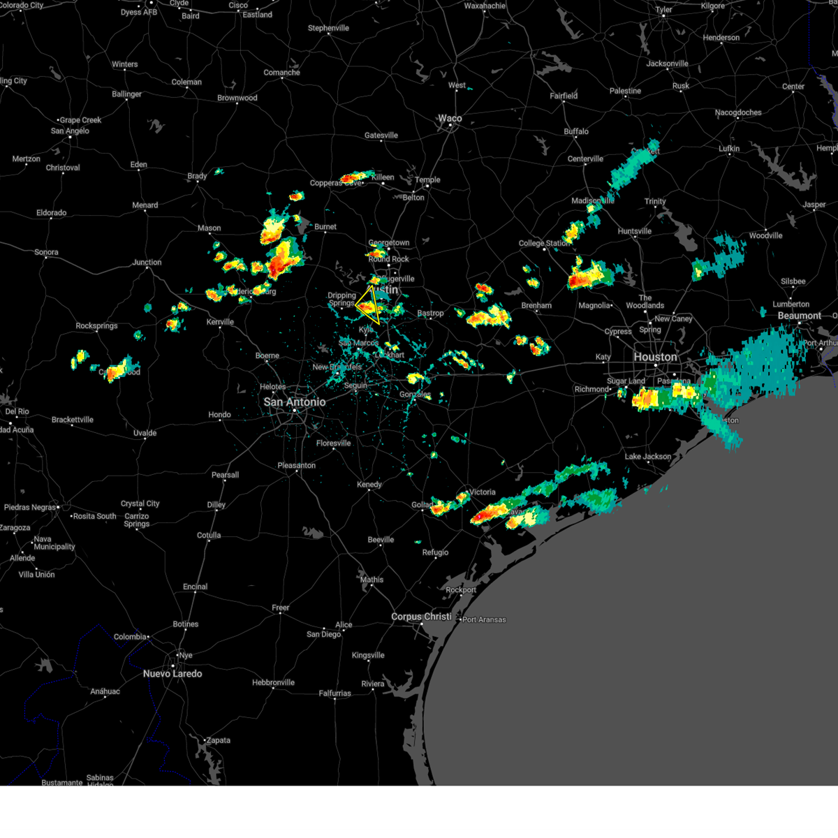
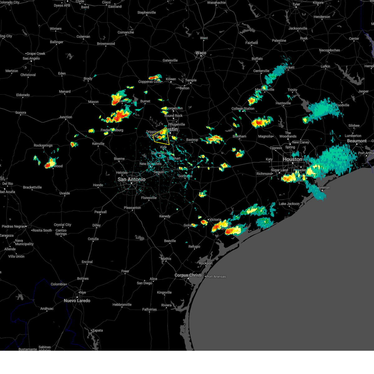
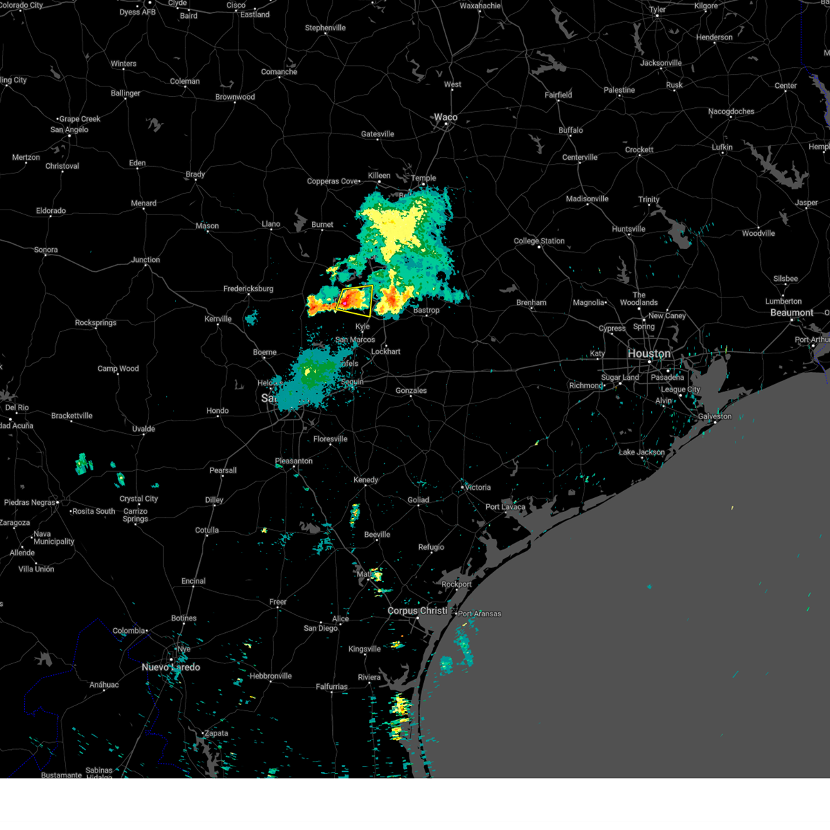
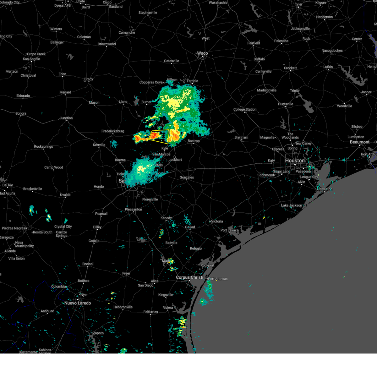
Hail Map for Austin, TX
The Austin, TX area has had 130 reports of on-the-ground hail by trained spotters, and has been under severe weather warnings 87 times during the past 12 months. Doppler radar has detected hail at or near Austin, TX on 107 occasions, including 12 occasions during the past year.
| Name: | Austin, TX |
| Where Located: | 56.8 miles S of Killeen, TX |
| Map: | Google Map for Austin, TX |
| Population: | 790390 |
| Housing Units: | 354241 |
| More Info: | Search Google for Austin, TX |
4
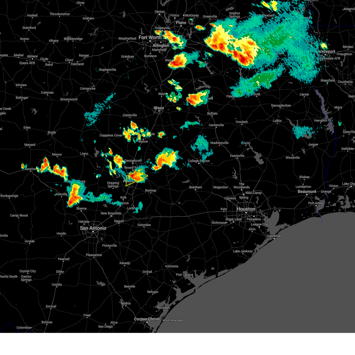
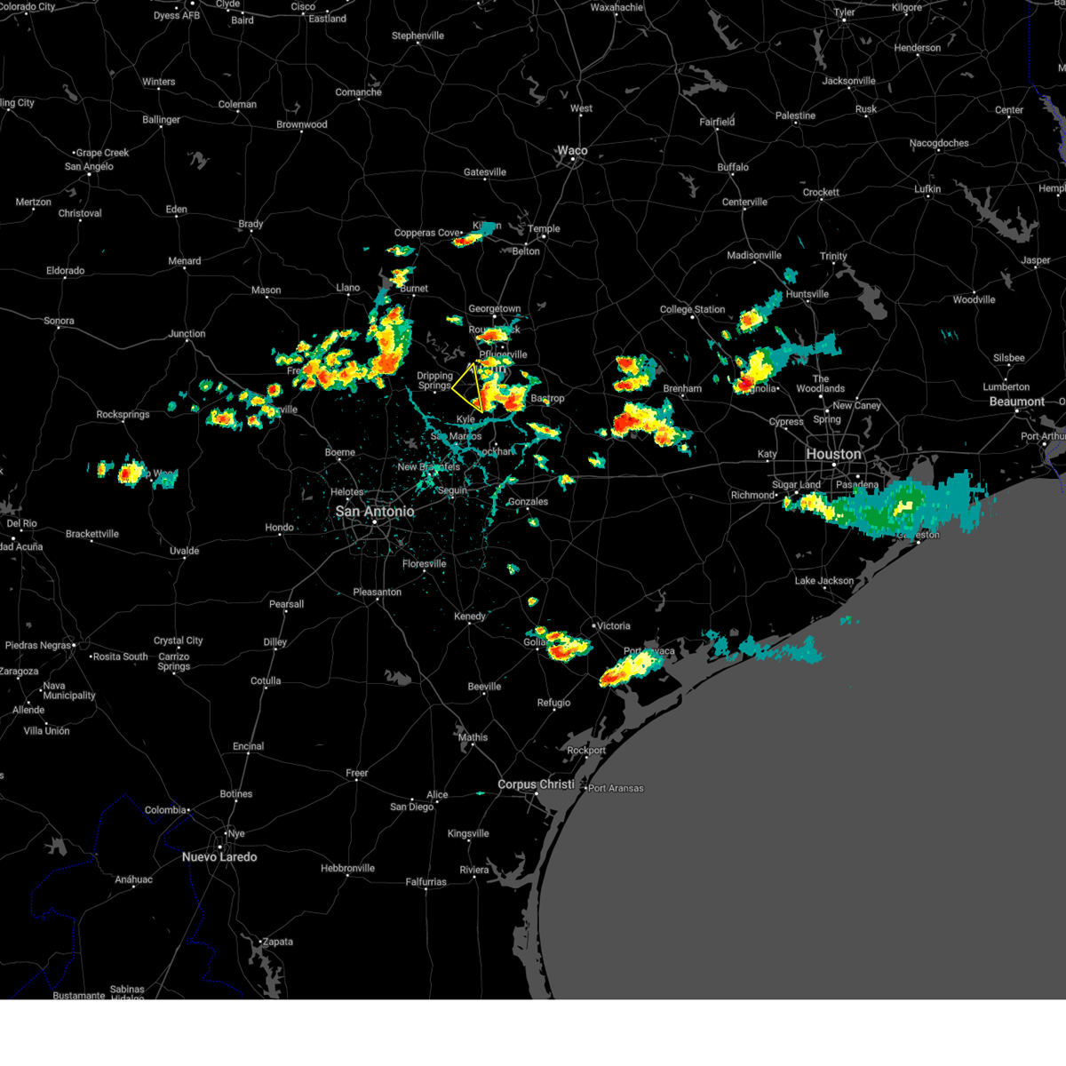
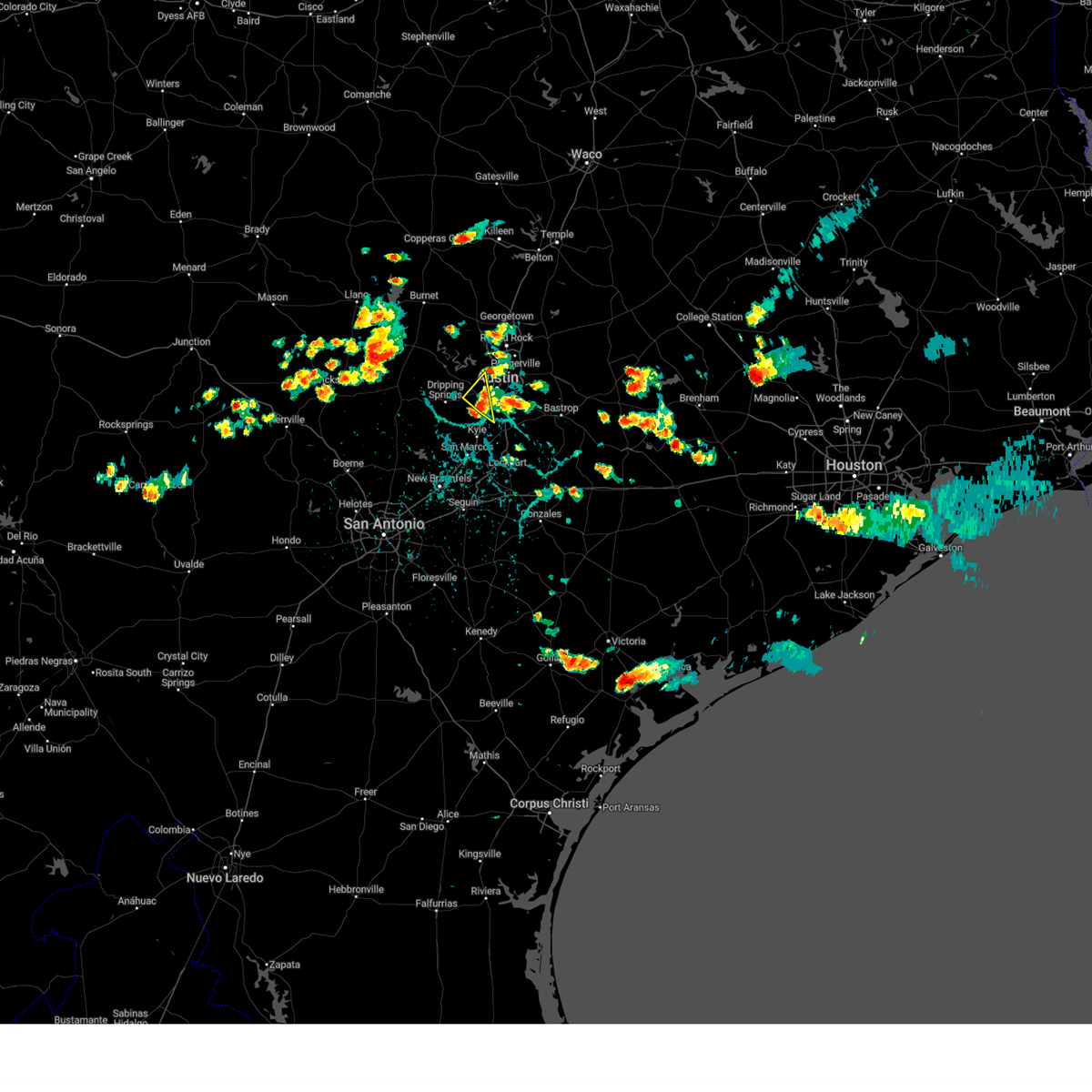
The Top Recent Hail Date for Austin, TX is Tuesday, April 9, 2024 (2nd out of 107)

Hail and Wind Damage Spotted near Austin, TX
| Date / Time | Report Details |
|---|---|
| 4/9/2024 9:32 PM CDT |
 At 932 pm cdt, a severe thunderstorm was located near wyldwood, or 10 miles southwest of elgin, moving east at 50 mph (radar indicated). Hazards include two inch hail and 60 mph wind gusts. People and animals outdoors will be injured. expect hail damage to roofs, siding, windows, and vehicles. expect wind damage to roofs, siding, and trees. Locations impacted include, austin, elgin, bastrop, giddings, lexington, austin bergstrom int airport, manor, dime box, fedor, paige, tanglewood, camp swift, circle d-kc estates, cedar creek, lake somerville state park & trailway, wyldwood, coupland, hornsby bend, webberville, and carmine. At 932 pm cdt, a severe thunderstorm was located near wyldwood, or 10 miles southwest of elgin, moving east at 50 mph (radar indicated). Hazards include two inch hail and 60 mph wind gusts. People and animals outdoors will be injured. expect hail damage to roofs, siding, windows, and vehicles. expect wind damage to roofs, siding, and trees. Locations impacted include, austin, elgin, bastrop, giddings, lexington, austin bergstrom int airport, manor, dime box, fedor, paige, tanglewood, camp swift, circle d-kc estates, cedar creek, lake somerville state park & trailway, wyldwood, coupland, hornsby bend, webberville, and carmine.
|
| 4/9/2024 9:28 PM CDT |
 Svrewx the national weather service in austin san antonio has issued a * severe thunderstorm warning for, southeastern williamson county in south central texas, southeastern travis county in south central texas, bastrop county in south central texas, lee county in south central texas, northeastern fayette county in south central texas, * until 1030 pm cdt. * at 927 pm cdt, a severe thunderstorm was located near wyldwood, or 7 miles east of austin bergstrom int airport, moving east at 50 mph (radar indicated). Hazards include ping pong ball size hail and 60 mph wind gusts. People and animals outdoors will be injured. expect hail damage to roofs, siding, windows, and vehicles. Expect wind damage to roofs, siding, and trees. Svrewx the national weather service in austin san antonio has issued a * severe thunderstorm warning for, southeastern williamson county in south central texas, southeastern travis county in south central texas, bastrop county in south central texas, lee county in south central texas, northeastern fayette county in south central texas, * until 1030 pm cdt. * at 927 pm cdt, a severe thunderstorm was located near wyldwood, or 7 miles east of austin bergstrom int airport, moving east at 50 mph (radar indicated). Hazards include ping pong ball size hail and 60 mph wind gusts. People and animals outdoors will be injured. expect hail damage to roofs, siding, windows, and vehicles. Expect wind damage to roofs, siding, and trees.
|
| 4/9/2024 9:12 PM CDT | Quarter sized hail reported 8.8 miles NNE of Austin, TX, public report of 1 inch diameter hail at slaughter lane and interstate 35. |
| 4/9/2024 9:11 PM CDT | Quarter sized hail reported 8.1 miles NNE of Austin, TX, report from mping quarter. |
| 4/9/2024 9:05 PM CDT |
 the severe thunderstorm warning has been cancelled and is no longer in effect the severe thunderstorm warning has been cancelled and is no longer in effect
|
| 4/9/2024 9:05 PM CDT |
 At 905 pm cdt, a severe thunderstorm was located over tanglewood forest, moving east at 35 mph (radar indicated). Hazards include 60 mph wind gusts and nickel size hail. Expect damage to roofs, siding, and trees. Locations impacted include, austin, kyle, buda, dripping springs, wimberley, tanglewood forest, austin bergstrom int airport, west lake hills, woodcreek, rollingwood, mustang ridge, niederwald, bear creek, barton creek, henly, shady hollow, onion creek, driftwood, manchaca, and mountain city. At 905 pm cdt, a severe thunderstorm was located over tanglewood forest, moving east at 35 mph (radar indicated). Hazards include 60 mph wind gusts and nickel size hail. Expect damage to roofs, siding, and trees. Locations impacted include, austin, kyle, buda, dripping springs, wimberley, tanglewood forest, austin bergstrom int airport, west lake hills, woodcreek, rollingwood, mustang ridge, niederwald, bear creek, barton creek, henly, shady hollow, onion creek, driftwood, manchaca, and mountain city.
|
| 4/9/2024 8:43 PM CDT |
 At 843 pm cdt, a severe thunderstorm was located near cedar park, moving east at 20 mph (radar indicated). Hazards include 60 mph wind gusts and quarter size hail. Hail damage to vehicles is expected. expect wind damage to roofs, siding, and trees. Locations impacted include, austin, round rock, cedar park, georgetown, pflugerville, anderson mill, windemere, leander, hutto, brushy creek, wells branch, jollyville, and jonah. At 843 pm cdt, a severe thunderstorm was located near cedar park, moving east at 20 mph (radar indicated). Hazards include 60 mph wind gusts and quarter size hail. Hail damage to vehicles is expected. expect wind damage to roofs, siding, and trees. Locations impacted include, austin, round rock, cedar park, georgetown, pflugerville, anderson mill, windemere, leander, hutto, brushy creek, wells branch, jollyville, and jonah.
|
| 4/9/2024 8:42 PM CDT |
 Svrewx the national weather service in austin san antonio has issued a * severe thunderstorm warning for, northern caldwell county in south central texas, hays county in south central texas, southwestern travis county in south central texas, southeastern blanco county in south central texas, north central comal county in south central texas, * until 945 pm cdt. * at 841 pm cdt, a severe thunderstorm was located over driftwood, or over dripping springs, moving east at 35 mph. a second severe storm was located over blanco and was also moving east at 35 mph (radar indicated). Hazards include 60 mph wind gusts and quarter size hail. Hail damage to vehicles is expected. Expect wind damage to roofs, siding, and trees. Svrewx the national weather service in austin san antonio has issued a * severe thunderstorm warning for, northern caldwell county in south central texas, hays county in south central texas, southwestern travis county in south central texas, southeastern blanco county in south central texas, north central comal county in south central texas, * until 945 pm cdt. * at 841 pm cdt, a severe thunderstorm was located over driftwood, or over dripping springs, moving east at 35 mph. a second severe storm was located over blanco and was also moving east at 35 mph (radar indicated). Hazards include 60 mph wind gusts and quarter size hail. Hail damage to vehicles is expected. Expect wind damage to roofs, siding, and trees.
|
| 4/9/2024 8:27 PM CDT |
 Svrewx the national weather service in austin san antonio has issued a * severe thunderstorm warning for, southwestern williamson county in south central texas, northeastern travis county in south central texas, * until 915 pm cdt. * at 827 pm cdt, a severe thunderstorm was located over leander, or over cedar park, moving east at 20 mph (public). Hazards include 60 mph wind gusts and quarter size hail. Hail damage to vehicles is expected. Expect wind damage to roofs, siding, and trees. Svrewx the national weather service in austin san antonio has issued a * severe thunderstorm warning for, southwestern williamson county in south central texas, northeastern travis county in south central texas, * until 915 pm cdt. * at 827 pm cdt, a severe thunderstorm was located over leander, or over cedar park, moving east at 20 mph (public). Hazards include 60 mph wind gusts and quarter size hail. Hail damage to vehicles is expected. Expect wind damage to roofs, siding, and trees.
|
| 4/9/2024 8:16 PM CDT |
 the severe thunderstorm warning has been cancelled and is no longer in effect the severe thunderstorm warning has been cancelled and is no longer in effect
|
| 4/9/2024 8:16 PM CDT |
 At 815 pm cdt, a severe thunderstorm was located over leander, or near cedar park, moving east at 40 mph (radar indicated). Hazards include 60 mph wind gusts and quarter size hail. Hail damage to vehicles is expected. expect wind damage to roofs, siding, and trees. Locations impacted include, round rock, cedar park, georgetown, anderson mill, leander, lago vista, liberty hill, jonestown, volente, brushy creek, seward junction, and jollyville. At 815 pm cdt, a severe thunderstorm was located over leander, or near cedar park, moving east at 40 mph (radar indicated). Hazards include 60 mph wind gusts and quarter size hail. Hail damage to vehicles is expected. expect wind damage to roofs, siding, and trees. Locations impacted include, round rock, cedar park, georgetown, anderson mill, leander, lago vista, liberty hill, jonestown, volente, brushy creek, seward junction, and jollyville.
|
| 4/9/2024 8:03 PM CDT |
 At 803 pm cdt, a severe thunderstorm was located near lago vista, or 11 miles west of cedar park, moving east at 40 mph (radar indicated). Hazards include ping pong ball size hail and 60 mph wind gusts. People and animals outdoors will be injured. expect hail damage to roofs, siding, windows, and vehicles. expect wind damage to roofs, siding, and trees. Locations impacted include, austin, round rock, cedar park, georgetown, bertram, anderson mill, leander, lago vista, hudson bend, liberty hill, oatmeal, smithwick, jonestown, volente, brushy creek, jollyville, and seward junction. At 803 pm cdt, a severe thunderstorm was located near lago vista, or 11 miles west of cedar park, moving east at 40 mph (radar indicated). Hazards include ping pong ball size hail and 60 mph wind gusts. People and animals outdoors will be injured. expect hail damage to roofs, siding, windows, and vehicles. expect wind damage to roofs, siding, and trees. Locations impacted include, austin, round rock, cedar park, georgetown, bertram, anderson mill, leander, lago vista, hudson bend, liberty hill, oatmeal, smithwick, jonestown, volente, brushy creek, jollyville, and seward junction.
|
| 4/9/2024 7:59 PM CDT |
 At 758 pm cdt, a severe thunderstorm was located near smithwick, or 12 miles east of marble falls, moving east at 30 mph. this is a destructive storm for northwestern travis county (radar indicated). Hazards include three inch hail and 60 mph wind gusts. People and animals outdoors will be severely injured. expect shattered windows, extensive damage to roofs, siding, and vehicles. Locations impacted include, austin, round rock, cedar park, georgetown, bertram, anderson mill, leander, lago vista, hudson bend, liberty hill, oatmeal, smithwick, jonestown, volente, brushy creek, jollyville, and seward junction. At 758 pm cdt, a severe thunderstorm was located near smithwick, or 12 miles east of marble falls, moving east at 30 mph. this is a destructive storm for northwestern travis county (radar indicated). Hazards include three inch hail and 60 mph wind gusts. People and animals outdoors will be severely injured. expect shattered windows, extensive damage to roofs, siding, and vehicles. Locations impacted include, austin, round rock, cedar park, georgetown, bertram, anderson mill, leander, lago vista, hudson bend, liberty hill, oatmeal, smithwick, jonestown, volente, brushy creek, jollyville, and seward junction.
|
| 4/9/2024 7:49 PM CDT |
 At 748 pm cdt, a severe thunderstorm was located over smithwick, or 9 miles east of marble falls, moving east at 40 mph. this is a destructive storm for southern burnet and northwestern travis county! (radar indicated). Hazards include softball size hail and 60 mph wind gusts. People and animals outdoors will be severely injured. expect shattered windows, extensive damage to roofs, siding, and vehicles. Locations impacted include, austin, round rock, cedar park, georgetown, burnet, marble falls, bertram, anderson mill, leander, lago vista, hudson bend, liberty hill, spicewood, oatmeal, smithwick, jonestown, briarcliff, volente, jollyville, and seward junction. At 748 pm cdt, a severe thunderstorm was located over smithwick, or 9 miles east of marble falls, moving east at 40 mph. this is a destructive storm for southern burnet and northwestern travis county! (radar indicated). Hazards include softball size hail and 60 mph wind gusts. People and animals outdoors will be severely injured. expect shattered windows, extensive damage to roofs, siding, and vehicles. Locations impacted include, austin, round rock, cedar park, georgetown, burnet, marble falls, bertram, anderson mill, leander, lago vista, hudson bend, liberty hill, spicewood, oatmeal, smithwick, jonestown, briarcliff, volente, jollyville, and seward junction.
|
| 4/9/2024 7:45 PM CDT |
 At 745 pm cdt, a severe thunderstorm was located over manor, or near pflugerville, moving east at 20 mph (radar indicated). Hazards include ping pong ball size hail and 60 mph wind gusts. People and animals outdoors will be injured. expect hail damage to roofs, siding, windows, and vehicles. expect wind damage to roofs, siding, and trees. Locations impacted include, austin, round rock, pflugerville, taylor, elgin, windemere, hutto, manor, coupland, rices crossing, cedar hills, butler, and wells branch. At 745 pm cdt, a severe thunderstorm was located over manor, or near pflugerville, moving east at 20 mph (radar indicated). Hazards include ping pong ball size hail and 60 mph wind gusts. People and animals outdoors will be injured. expect hail damage to roofs, siding, windows, and vehicles. expect wind damage to roofs, siding, and trees. Locations impacted include, austin, round rock, pflugerville, taylor, elgin, windemere, hutto, manor, coupland, rices crossing, cedar hills, butler, and wells branch.
|
| 4/9/2024 7:43 PM CDT |
 Svrewx the national weather service in austin san antonio has issued a * severe thunderstorm warning for, southwestern williamson county in south central texas, northwestern travis county in south central texas, south central burnet county in south central texas, * until 830 pm cdt. * at 742 pm cdt, a severe thunderstorm was located over smithwick, or near marble falls, moving east at 40 mph. this is a destructive storm for southern burnet and northwestern travis county (emergency management in burnet county). Hazards include three inch hail and 60 mph wind gusts. People and animals outdoors will be severely injured. Expect shattered windows, extensive damage to roofs, siding, and vehicles. Svrewx the national weather service in austin san antonio has issued a * severe thunderstorm warning for, southwestern williamson county in south central texas, northwestern travis county in south central texas, south central burnet county in south central texas, * until 830 pm cdt. * at 742 pm cdt, a severe thunderstorm was located over smithwick, or near marble falls, moving east at 40 mph. this is a destructive storm for southern burnet and northwestern travis county (emergency management in burnet county). Hazards include three inch hail and 60 mph wind gusts. People and animals outdoors will be severely injured. Expect shattered windows, extensive damage to roofs, siding, and vehicles.
|
| 4/9/2024 7:27 PM CDT |
 At 727 pm cdt, a severe thunderstorm was located near windemere, moving east at 20 mph (radar indicated). Hazards include ping pong ball size hail and 60 mph wind gusts. People and animals outdoors will be injured. expect hail damage to roofs, siding, windows, and vehicles. expect wind damage to roofs, siding, and trees. Locations impacted include, austin, pflugerville, taylor, elgin, windemere, hutto, manor, coupland, hornsby bend, webberville, rices crossing, wells branch, cedar hills, camp mabry, butler, and mcdade. At 727 pm cdt, a severe thunderstorm was located near windemere, moving east at 20 mph (radar indicated). Hazards include ping pong ball size hail and 60 mph wind gusts. People and animals outdoors will be injured. expect hail damage to roofs, siding, windows, and vehicles. expect wind damage to roofs, siding, and trees. Locations impacted include, austin, pflugerville, taylor, elgin, windemere, hutto, manor, coupland, hornsby bend, webberville, rices crossing, wells branch, cedar hills, camp mabry, butler, and mcdade.
|
| 4/9/2024 7:23 PM CDT | Quarter sized hail reported 8.2 miles S of Austin, TX, report from mping quarter (1.00 in.). |
| 4/9/2024 7:19 PM CDT |
 Svrewx the national weather service in austin san antonio has issued a * severe thunderstorm warning for, south central williamson county in south central texas, northeastern travis county in south central texas, north central bastrop county in south central texas, * until 815 pm cdt. * at 719 pm cdt, a severe thunderstorm was located near austin, moving east at 20 mph (radar indicated). Hazards include 60 mph wind gusts and quarter size hail. Hail damage to vehicles is expected. Expect wind damage to roofs, siding, and trees. Svrewx the national weather service in austin san antonio has issued a * severe thunderstorm warning for, south central williamson county in south central texas, northeastern travis county in south central texas, north central bastrop county in south central texas, * until 815 pm cdt. * at 719 pm cdt, a severe thunderstorm was located near austin, moving east at 20 mph (radar indicated). Hazards include 60 mph wind gusts and quarter size hail. Hail damage to vehicles is expected. Expect wind damage to roofs, siding, and trees.
|
| 4/9/2024 7:12 PM CDT | Ping Pong Ball sized hail reported 6.1 miles S of Austin, TX |
| 4/9/2024 5:39 PM CDT |
 At 538 pm cdt, a severe thunderstorm was located near manor, or near pflugerville, moving northeast at 20 mph (radar indicated). Hazards include quarter size hail. Damage to vehicles is expected. Locations impacted include, austin, pflugerville, elgin, windemere, manor, coupland, and rices crossing. At 538 pm cdt, a severe thunderstorm was located near manor, or near pflugerville, moving northeast at 20 mph (radar indicated). Hazards include quarter size hail. Damage to vehicles is expected. Locations impacted include, austin, pflugerville, elgin, windemere, manor, coupland, and rices crossing.
|
| 4/9/2024 5:28 PM CDT | Quarter sized hail reported 8.1 miles WSW of Austin, TX, report from mping quarter (1.00 in.). |
| 4/9/2024 5:25 PM CDT |
 At 525 pm cdt, a severe thunderstorm was located near manor, or near pflugerville, moving east at 15 mph (radar indicated). Hazards include half dollar size hail. Damage to vehicles is expected. Locations impacted include, austin, pflugerville, taylor, elgin, windemere, hutto, manor, coupland, rices crossing, and wells branch. At 525 pm cdt, a severe thunderstorm was located near manor, or near pflugerville, moving east at 15 mph (radar indicated). Hazards include half dollar size hail. Damage to vehicles is expected. Locations impacted include, austin, pflugerville, taylor, elgin, windemere, hutto, manor, coupland, rices crossing, and wells branch.
|
| 4/9/2024 5:11 PM CDT | Ping Pong Ball sized hail reported 6.6 miles SW of Austin, TX |
| 4/9/2024 5:10 PM CDT | Quarter sized hail reported 7.5 miles SW of Austin, TX, report from mping quarter (1.00 in.). |
| 4/9/2024 5:10 PM CDT | Ping Pong Ball sized hail reported 7.5 miles SW of Austin, TX, corrects previous hail report from 5 sw pflugerville. report from mping quarter (1.50 in.). |
| 4/9/2024 5:06 PM CDT | Hen Egg sized hail reported 5.7 miles SSE of Austin, TX, pictures on x of egg size hail in the allandale neighborhood of austin. |
| 4/9/2024 5:05 PM CDT | Tennis Ball sized hail reported 4 miles S of Austin, TX, pictures on x of hail up to tennis ball size near mopac and far west blvd in nw austin. |
| 4/9/2024 5:05 PM CDT | Hen Egg sized hail reported 6.7 miles SW of Austin, TX, delayed report: corner of brownie drive and grady drive. time estimated via radar. |
| 4/9/2024 5:04 PM CDT | Ping Pong Ball sized hail reported 3.7 miles SSW of Austin, TX, report from mping ping pong ball (1.50 in.). |
| 4/9/2024 5:03 PM CDT | Tea Cup sized hail reported 4 miles S of Austin, TX, forwarded by media. oblong shaped... with max width of 3.25 inches. |
| 4/9/2024 5:03 PM CDT | Hen Egg sized hail reported 4 miles S of Austin, TX, picture of 2 inch diameter hail forwarded via media. |
| 4/9/2024 5:02 PM CDT |
 At 459 pm cdt, a severe thunderstorm was located near windemere, moving northeast at 25 mph (radar indicated). Hazards include golf ball size hail. People and animals outdoors will be injured. expect damage to roofs, siding, windows, and vehicles. Locations impacted include, austin, round rock, pflugerville, taylor, elgin, windemere, hutto, manor, coupland, rices crossing, wells branch, and jollyville. At 459 pm cdt, a severe thunderstorm was located near windemere, moving northeast at 25 mph (radar indicated). Hazards include golf ball size hail. People and animals outdoors will be injured. expect damage to roofs, siding, windows, and vehicles. Locations impacted include, austin, round rock, pflugerville, taylor, elgin, windemere, hutto, manor, coupland, rices crossing, wells branch, and jollyville.
|
| 4/9/2024 5:01 PM CDT | Golf Ball sized hail reported 7.1 miles SSW of Austin, TX, report from mping golf ball (1.75 in.). |
| 4/9/2024 5:00 PM CDT | Ping Pong Ball sized hail reported 4.8 miles SSW of Austin, TX, estimated hail up to 1.5. |
| 4/9/2024 5:00 PM CDT | Hen Egg sized hail reported 4 miles S of Austin, TX, report from mping hen egg (2.00 in.). |
| 4/9/2024 4:59 PM CDT | Golf Ball sized hail reported 4 miles S of Austin, TX, report from mping golf ball (1.75 in.). |
| 4/9/2024 4:57 PM CDT |
 At 457 pm cdt, a severe thunderstorm was located near austin, moving east at 25 mph (radar indicated). Hazards include quarter size hail. Damage to vehicles is expected. Locations impacted include, austin, bee cave, west lake hills, barton creek, camp mabry, and lost creek. At 457 pm cdt, a severe thunderstorm was located near austin, moving east at 25 mph (radar indicated). Hazards include quarter size hail. Damage to vehicles is expected. Locations impacted include, austin, bee cave, west lake hills, barton creek, camp mabry, and lost creek.
|
| 4/9/2024 4:55 PM CDT | Golf Ball sized hail reported 5.4 miles S of Austin, TX, gold ball size hail at kvue studios in north austin. |
| 4/9/2024 4:55 PM CDT |
 Svrewx the national weather service in austin san antonio has issued a * severe thunderstorm warning for, southeastern williamson county in south central texas, northeastern travis county in south central texas, northern bastrop county in south central texas, * until 600 pm cdt. * at 454 pm cdt, a severe thunderstorm was located near windemere, moving northeast at 25 mph (radar indicated). Hazards include half dollar size hail. damage to vehicles is expected Svrewx the national weather service in austin san antonio has issued a * severe thunderstorm warning for, southeastern williamson county in south central texas, northeastern travis county in south central texas, northern bastrop county in south central texas, * until 600 pm cdt. * at 454 pm cdt, a severe thunderstorm was located near windemere, moving northeast at 25 mph (radar indicated). Hazards include half dollar size hail. damage to vehicles is expected
|
| 4/9/2024 4:36 PM CDT |
 At 434 pm cdt, a severe thunderstorm was located over mansfield dam, or 8 miles southwest of anderson mill, moving northeast at 10 mph (radar indicated). Hazards include 60 mph wind gusts and quarter size hail. Hail damage to vehicles is expected. expect wind damage to roofs, siding, and trees. Locations impacted include, austin, anderson mill, lakeway, bee cave, west lake hills, hudson bend, the hills, rollingwood, barton creek, mansfield dam, camp mabry, and lost creek. At 434 pm cdt, a severe thunderstorm was located over mansfield dam, or 8 miles southwest of anderson mill, moving northeast at 10 mph (radar indicated). Hazards include 60 mph wind gusts and quarter size hail. Hail damage to vehicles is expected. expect wind damage to roofs, siding, and trees. Locations impacted include, austin, anderson mill, lakeway, bee cave, west lake hills, hudson bend, the hills, rollingwood, barton creek, mansfield dam, camp mabry, and lost creek.
|
| 4/9/2024 4:23 PM CDT |
 At 422 pm cdt, a severe thunderstorm was located near mansfield dam, or 9 miles southwest of anderson mill, moving northeast at 15 mph (radar indicated). Hazards include 60 mph wind gusts and quarter size hail. Hail damage to vehicles is expected. expect wind damage to roofs, siding, and trees. Locations impacted include, austin, anderson mill, lakeway, bee cave, west lake hills, hudson bend, the hills, rollingwood, barton creek, mansfield dam, camp mabry, and lost creek. At 422 pm cdt, a severe thunderstorm was located near mansfield dam, or 9 miles southwest of anderson mill, moving northeast at 15 mph (radar indicated). Hazards include 60 mph wind gusts and quarter size hail. Hail damage to vehicles is expected. expect wind damage to roofs, siding, and trees. Locations impacted include, austin, anderson mill, lakeway, bee cave, west lake hills, hudson bend, the hills, rollingwood, barton creek, mansfield dam, camp mabry, and lost creek.
|
| 4/9/2024 4:09 PM CDT |
 Svrewx the national weather service in austin san antonio has issued a * severe thunderstorm warning for, west central travis county in south central texas, * until 515 pm cdt. * at 409 pm cdt, a severe thunderstorm was located over bee cave, or 11 miles west of austin, moving east at 15 mph (radar indicated). Hazards include 60 mph wind gusts and quarter size hail. Hail damage to vehicles is expected. Expect wind damage to roofs, siding, and trees. Svrewx the national weather service in austin san antonio has issued a * severe thunderstorm warning for, west central travis county in south central texas, * until 515 pm cdt. * at 409 pm cdt, a severe thunderstorm was located over bee cave, or 11 miles west of austin, moving east at 15 mph (radar indicated). Hazards include 60 mph wind gusts and quarter size hail. Hail damage to vehicles is expected. Expect wind damage to roofs, siding, and trees.
|
| 4/1/2024 9:55 PM CDT | Quarter sized hail reported 10.4 miles SE of Austin, TX, picture of near quarter sized hail in steiner ranch shared on social media. |
| 4/1/2024 9:55 PM CDT | Ping Pong Ball sized hail reported 13.1 miles SE of Austin, TX, picture of several near ping pong ball sized hailstones relayed from the public to news media. time estimated by radar. |
| 4/1/2024 9:52 PM CDT | Ping Pong Ball sized hail reported 12.9 miles ESE of Austin, TX, picture of measured hail stone relayed from the public to the news media. time adjusted based on radar. |
| 4/1/2024 9:48 PM CDT | Half Dollar sized hail reported 12.8 miles E of Austin, TX, measured picture of 1.25 inch hail shared on social media. |
| 4/1/2024 9:34 PM CDT |
 the severe thunderstorm warning has been cancelled and is no longer in effect the severe thunderstorm warning has been cancelled and is no longer in effect
|
| 4/1/2024 9:24 PM CDT |
 Svrewx the national weather service in austin san antonio has issued a * severe thunderstorm warning for, northwestern hays county in south central texas, northwestern travis county in south central texas, northeastern blanco county in south central texas, * until 1015 pm cdt. * at 924 pm cdt, a severe thunderstorm was located near pedernales falls state park, or 7 miles south of round mountain, moving east at 55 mph (radar indicated). Hazards include half dollar size hail. damage to vehicles is expected Svrewx the national weather service in austin san antonio has issued a * severe thunderstorm warning for, northwestern hays county in south central texas, northwestern travis county in south central texas, northeastern blanco county in south central texas, * until 1015 pm cdt. * at 924 pm cdt, a severe thunderstorm was located near pedernales falls state park, or 7 miles south of round mountain, moving east at 55 mph (radar indicated). Hazards include half dollar size hail. damage to vehicles is expected
|
| 10/26/2023 8:31 AM CDT |
 At 830 am cdt, a severe thunderstorm capable of producing a tornado was located over mustang ridge, or 8 miles south of austin bergstrom int airport, moving northeast at 15 mph (radar indicated rotation). Hazards include tornado. Flying debris will be dangerous to those caught without shelter. mobile homes will be damaged or destroyed. damage to roofs, windows, and vehicles will occur. tree damage is likely. Locations impacted include, austin, austin bergstrom int airport, mustang ridge, hornsby bend, creedmoor, garfield, maha, del valle, pilot knob, and mckinney falls state park. At 830 am cdt, a severe thunderstorm capable of producing a tornado was located over mustang ridge, or 8 miles south of austin bergstrom int airport, moving northeast at 15 mph (radar indicated rotation). Hazards include tornado. Flying debris will be dangerous to those caught without shelter. mobile homes will be damaged or destroyed. damage to roofs, windows, and vehicles will occur. tree damage is likely. Locations impacted include, austin, austin bergstrom int airport, mustang ridge, hornsby bend, creedmoor, garfield, maha, del valle, pilot knob, and mckinney falls state park.
|
| 10/26/2023 8:23 AM CDT |
 At 822 am cdt, a confirmed tornado was located over mustang ridge, or 10 miles south of austin bergstrom int airport, moving northeast at 15 mph (emergency management confirmed tornado). Hazards include damaging tornado. Flying debris will be dangerous to those caught without shelter. mobile homes will be damaged or destroyed. damage to roofs, windows, and vehicles will occur. Tree damage is likely. At 822 am cdt, a confirmed tornado was located over mustang ridge, or 10 miles south of austin bergstrom int airport, moving northeast at 15 mph (emergency management confirmed tornado). Hazards include damaging tornado. Flying debris will be dangerous to those caught without shelter. mobile homes will be damaged or destroyed. damage to roofs, windows, and vehicles will occur. Tree damage is likely.
|
| 9/24/2023 10:44 PM CDT | Hen Egg sized hail reported 2.9 miles W of Austin, TX, report from mping hen egg. |
| 9/24/2023 10:31 PM CDT |
 At 1030 pm cdt, a severe thunderstorm was located near austin bergstrom int airport, moving south at 20 mph (radar indicated). Hazards include 60 mph wind gusts and quarter size hail. Hail damage to vehicles is expected. expect wind damage to roofs, siding, and trees. locations impacted include, austin, kyle, buda, lockhart, bastrop, austin bergstrom int airport, west lake hills, rollingwood, uhland, mustang ridge, niederwald, onion creek, cedar creek, wyldwood, hornsby bend, upton, sunset valley, san leanna, webberville, and creedmoor. hail threat, radar indicated max hail size, 1. 00 in wind threat, radar indicated max wind gust, 60 mph. At 1030 pm cdt, a severe thunderstorm was located near austin bergstrom int airport, moving south at 20 mph (radar indicated). Hazards include 60 mph wind gusts and quarter size hail. Hail damage to vehicles is expected. expect wind damage to roofs, siding, and trees. locations impacted include, austin, kyle, buda, lockhart, bastrop, austin bergstrom int airport, west lake hills, rollingwood, uhland, mustang ridge, niederwald, onion creek, cedar creek, wyldwood, hornsby bend, upton, sunset valley, san leanna, webberville, and creedmoor. hail threat, radar indicated max hail size, 1. 00 in wind threat, radar indicated max wind gust, 60 mph.
|
| 9/24/2023 10:29 PM CDT | Tennis Ball sized hail reported 3.4 miles SSW of Austin, TX, report from mping tennis ball. |
| 9/24/2023 10:20 PM CDT |
 At 1020 pm cdt, a severe thunderstorm was located over austin bergstrom int airport, moving south at 20 mph (radar indicated). Hazards include tennis ball size hail and 60 mph wind gusts. People and animals outdoors will be injured. expect hail damage to roofs, siding, windows, and vehicles. expect wind damage to roofs, siding, and trees. locations impacted include, austin, kyle, buda, lockhart, bastrop, austin bergstrom int airport, manor, west lake hills, rollingwood, uhland, mustang ridge, niederwald, onion creek, cedar creek, wyldwood, hornsby bend, upton, sunset valley, san leanna, and webberville. thunderstorm damage threat, considerable hail threat, radar indicated max hail size, 2. 50 in wind threat, radar indicated max wind gust, 60 mph. At 1020 pm cdt, a severe thunderstorm was located over austin bergstrom int airport, moving south at 20 mph (radar indicated). Hazards include tennis ball size hail and 60 mph wind gusts. People and animals outdoors will be injured. expect hail damage to roofs, siding, windows, and vehicles. expect wind damage to roofs, siding, and trees. locations impacted include, austin, kyle, buda, lockhart, bastrop, austin bergstrom int airport, manor, west lake hills, rollingwood, uhland, mustang ridge, niederwald, onion creek, cedar creek, wyldwood, hornsby bend, upton, sunset valley, san leanna, and webberville. thunderstorm damage threat, considerable hail threat, radar indicated max hail size, 2. 50 in wind threat, radar indicated max wind gust, 60 mph.
|
| 9/24/2023 10:19 PM CDT | Ping Pong Ball sized hail reported 2.9 miles W of Austin, TX, 1.5 inch hail measured via picture from x. |
| 9/24/2023 10:17 PM CDT | Tennis Ball sized hail reported 0.7 miles SW of Austin, TX, 2.50 inch measured hail in central austin via picture via x. |
| 9/24/2023 10:17 PM CDT | Tennis Ball sized hail reported 1.6 miles NNW of Austin, TX, via x. |
| 9/24/2023 10:11 PM CDT | Quarter sized hail reported 3.9 miles WSW of Austin, TX |
| 9/24/2023 10:10 PM CDT | Hen Egg sized hail reported 2.8 miles SSW of Austin, TX, measured via x from brentwood area in austin. |
| 9/24/2023 10:10 PM CDT | Tennis Ball sized hail reported 3.4 miles WSW of Austin, TX, report from mping tennis ball. |
| 9/24/2023 10:10 PM CDT | Hen Egg sized hail reported 2.9 miles W of Austin, TX, via x. |
| 9/24/2023 10:08 PM CDT | Golf Ball sized hail reported 1.2 miles WSW of Austin, TX, intersection of 38th st and duval st. |
| 9/24/2023 10:05 PM CDT | Hen Egg sized hail reported 5.8 miles SW of Austin, TX, report from mping hen egg+. |
| 9/24/2023 10:04 PM CDT |
 At 1004 pm cdt, a severe thunderstorm was located near austin bergstrom int airport, moving south at 15 mph (radar indicated). Hazards include tennis ball size hail and 60 mph wind gusts. People and animals outdoors will be injured. expect hail damage to roofs, siding, windows, and vehicles. expect wind damage to roofs, siding, and trees. locations impacted include, austin, pflugerville, kyle, buda, lockhart, bastrop, austin bergstrom int airport, manor, west lake hills, rollingwood, uhland, mustang ridge, niederwald, onion creek, cedar creek, wyldwood, hornsby bend, upton, sunset valley, and san leanna. thunderstorm damage threat, considerable hail threat, radar indicated max hail size, 2. 50 in wind threat, radar indicated max wind gust, 60 mph. At 1004 pm cdt, a severe thunderstorm was located near austin bergstrom int airport, moving south at 15 mph (radar indicated). Hazards include tennis ball size hail and 60 mph wind gusts. People and animals outdoors will be injured. expect hail damage to roofs, siding, windows, and vehicles. expect wind damage to roofs, siding, and trees. locations impacted include, austin, pflugerville, kyle, buda, lockhart, bastrop, austin bergstrom int airport, manor, west lake hills, rollingwood, uhland, mustang ridge, niederwald, onion creek, cedar creek, wyldwood, hornsby bend, upton, sunset valley, and san leanna. thunderstorm damage threat, considerable hail threat, radar indicated max hail size, 2. 50 in wind threat, radar indicated max wind gust, 60 mph.
|
| 9/24/2023 10:03 PM CDT |
 At 1003 pm cdt, a severe thunderstorm was located near austin bergstrom int airport, moving south at 15 mph (radar indicated). Hazards include golf ball size hail and 60 mph wind gusts. People and animals outdoors will be injured. expect hail damage to roofs, siding, windows, and vehicles. expect wind damage to roofs, siding, and trees. locations impacted include, austin, pflugerville, kyle, buda, lockhart, bastrop, austin bergstrom int airport, manor, west lake hills, rollingwood, uhland, mustang ridge, niederwald, onion creek, cedar creek, wyldwood, hornsby bend, upton, sunset valley, and san leanna. thunderstorm damage threat, considerable hail threat, radar indicated max hail size, 1. 75 in wind threat, radar indicated max wind gust, 60 mph. At 1003 pm cdt, a severe thunderstorm was located near austin bergstrom int airport, moving south at 15 mph (radar indicated). Hazards include golf ball size hail and 60 mph wind gusts. People and animals outdoors will be injured. expect hail damage to roofs, siding, windows, and vehicles. expect wind damage to roofs, siding, and trees. locations impacted include, austin, pflugerville, kyle, buda, lockhart, bastrop, austin bergstrom int airport, manor, west lake hills, rollingwood, uhland, mustang ridge, niederwald, onion creek, cedar creek, wyldwood, hornsby bend, upton, sunset valley, and san leanna. thunderstorm damage threat, considerable hail threat, radar indicated max hail size, 1. 75 in wind threat, radar indicated max wind gust, 60 mph.
|
| 9/24/2023 10:00 PM CDT | Golf Ball sized hail reported 1.6 miles N of Austin, TX, golf ball size hail near intersection of lamar blvd and burnet. |
| 9/24/2023 9:57 PM CDT | Quarter sized hail reported 3.7 miles SSW of Austin, TX, report from mping quarter. |
| 9/24/2023 9:55 PM CDT | Tea Cup sized hail reported 3.3 miles S of Austin, TX, 3 inch hail reported on burnet ln in brentwood via x. |
| 9/24/2023 9:50 PM CDT | Hen Egg sized hail reported 1.6 miles SW of Austin, TX, picture of 2 to 2.25 inch hail near hyde park via x. |
| 9/24/2023 9:49 PM CDT | Quarter sized hail reported 3.4 miles WSW of Austin, TX, report from mping quarter. |
| 9/24/2023 9:47 PM CDT | Quarter sized hail reported 4.6 miles SSW of Austin, TX, report from mping quarter. |
| 9/24/2023 9:40 PM CDT | Golf Ball sized hail reported 4.6 miles SSW of Austin, TX, hail up to the size of golf balls near the intersection of north lamar boulevard and highway 183. |
| 9/24/2023 9:40 PM CDT |
 At 939 pm cdt, a severe thunderstorm was located near austin, moving south at 20 mph (radar indicated). Hazards include tennis ball size hail and 60 mph wind gusts. People and animals outdoors will be injured. expect hail damage to roofs, siding, windows, and vehicles. Expect wind damage to roofs, siding, and trees. At 939 pm cdt, a severe thunderstorm was located near austin, moving south at 20 mph (radar indicated). Hazards include tennis ball size hail and 60 mph wind gusts. People and animals outdoors will be injured. expect hail damage to roofs, siding, windows, and vehicles. Expect wind damage to roofs, siding, and trees.
|
| 9/24/2023 9:33 PM CDT |
 At 932 pm cdt, a severe thunderstorm was located near windemere, moving south at 20 mph. this is a destructive storm for areas along i-35 from wells branch to east side of austin (radar indicated). Hazards include three inch hail and 60 mph wind gusts. People and animals outdoors will be severely injured. expect shattered windows, extensive damage to roofs, siding, and vehicles. locations impacted include, austin, pflugerville, windemere, manor, west lake hills, rollingwood, sunset valley, camp mabry, and wells branch. thunderstorm damage threat, destructive hail threat, radar indicated max hail size, 3. 00 in wind threat, radar indicated max wind gust, 60 mph. At 932 pm cdt, a severe thunderstorm was located near windemere, moving south at 20 mph. this is a destructive storm for areas along i-35 from wells branch to east side of austin (radar indicated). Hazards include three inch hail and 60 mph wind gusts. People and animals outdoors will be severely injured. expect shattered windows, extensive damage to roofs, siding, and vehicles. locations impacted include, austin, pflugerville, windemere, manor, west lake hills, rollingwood, sunset valley, camp mabry, and wells branch. thunderstorm damage threat, destructive hail threat, radar indicated max hail size, 3. 00 in wind threat, radar indicated max wind gust, 60 mph.
|
| 9/24/2023 9:31 PM CDT | Quarter sized hail reported 7.5 miles SW of Austin, TX, report from mping quarter. |
| 9/24/2023 9:31 PM CDT | Hen Egg sized hail reported 9.1 miles SSW of Austin, TX, report from mping hen egg. |
| 9/24/2023 9:30 PM CDT | Half Dollar sized hail reported 7.6 miles SW of Austin, TX |
| 9/24/2023 9:23 PM CDT | Hen Egg sized hail reported 8.8 miles SSW of Austin, TX |
| 9/24/2023 9:23 PM CDT | Several large 4 to 5 inch limbs were blown down on floral park drive just west of jollyville road. trees limbs blocking sidewalk and bike lane in travis county TX, 8.1 miles S of Austin, TX |
| 9/24/2023 9:22 PM CDT | Ping Pong Ball sized hail reported 7.1 miles SSW of Austin, TX, amateur radio report of ping pong ball sized hail at metric boulevard and braker lane. |
| 9/24/2023 9:20 PM CDT |
 At 918 pm cdt, a severe thunderstorm was located over windemere, moving south at 20 mph. this is a destructive storm for areas along i-35 from wells branch to east side of austin (radar indicated). Hazards include three inch hail and 60 mph wind gusts. People and animals outdoors will be severely injured. expect shattered windows, extensive damage to roofs, siding, and vehicles. locations impacted include, austin, round rock, cedar park, georgetown, pflugerville, anderson mill, windemere, hutto, manor, west lake hills, rollingwood, coupland, sunset valley, rices crossing, brushy creek, wells branch, jollyville, and camp mabry. thunderstorm damage threat, destructive hail threat, radar indicated max hail size, 3. 00 in wind threat, radar indicated max wind gust, 60 mph. At 918 pm cdt, a severe thunderstorm was located over windemere, moving south at 20 mph. this is a destructive storm for areas along i-35 from wells branch to east side of austin (radar indicated). Hazards include three inch hail and 60 mph wind gusts. People and animals outdoors will be severely injured. expect shattered windows, extensive damage to roofs, siding, and vehicles. locations impacted include, austin, round rock, cedar park, georgetown, pflugerville, anderson mill, windemere, hutto, manor, west lake hills, rollingwood, coupland, sunset valley, rices crossing, brushy creek, wells branch, jollyville, and camp mabry. thunderstorm damage threat, destructive hail threat, radar indicated max hail size, 3. 00 in wind threat, radar indicated max wind gust, 60 mph.
|
| 9/24/2023 9:13 PM CDT | Quarter sized hail reported 11.4 miles SSW of Austin, TX, report from mping quarter. |
| 9/24/2023 9:03 PM CDT | Quarter sized hail reported 14.4 miles S of Austin, TX, intersection of 620 and o connor drive. |
| 9/24/2023 9:01 PM CDT |
 At 900 pm cdt, a severe thunderstorm was located over round rock, moving south at 15 mph. this is a destructive storm for round rock to pflugerville (radar indicated). Hazards include softball size hail and 60 mph wind gusts. People and animals outdoors will be severely injured. expect shattered windows, extensive damage to roofs, siding, and vehicles. locations impacted include, austin, round rock, cedar park, georgetown, pflugerville, taylor, anderson mill, serenada, windemere, leander, hutto, manor, west lake hills, rollingwood, weir, georgetown dam, coupland, sunset valley, rices crossing, and brushy creek. thunderstorm damage threat, destructive hail threat, radar indicated max hail size, 4. 00 in wind threat, radar indicated max wind gust, 60 mph. At 900 pm cdt, a severe thunderstorm was located over round rock, moving south at 15 mph. this is a destructive storm for round rock to pflugerville (radar indicated). Hazards include softball size hail and 60 mph wind gusts. People and animals outdoors will be severely injured. expect shattered windows, extensive damage to roofs, siding, and vehicles. locations impacted include, austin, round rock, cedar park, georgetown, pflugerville, taylor, anderson mill, serenada, windemere, leander, hutto, manor, west lake hills, rollingwood, weir, georgetown dam, coupland, sunset valley, rices crossing, and brushy creek. thunderstorm damage threat, destructive hail threat, radar indicated max hail size, 4. 00 in wind threat, radar indicated max wind gust, 60 mph.
|
| 9/24/2023 8:55 PM CDT |
 At 853 pm cdt, a severe thunderstorm was located over round rock, moving south at 15 mph. this is a destructive storm for round rock to pflugerville (radar indicated). Hazards include baseball size hail and 60 mph wind gusts. People and animals outdoors will be severely injured. expect shattered windows, extensive damage to roofs, siding, and vehicles. locations impacted include, austin, round rock, cedar park, georgetown, pflugerville, taylor, anderson mill, serenada, windemere, leander, hutto, manor, west lake hills, rollingwood, weir, georgetown dam, coupland, sunset valley, rices crossing, and brushy creek. thunderstorm damage threat, destructive hail threat, radar indicated max hail size, 2. 75 in wind threat, radar indicated max wind gust, 60 mph. At 853 pm cdt, a severe thunderstorm was located over round rock, moving south at 15 mph. this is a destructive storm for round rock to pflugerville (radar indicated). Hazards include baseball size hail and 60 mph wind gusts. People and animals outdoors will be severely injured. expect shattered windows, extensive damage to roofs, siding, and vehicles. locations impacted include, austin, round rock, cedar park, georgetown, pflugerville, taylor, anderson mill, serenada, windemere, leander, hutto, manor, west lake hills, rollingwood, weir, georgetown dam, coupland, sunset valley, rices crossing, and brushy creek. thunderstorm damage threat, destructive hail threat, radar indicated max hail size, 2. 75 in wind threat, radar indicated max wind gust, 60 mph.
|
| 9/24/2023 8:40 PM CDT |
 At 839 pm cdt, a severe thunderstorm was located near georgetown, moving south at 15 mph (radar indicated). Hazards include two inch hail and 60 mph wind gusts. People and animals outdoors will be injured. expect hail damage to roofs, siding, windows, and vehicles. Expect wind damage to roofs, siding, and trees. At 839 pm cdt, a severe thunderstorm was located near georgetown, moving south at 15 mph (radar indicated). Hazards include two inch hail and 60 mph wind gusts. People and animals outdoors will be injured. expect hail damage to roofs, siding, windows, and vehicles. Expect wind damage to roofs, siding, and trees.
|
| 9/14/2023 5:12 PM CDT |
 The severe thunderstorm warning for south central travis county will expire at 515 pm cdt, the storm which prompted the warning has weakened below severe limits, and has exited the warned area. therefore, the warning will be allowed to expire. however small hail, gusty winds and heavy rain are still possible with this thunderstorm. The severe thunderstorm warning for south central travis county will expire at 515 pm cdt, the storm which prompted the warning has weakened below severe limits, and has exited the warned area. therefore, the warning will be allowed to expire. however small hail, gusty winds and heavy rain are still possible with this thunderstorm.
|
| 9/14/2023 4:49 PM CDT |
 At 449 pm cdt, a severe thunderstorm was located over tanglewood forest, moving east at 5 mph (radar indicated). Hazards include 60 mph wind gusts and quarter size hail. Hail damage to vehicles is expected. expect wind damage to roofs, siding, and trees. locations impacted include, austin, tanglewood forest, west lake hills, bear creek, onion creek, barton creek, shady hollow, manchaca, sunset valley, san leanna, and lost creek. hail threat, radar indicated max hail size, 1. 00 in wind threat, radar indicated max wind gust, 60 mph. At 449 pm cdt, a severe thunderstorm was located over tanglewood forest, moving east at 5 mph (radar indicated). Hazards include 60 mph wind gusts and quarter size hail. Hail damage to vehicles is expected. expect wind damage to roofs, siding, and trees. locations impacted include, austin, tanglewood forest, west lake hills, bear creek, onion creek, barton creek, shady hollow, manchaca, sunset valley, san leanna, and lost creek. hail threat, radar indicated max hail size, 1. 00 in wind threat, radar indicated max wind gust, 60 mph.
|
| 9/14/2023 4:33 PM CDT |
 At 433 pm cdt, a severe thunderstorm was located over shady hollow, or over tanglewood forest, moving east at 10 mph (radar indicated). Hazards include 60 mph wind gusts and quarter size hail. Hail damage to vehicles is expected. expect wind damage to roofs, siding, and trees. locations impacted include, austin, tanglewood forest, west lake hills, bear creek, onion creek, barton creek, shady hollow, manchaca, sunset valley, san leanna, and lost creek. hail threat, radar indicated max hail size, 1. 00 in wind threat, radar indicated max wind gust, 60 mph. At 433 pm cdt, a severe thunderstorm was located over shady hollow, or over tanglewood forest, moving east at 10 mph (radar indicated). Hazards include 60 mph wind gusts and quarter size hail. Hail damage to vehicles is expected. expect wind damage to roofs, siding, and trees. locations impacted include, austin, tanglewood forest, west lake hills, bear creek, onion creek, barton creek, shady hollow, manchaca, sunset valley, san leanna, and lost creek. hail threat, radar indicated max hail size, 1. 00 in wind threat, radar indicated max wind gust, 60 mph.
|
| 9/14/2023 4:16 PM CDT |
 At 416 pm cdt, a severe thunderstorm was located over bear creek, or near dripping springs, moving east at 5 mph (radar indicated). Hazards include 60 mph wind gusts and quarter size hail. Hail damage to vehicles is expected. Expect wind damage to roofs, siding, and trees. At 416 pm cdt, a severe thunderstorm was located over bear creek, or near dripping springs, moving east at 5 mph (radar indicated). Hazards include 60 mph wind gusts and quarter size hail. Hail damage to vehicles is expected. Expect wind damage to roofs, siding, and trees.
|
| 6/21/2023 6:55 PM CDT |
 At 654 pm cdt, severe thunderstorms were located along a line extending from buchanan dam to near spicewood to near canyon lake, moving east at 35 mph (radar indicated). Hazards include 60 mph wind gusts and quarter size hail. Hail damage to vehicles is expected. expect wind damage to roofs, siding, and trees. locations impacted include, burnet, marble falls, kingsland, dripping springs, wimberley, blanco, bertram, round mountain, buchanan dam, canyon lake dam, leander, canyon lake, gainesville, lakeway, lago vista, bee cave, granite shoals, horseshoe bay, hudson bend and the hills. hail threat, radar indicated max hail size, 1. 00 in wind threat, radar indicated max wind gust, 60 mph. At 654 pm cdt, severe thunderstorms were located along a line extending from buchanan dam to near spicewood to near canyon lake, moving east at 35 mph (radar indicated). Hazards include 60 mph wind gusts and quarter size hail. Hail damage to vehicles is expected. expect wind damage to roofs, siding, and trees. locations impacted include, burnet, marble falls, kingsland, dripping springs, wimberley, blanco, bertram, round mountain, buchanan dam, canyon lake dam, leander, canyon lake, gainesville, lakeway, lago vista, bee cave, granite shoals, horseshoe bay, hudson bend and the hills. hail threat, radar indicated max hail size, 1. 00 in wind threat, radar indicated max wind gust, 60 mph.
|
| 6/21/2023 6:30 PM CDT |
 At 630 pm cdt, severe thunderstorms were located along a line extending from near baby head to near round mountain to near kreutzberg, moving east at 30 mph (radar indicated). Hazards include 60 mph wind gusts and quarter size hail. Hail damage to vehicles is expected. Expect wind damage to roofs, siding, and trees. At 630 pm cdt, severe thunderstorms were located along a line extending from near baby head to near round mountain to near kreutzberg, moving east at 30 mph (radar indicated). Hazards include 60 mph wind gusts and quarter size hail. Hail damage to vehicles is expected. Expect wind damage to roofs, siding, and trees.
|
| 6/16/2023 10:14 PM CDT | Ping Pong Ball sized hail reported 4 miles SW of Austin, TX, spotter reports ping pong ball sized hail. |
| 6/16/2023 10:12 PM CDT |
 At 1012 pm cdt, a severe thunderstorm was located near austin, moving southeast at 25 mph (radar indicated). Hazards include quarter size hail. damage to vehicles is expected At 1012 pm cdt, a severe thunderstorm was located near austin, moving southeast at 25 mph (radar indicated). Hazards include quarter size hail. damage to vehicles is expected
|
| 6/16/2023 10:05 PM CDT | Half Dollar sized hail reported 4 miles S of Austin, TX, report from mping: half dollar (1.25 in.). |
| 6/16/2023 9:56 PM CDT |
 At 956 pm cdt, a severe thunderstorm was located near anderson mill, moving southeast at 25 mph (trained weather spotters). Hazards include ping pong ball size hail and 60 mph wind gusts. People and animals outdoors will be injured. expect hail damage to roofs, siding, windows, and vehicles. expect wind damage to roofs, siding, and trees. locations impacted include, austin, round rock, cedar park, pflugerville, anderson mill, windemere, manor, camp mabry, brushy creek, wells branch and jollyville. hail threat, observed max hail size, 1. 50 in wind threat, radar indicated max wind gust, 60 mph. At 956 pm cdt, a severe thunderstorm was located near anderson mill, moving southeast at 25 mph (trained weather spotters). Hazards include ping pong ball size hail and 60 mph wind gusts. People and animals outdoors will be injured. expect hail damage to roofs, siding, windows, and vehicles. expect wind damage to roofs, siding, and trees. locations impacted include, austin, round rock, cedar park, pflugerville, anderson mill, windemere, manor, camp mabry, brushy creek, wells branch and jollyville. hail threat, observed max hail size, 1. 50 in wind threat, radar indicated max wind gust, 60 mph.
|
| 6/16/2023 9:46 PM CDT |
 At 946 pm cdt, a severe thunderstorm was located over anderson mill, moving southeast at 25 mph (trained weather spotters). Hazards include golf ball size hail and 60 mph wind gusts. People and animals outdoors will be injured. expect hail damage to roofs, siding, windows, and vehicles. expect wind damage to roofs, siding, and trees. locations impacted include, austin, round rock, cedar park, pflugerville, anderson mill, windemere, leander, manor, jonestown, volente, brushy creek, wells branch, jollyville and camp mabry. thunderstorm damage threat, considerable hail threat, observed max hail size, 1. 75 in wind threat, radar indicated max wind gust, 60 mph. At 946 pm cdt, a severe thunderstorm was located over anderson mill, moving southeast at 25 mph (trained weather spotters). Hazards include golf ball size hail and 60 mph wind gusts. People and animals outdoors will be injured. expect hail damage to roofs, siding, windows, and vehicles. expect wind damage to roofs, siding, and trees. locations impacted include, austin, round rock, cedar park, pflugerville, anderson mill, windemere, leander, manor, jonestown, volente, brushy creek, wells branch, jollyville and camp mabry. thunderstorm damage threat, considerable hail threat, observed max hail size, 1. 75 in wind threat, radar indicated max wind gust, 60 mph.
|
| 6/16/2023 9:32 PM CDT |
 At 931 pm cdt, a severe thunderstorm was located over cedar park, moving southeast at 25 mph (radar indicated). Hazards include ping pong ball size hail. People and animals outdoors will be injured. expect damage to roofs, siding, windows, and vehicles. locations impacted include, austin, round rock, cedar park, georgetown, anderson mill, leander, lago vista, liberty hill, jonestown, volente, brushy creek and jollyville. hail threat, radar indicated max hail size, 1. 50 in wind threat, radar indicated max wind gust, <50 mph. At 931 pm cdt, a severe thunderstorm was located over cedar park, moving southeast at 25 mph (radar indicated). Hazards include ping pong ball size hail. People and animals outdoors will be injured. expect damage to roofs, siding, windows, and vehicles. locations impacted include, austin, round rock, cedar park, georgetown, anderson mill, leander, lago vista, liberty hill, jonestown, volente, brushy creek and jollyville. hail threat, radar indicated max hail size, 1. 50 in wind threat, radar indicated max wind gust, <50 mph.
|
| 6/16/2023 9:31 PM CDT |
 At 931 pm cdt, a severe thunderstorm was located over cedar park, moving southeast at 25 mph (radar indicated). Hazards include ping pong ball size hail. People and animals outdoors will be injured. Expect damage to roofs, siding, windows, and vehicles. At 931 pm cdt, a severe thunderstorm was located over cedar park, moving southeast at 25 mph (radar indicated). Hazards include ping pong ball size hail. People and animals outdoors will be injured. Expect damage to roofs, siding, windows, and vehicles.
|
| 6/16/2023 9:18 PM CDT |
 At 917 pm cdt, a severe thunderstorm was located over leander, or near cedar park, moving southeast at 25 mph (radar indicated). Hazards include golf ball size hail. People and animals outdoors will be injured. expect damage to roofs, siding, windows, and vehicles. locations impacted include, austin, round rock, cedar park, georgetown, anderson mill, leander, lago vista, liberty hill, jonestown, volente, brushy creek, seward junction and jollyville. thunderstorm damage threat, considerable hail threat, radar indicated max hail size, 1. 75 in wind threat, radar indicated max wind gust, <50 mph. At 917 pm cdt, a severe thunderstorm was located over leander, or near cedar park, moving southeast at 25 mph (radar indicated). Hazards include golf ball size hail. People and animals outdoors will be injured. expect damage to roofs, siding, windows, and vehicles. locations impacted include, austin, round rock, cedar park, georgetown, anderson mill, leander, lago vista, liberty hill, jonestown, volente, brushy creek, seward junction and jollyville. thunderstorm damage threat, considerable hail threat, radar indicated max hail size, 1. 75 in wind threat, radar indicated max wind gust, <50 mph.
|
| 6/16/2023 9:11 PM CDT |
 At 911 pm cdt, a severe thunderstorm was located near leander, or 9 miles northwest of cedar park, moving southeast at 25 mph (radar indicated). Hazards include golf ball size hail. People and animals outdoors will be injured. Expect damage to roofs, siding, windows, and vehicles. At 911 pm cdt, a severe thunderstorm was located near leander, or 9 miles northwest of cedar park, moving southeast at 25 mph (radar indicated). Hazards include golf ball size hail. People and animals outdoors will be injured. Expect damage to roofs, siding, windows, and vehicles.
|
| 6/16/2023 8:59 PM CDT |
 At 859 pm cdt, a severe thunderstorm was located near liberty hill, or 8 miles southeast of bertram, moving southeast at 25 mph (radar indicated). Hazards include quarter size hail. damage to vehicles is expected At 859 pm cdt, a severe thunderstorm was located near liberty hill, or 8 miles southeast of bertram, moving southeast at 25 mph (radar indicated). Hazards include quarter size hail. damage to vehicles is expected
|
| 6/10/2023 4:33 AM CDT | Quarter sized hail reported 16.4 miles ENE of Austin, TX |
| 6/10/2023 4:25 AM CDT |
 At 424 am cdt, a severe thunderstorm was located over bear creek, or near dripping springs, moving east at 20 mph (radar indicated). Hazards include 60 mph wind gusts and half dollar size hail. Hail damage to vehicles is expected. expect wind damage to roofs, siding, and trees. locations impacted include, austin, dripping springs, tanglewood forest, bee cave, west lake hills, rollingwood, bear creek, barton creek, shady hollow, driftwood, manchaca, sunset valley, san leanna, hays and lost creek. hail threat, radar indicated max hail size, 1. 25 in wind threat, radar indicated max wind gust, 60 mph. At 424 am cdt, a severe thunderstorm was located over bear creek, or near dripping springs, moving east at 20 mph (radar indicated). Hazards include 60 mph wind gusts and half dollar size hail. Hail damage to vehicles is expected. expect wind damage to roofs, siding, and trees. locations impacted include, austin, dripping springs, tanglewood forest, bee cave, west lake hills, rollingwood, bear creek, barton creek, shady hollow, driftwood, manchaca, sunset valley, san leanna, hays and lost creek. hail threat, radar indicated max hail size, 1. 25 in wind threat, radar indicated max wind gust, 60 mph.
|
| 6/10/2023 4:14 AM CDT |
 At 414 am cdt, a severe thunderstorm was located near bear creek, or near dripping springs, moving east at 20 mph (radar indicated). Hazards include quarter size hail. damage to vehicles is expected At 414 am cdt, a severe thunderstorm was located near bear creek, or near dripping springs, moving east at 20 mph (radar indicated). Hazards include quarter size hail. damage to vehicles is expected
|
| 6/3/2023 9:33 PM CDT |
 At 933 pm cdt, severe thunderstorms were located along a line extending from near manor to cedar creek to near lockhart to near kyle, moving southeast at 30 mph (radar indicated). Hazards include 60 mph wind gusts and nickel size hail. Expect damage to roofs, siding, and trees. locations impacted include, austin, san marcos, pflugerville, kyle, buda, lockhart, bastrop, luling, tanglewood forest, austin bergstrom int airport, manor, west lake hills, rollingwood, martindale, uhland, mustang ridge, niederwald, camp swift, shady hollow and circle d-kc estates. hail threat, radar indicated max hail size, 0. 88 in wind threat, radar indicated max wind gust, 60 mph. At 933 pm cdt, severe thunderstorms were located along a line extending from near manor to cedar creek to near lockhart to near kyle, moving southeast at 30 mph (radar indicated). Hazards include 60 mph wind gusts and nickel size hail. Expect damage to roofs, siding, and trees. locations impacted include, austin, san marcos, pflugerville, kyle, buda, lockhart, bastrop, luling, tanglewood forest, austin bergstrom int airport, manor, west lake hills, rollingwood, martindale, uhland, mustang ridge, niederwald, camp swift, shady hollow and circle d-kc estates. hail threat, radar indicated max hail size, 0. 88 in wind threat, radar indicated max wind gust, 60 mph.
|
| 6/3/2023 9:14 PM CDT |
 At 914 pm cdt, severe thunderstorms were located along a line extending from near windemere to near austin bergstrom int airport to niederwald to near kyle, moving southeast at 30 mph (radar indicated). Hazards include 60 mph wind gusts and nickel size hail. expect damage to roofs, siding, and trees At 914 pm cdt, severe thunderstorms were located along a line extending from near windemere to near austin bergstrom int airport to niederwald to near kyle, moving southeast at 30 mph (radar indicated). Hazards include 60 mph wind gusts and nickel size hail. expect damage to roofs, siding, and trees
|
| 6/3/2023 9:09 PM CDT | 59 mph thunderstorm wind gusts measured at austin bergstrom international airpor in travis county TX, 8.3 miles NW of Austin, TX |
| 6/3/2023 8:50 PM CDT |
 At 850 pm cdt, severe thunderstorms were located along a line extending from near anderson mill to shady hollow to near woodcreek, moving southeast at 20 mph (radar indicated). Hazards include 60 mph wind gusts and nickel size hail. Expect damage to roofs, siding, and trees. locations impacted include, austin, round rock, cedar park, san marcos, pflugerville, kyle, buda, dripping springs, wimberley, tanglewood forest, anderson mill, austin bergstrom int airport, windemere, lakeway, manor, bee cave, west lake hills, hudson bend, the hills and woodcreek. hail threat, radar indicated max hail size, 0. 88 in wind threat, radar indicated max wind gust, 60 mph. At 850 pm cdt, severe thunderstorms were located along a line extending from near anderson mill to shady hollow to near woodcreek, moving southeast at 20 mph (radar indicated). Hazards include 60 mph wind gusts and nickel size hail. Expect damage to roofs, siding, and trees. locations impacted include, austin, round rock, cedar park, san marcos, pflugerville, kyle, buda, dripping springs, wimberley, tanglewood forest, anderson mill, austin bergstrom int airport, windemere, lakeway, manor, bee cave, west lake hills, hudson bend, the hills and woodcreek. hail threat, radar indicated max hail size, 0. 88 in wind threat, radar indicated max wind gust, 60 mph.
|
| 6/3/2023 8:29 PM CDT |
 At 829 pm cdt, severe thunderstorms were located along a line extending from cedar park to lakeway to near henly, moving southeast at 25 mph (radar indicated). Hazards include 60 mph wind gusts and quarter size hail. Hail damage to vehicles is expected. expect wind damage to roofs, siding, and trees. locations impacted include, austin, round rock, cedar park, georgetown, san marcos, pflugerville, kyle, buda, dripping springs, wimberley, tanglewood forest, anderson mill, austin bergstrom int airport, windemere, leander, hutto, lakeway, manor, lago vista and bee cave. hail threat, radar indicated max hail size, 1. 00 in wind threat, radar indicated max wind gust, 60 mph. At 829 pm cdt, severe thunderstorms were located along a line extending from cedar park to lakeway to near henly, moving southeast at 25 mph (radar indicated). Hazards include 60 mph wind gusts and quarter size hail. Hail damage to vehicles is expected. expect wind damage to roofs, siding, and trees. locations impacted include, austin, round rock, cedar park, georgetown, san marcos, pflugerville, kyle, buda, dripping springs, wimberley, tanglewood forest, anderson mill, austin bergstrom int airport, windemere, leander, hutto, lakeway, manor, lago vista and bee cave. hail threat, radar indicated max hail size, 1. 00 in wind threat, radar indicated max wind gust, 60 mph.
|
| 6/3/2023 8:17 PM CDT |
 At 817 pm cdt, severe thunderstorms were located along a line extending from leander to near lakeway to near henly, moving southeast at 20 mph (radar indicated). Hazards include 60 mph wind gusts and half dollar size hail. Hail damage to vehicles is expected. Expect wind damage to roofs, siding, and trees. At 817 pm cdt, severe thunderstorms were located along a line extending from leander to near lakeway to near henly, moving southeast at 20 mph (radar indicated). Hazards include 60 mph wind gusts and half dollar size hail. Hail damage to vehicles is expected. Expect wind damage to roofs, siding, and trees.
|
| 5/23/2023 6:34 PM CDT |
 At 633 pm cdt, a severe thunderstorm was located near hudson bend, or near cedar park, moving southeast at 10 mph (public). Hazards include quarter size hail. Damage to vehicles is expected. locations impacted include, anderson mill, leander, lakeway, lago vista, bee cave, hudson bend, the hills, mansfield dam, jonestown, point venture, volente, lost creek and jollyville. hail threat, observed max hail size, 1. 00 in wind threat, radar indicated max wind gust, <50 mph. At 633 pm cdt, a severe thunderstorm was located near hudson bend, or near cedar park, moving southeast at 10 mph (public). Hazards include quarter size hail. Damage to vehicles is expected. locations impacted include, anderson mill, leander, lakeway, lago vista, bee cave, hudson bend, the hills, mansfield dam, jonestown, point venture, volente, lost creek and jollyville. hail threat, observed max hail size, 1. 00 in wind threat, radar indicated max wind gust, <50 mph.
|
| 5/23/2023 6:29 PM CDT |
 At 629 pm cdt, a severe thunderstorm was located near lago vista, or near cedar park, and is nearly stationary (radar indicated). Hazards include half dollar size hail. Damage to vehicles is expected. locations impacted include, austin, cedar park, anderson mill, leander, lakeway, lago vista, bee cave, hudson bend, the hills, mansfield dam, jonestown, point venture, volente, lost creek and jollyville. hail threat, radar indicated max hail size, 1. 25 in wind threat, radar indicated max wind gust, <50 mph. At 629 pm cdt, a severe thunderstorm was located near lago vista, or near cedar park, and is nearly stationary (radar indicated). Hazards include half dollar size hail. Damage to vehicles is expected. locations impacted include, austin, cedar park, anderson mill, leander, lakeway, lago vista, bee cave, hudson bend, the hills, mansfield dam, jonestown, point venture, volente, lost creek and jollyville. hail threat, radar indicated max hail size, 1. 25 in wind threat, radar indicated max wind gust, <50 mph.
|
| 5/23/2023 6:17 PM CDT |
 At 617 pm cdt, a severe thunderstorm was located near lago vista, or near cedar park, and is nearly stationary (radar indicated). Hazards include golf ball size hail. People and animals outdoors will be injured. expect damage to roofs, siding, windows, and vehicles. locations impacted include, austin, cedar park, anderson mill, leander, lakeway, lago vista, bee cave, hudson bend, the hills, mansfield dam, jonestown, point venture, volente, lost creek and jollyville. thunderstorm damage threat, considerable hail threat, radar indicated max hail size, 1. 75 in wind threat, radar indicated max wind gust, <50 mph. At 617 pm cdt, a severe thunderstorm was located near lago vista, or near cedar park, and is nearly stationary (radar indicated). Hazards include golf ball size hail. People and animals outdoors will be injured. expect damage to roofs, siding, windows, and vehicles. locations impacted include, austin, cedar park, anderson mill, leander, lakeway, lago vista, bee cave, hudson bend, the hills, mansfield dam, jonestown, point venture, volente, lost creek and jollyville. thunderstorm damage threat, considerable hail threat, radar indicated max hail size, 1. 75 in wind threat, radar indicated max wind gust, <50 mph.
|
| 5/23/2023 6:14 PM CDT |
 At 614 pm cdt, a severe thunderstorm was located near lago vista, or near cedar park, moving southeast at 10 mph (radar indicated). Hazards include half dollar size hail. damage to vehicles is expected At 614 pm cdt, a severe thunderstorm was located near lago vista, or near cedar park, moving southeast at 10 mph (radar indicated). Hazards include half dollar size hail. damage to vehicles is expected
|
| 5/23/2023 5:53 PM CDT |
 At 552 pm cdt, a severe thunderstorm was located near leander, or near cedar park, moving southeast at 5 mph (radar indicated). Hazards include 60 mph wind gusts and quarter size hail. Hail damage to vehicles is expected. Expect wind damage to roofs, siding, and trees. At 552 pm cdt, a severe thunderstorm was located near leander, or near cedar park, moving southeast at 5 mph (radar indicated). Hazards include 60 mph wind gusts and quarter size hail. Hail damage to vehicles is expected. Expect wind damage to roofs, siding, and trees.
|
| 5/5/2023 11:19 PM CDT |
 At 1119 pm cdt, a severe thunderstorm was located 10 miles northwest of fedor, or 11 miles east of elgin, moving east at 45 mph (radar indicated). Hazards include 60 mph wind gusts and quarter size hail. Hail damage to vehicles is expected. expect wind damage to roofs, siding, and trees. locations impacted include, austin, pflugerville, taylor, elgin, lexington, hutto, manor, fedor, paige, tanglewood, coupland, camp swift, circle d-kc estates, knobb springs, rices crossing, blue, beyarsville, mcdade, cedar hills and hills. hail threat, radar indicated max hail size, 1. 00 in wind threat, radar indicated max wind gust, 60 mph. At 1119 pm cdt, a severe thunderstorm was located 10 miles northwest of fedor, or 11 miles east of elgin, moving east at 45 mph (radar indicated). Hazards include 60 mph wind gusts and quarter size hail. Hail damage to vehicles is expected. expect wind damage to roofs, siding, and trees. locations impacted include, austin, pflugerville, taylor, elgin, lexington, hutto, manor, fedor, paige, tanglewood, coupland, camp swift, circle d-kc estates, knobb springs, rices crossing, blue, beyarsville, mcdade, cedar hills and hills. hail threat, radar indicated max hail size, 1. 00 in wind threat, radar indicated max wind gust, 60 mph.
|
| 5/5/2023 10:44 PM CDT |
 At 1044 pm cdt, a severe thunderstorm was located over windemere, moving east at 45 mph (radar indicated). Hazards include 60 mph wind gusts and quarter size hail. Hail damage to vehicles is expected. Expect wind damage to roofs, siding, and trees. At 1044 pm cdt, a severe thunderstorm was located over windemere, moving east at 45 mph (radar indicated). Hazards include 60 mph wind gusts and quarter size hail. Hail damage to vehicles is expected. Expect wind damage to roofs, siding, and trees.
|
| 5/5/2023 10:15 PM CDT |
 At 1015 pm cdt, a severe thunderstorm was located near lago vista, or 10 miles west of cedar park, moving east at 15 mph (radar indicated). Hazards include 70 mph wind gusts and half dollar size hail. Hail damage to vehicles is expected. expect considerable tree damage. wind damage is also likely to mobile homes, roofs, and outbuildings. locations impacted include, austin, cedar park, anderson mill, leander, lakeway, lago vista, bee cave, hudson bend, the hills, spicewood, barton creek, mansfield dam, jonestown, briarcliff, point venture, volente, lost creek and brushy creek. thunderstorm damage threat, considerable hail threat, radar indicated max hail size, 1. 25 in wind threat, radar indicated max wind gust, 70 mph. At 1015 pm cdt, a severe thunderstorm was located near lago vista, or 10 miles west of cedar park, moving east at 15 mph (radar indicated). Hazards include 70 mph wind gusts and half dollar size hail. Hail damage to vehicles is expected. expect considerable tree damage. wind damage is also likely to mobile homes, roofs, and outbuildings. locations impacted include, austin, cedar park, anderson mill, leander, lakeway, lago vista, bee cave, hudson bend, the hills, spicewood, barton creek, mansfield dam, jonestown, briarcliff, point venture, volente, lost creek and brushy creek. thunderstorm damage threat, considerable hail threat, radar indicated max hail size, 1. 25 in wind threat, radar indicated max wind gust, 70 mph.
|
| 5/5/2023 9:47 PM CDT |
 At 947 pm cdt, a severe thunderstorm was located over smithwick, or 9 miles east of marble falls, moving east at 15 mph (radar indicated). Hazards include 70 mph wind gusts and half dollar size hail. Hail damage to vehicles is expected. expect considerable tree damage. Wind damage is also likely to mobile homes, roofs, and outbuildings. At 947 pm cdt, a severe thunderstorm was located over smithwick, or 9 miles east of marble falls, moving east at 15 mph (radar indicated). Hazards include 70 mph wind gusts and half dollar size hail. Hail damage to vehicles is expected. expect considerable tree damage. Wind damage is also likely to mobile homes, roofs, and outbuildings.
|
| 5/5/2023 9:42 PM CDT |
 At 942 pm cdt, a severe thunderstorm was located over lakeway, or 11 miles north of dripping springs, moving southeast at 30 mph (radar indicated). Hazards include 70 mph wind gusts and half dollar size hail. Hail damage to vehicles is expected. expect considerable tree damage. wind damage is also likely to mobile homes, roofs, and outbuildings. locations impacted include, austin, cedar park, burnet, marble falls, round mountain, anderson mill, leander, lakeway, lago vista, bee cave, granite shoals, horseshoe bay, hudson bend, the hills, meadowlakes, highland haven, spicewood, longhorn cavern state park, smithwick and mansfield dam. thunderstorm damage threat, considerable hail threat, radar indicated max hail size, 1. 25 in wind threat, radar indicated max wind gust, 70 mph. At 942 pm cdt, a severe thunderstorm was located over lakeway, or 11 miles north of dripping springs, moving southeast at 30 mph (radar indicated). Hazards include 70 mph wind gusts and half dollar size hail. Hail damage to vehicles is expected. expect considerable tree damage. wind damage is also likely to mobile homes, roofs, and outbuildings. locations impacted include, austin, cedar park, burnet, marble falls, round mountain, anderson mill, leander, lakeway, lago vista, bee cave, granite shoals, horseshoe bay, hudson bend, the hills, meadowlakes, highland haven, spicewood, longhorn cavern state park, smithwick and mansfield dam. thunderstorm damage threat, considerable hail threat, radar indicated max hail size, 1. 25 in wind threat, radar indicated max wind gust, 70 mph.
|
| 5/5/2023 9:16 PM CDT |
 At 915 pm cdt, a severe thunderstorm was located near spicewood, or 7 miles southeast of marble falls, moving southeast at 30 mph (radar indicated). Hazards include ping pong ball size hail and 60 mph wind gusts. People and animals outdoors will be injured. expect hail damage to roofs, siding, windows, and vehicles. expect wind damage to roofs, siding, and trees. locations impacted include, austin, cedar park, burnet, marble falls, kingsland, dripping springs, round mountain, anderson mill, leander, lakeway, lago vista, bee cave, granite shoals, horseshoe bay, hudson bend, the hills, meadowlakes, highland haven, spicewood and cypress mill. hail threat, radar indicated max hail size, 1. 50 in wind threat, radar indicated max wind gust, 60 mph. At 915 pm cdt, a severe thunderstorm was located near spicewood, or 7 miles southeast of marble falls, moving southeast at 30 mph (radar indicated). Hazards include ping pong ball size hail and 60 mph wind gusts. People and animals outdoors will be injured. expect hail damage to roofs, siding, windows, and vehicles. expect wind damage to roofs, siding, and trees. locations impacted include, austin, cedar park, burnet, marble falls, kingsland, dripping springs, round mountain, anderson mill, leander, lakeway, lago vista, bee cave, granite shoals, horseshoe bay, hudson bend, the hills, meadowlakes, highland haven, spicewood and cypress mill. hail threat, radar indicated max hail size, 1. 50 in wind threat, radar indicated max wind gust, 60 mph.
|
| 5/5/2023 8:55 PM CDT |
 At 853 pm cdt, a severe thunderstorm was located over granite shoals, or near marble falls, moving southeast at 35 mph (radar indicated). Hazards include ping pong ball size hail and 60 mph wind gusts. People and animals outdoors will be injured. expect hail damage to roofs, siding, windows, and vehicles. Expect wind damage to roofs, siding, and trees. At 853 pm cdt, a severe thunderstorm was located over granite shoals, or near marble falls, moving southeast at 35 mph (radar indicated). Hazards include ping pong ball size hail and 60 mph wind gusts. People and animals outdoors will be injured. expect hail damage to roofs, siding, windows, and vehicles. Expect wind damage to roofs, siding, and trees.
|
| 4/28/2023 6:25 PM CDT |
 At 624 pm cdt, severe thunderstorms were located along a line extending from near lake somerville state park & trailway to near rosanky, moving east at 35 mph (radar indicated). Hazards include 60 mph wind gusts and quarter size hail. Hail damage to vehicles is expected. Expect wind damage to roofs, siding, and trees. At 624 pm cdt, severe thunderstorms were located along a line extending from near lake somerville state park & trailway to near rosanky, moving east at 35 mph (radar indicated). Hazards include 60 mph wind gusts and quarter size hail. Hail damage to vehicles is expected. Expect wind damage to roofs, siding, and trees.
|
| 4/28/2023 6:03 PM CDT |
 At 603 pm cdt, severe thunderstorms were located along a line extending from near niederwald to near mico, moving southeast at 35 mph (trained weather spotters). Hazards include golf ball size hail and 60 mph wind gusts. People and animals outdoors will be injured. expect hail damage to roofs, siding, windows, and vehicles. expect wind damage to roofs, siding, and trees. locations impacted include, san antonio, new braunfels, san marcos, schertz, kyle, buda, boerne, lockhart, selma, wimberley, bandera, canyon lake dam, canyon lake, helotes, fair oaks ranch, bulverde, garden ridge, shavano park, hollywood park and cross mountain. thunderstorm damage threat, considerable hail threat, observed max hail size, 1. 75 in wind threat, radar indicated max wind gust, 60 mph. At 603 pm cdt, severe thunderstorms were located along a line extending from near niederwald to near mico, moving southeast at 35 mph (trained weather spotters). Hazards include golf ball size hail and 60 mph wind gusts. People and animals outdoors will be injured. expect hail damage to roofs, siding, windows, and vehicles. expect wind damage to roofs, siding, and trees. locations impacted include, san antonio, new braunfels, san marcos, schertz, kyle, buda, boerne, lockhart, selma, wimberley, bandera, canyon lake dam, canyon lake, helotes, fair oaks ranch, bulverde, garden ridge, shavano park, hollywood park and cross mountain. thunderstorm damage threat, considerable hail threat, observed max hail size, 1. 75 in wind threat, radar indicated max wind gust, 60 mph.
|
| 4/28/2023 5:50 PM CDT |
 At 549 pm cdt, severe thunderstorms were located along a line extending from buda to near lakehills, moving southeast at 35 mph (trained weather spotters reported golf ball size hail in downtown bandera at 5:30 pm). Hazards include golf ball size hail and 60 mph wind gusts. People and animals outdoors will be injured. expect hail damage to roofs, siding, windows, and vehicles. expect wind damage to roofs, siding, and trees. locations impacted include, san antonio, new braunfels, san marcos, schertz, kyle, buda, boerne, lockhart, selma, dripping springs, wimberley, bandera, canyon lake dam, canyon lake, helotes, fair oaks ranch, bulverde, garden ridge, shavano park and hollywood park. thunderstorm damage threat, considerable hail threat, observed max hail size, 1. 75 in wind threat, radar indicated max wind gust, 60 mph. At 549 pm cdt, severe thunderstorms were located along a line extending from buda to near lakehills, moving southeast at 35 mph (trained weather spotters reported golf ball size hail in downtown bandera at 5:30 pm). Hazards include golf ball size hail and 60 mph wind gusts. People and animals outdoors will be injured. expect hail damage to roofs, siding, windows, and vehicles. expect wind damage to roofs, siding, and trees. locations impacted include, san antonio, new braunfels, san marcos, schertz, kyle, buda, boerne, lockhart, selma, dripping springs, wimberley, bandera, canyon lake dam, canyon lake, helotes, fair oaks ranch, bulverde, garden ridge, shavano park and hollywood park. thunderstorm damage threat, considerable hail threat, observed max hail size, 1. 75 in wind threat, radar indicated max wind gust, 60 mph.
|
| 4/28/2023 5:48 PM CDT |
 At 547 pm cdt, severe thunderstorms were located along a line extending from 7 miles east of tanglewood to near mustang ridge, moving east at 45 mph (radar indicated). Hazards include 60 mph wind gusts and quarter size hail. Hail damage to vehicles is expected. Expect wind damage to roofs, siding, and trees. At 547 pm cdt, severe thunderstorms were located along a line extending from 7 miles east of tanglewood to near mustang ridge, moving east at 45 mph (radar indicated). Hazards include 60 mph wind gusts and quarter size hail. Hail damage to vehicles is expected. Expect wind damage to roofs, siding, and trees.
|
| 4/28/2023 5:40 PM CDT |
 At 540 pm cdt, severe thunderstorms were located along a line extending from near shady hollow to 6 miles west of lakehills, moving southeast at 35 mph (radar indicated). Hazards include golf ball size hail and 60 mph wind gusts. People and animals outdoors will be injured. expect hail damage to roofs, siding, windows, and vehicles. Expect wind damage to roofs, siding, and trees. At 540 pm cdt, severe thunderstorms were located along a line extending from near shady hollow to 6 miles west of lakehills, moving southeast at 35 mph (radar indicated). Hazards include golf ball size hail and 60 mph wind gusts. People and animals outdoors will be injured. expect hail damage to roofs, siding, windows, and vehicles. Expect wind damage to roofs, siding, and trees.
|
| 4/28/2023 5:32 PM CDT |
 At 532 pm cdt, a severe thunderstorm was located over manor, or near pflugerville, moving southeast at 25 mph (radar indicated). Hazards include ping pong ball size hail and 60 mph wind gusts. People and animals outdoors will be injured. expect hail damage to roofs, siding, windows, and vehicles. expect wind damage to roofs, siding, and trees. locations impacted include, austin, pflugerville, elgin, lexington, tanglewood forest, austin bergstrom int airport, manor, rollingwood, mustang ridge, bear creek, tanglewood, coupland, shady hollow, onion creek, wyldwood, hornsby bend, manchaca, sunset valley, san leanna and webberville. hail threat, radar indicated max hail size, 1. 50 in wind threat, radar indicated max wind gust, 60 mph. At 532 pm cdt, a severe thunderstorm was located over manor, or near pflugerville, moving southeast at 25 mph (radar indicated). Hazards include ping pong ball size hail and 60 mph wind gusts. People and animals outdoors will be injured. expect hail damage to roofs, siding, windows, and vehicles. expect wind damage to roofs, siding, and trees. locations impacted include, austin, pflugerville, elgin, lexington, tanglewood forest, austin bergstrom int airport, manor, rollingwood, mustang ridge, bear creek, tanglewood, coupland, shady hollow, onion creek, wyldwood, hornsby bend, manchaca, sunset valley, san leanna and webberville. hail threat, radar indicated max hail size, 1. 50 in wind threat, radar indicated max wind gust, 60 mph.
|
| 4/28/2023 5:26 PM CDT |
 At 526 pm cdt, a severe thunderstorm was located near pflugerville, moving east at 25 mph (radar indicated). Hazards include 60 mph wind gusts and half dollar size hail. Hail damage to vehicles is expected. expect wind damage to roofs, siding, and trees. this severe storm will be near, coupland around 535 pm cdt. other locations impacted by this severe thunderstorm include camp mabry, rices crossing, lost creek, noack, hoxie, wells branch, sandoval, hare and laneport. hail threat, radar indicated max hail size, 1. 25 in wind threat, radar indicated max wind gust, 60 mph. At 526 pm cdt, a severe thunderstorm was located near pflugerville, moving east at 25 mph (radar indicated). Hazards include 60 mph wind gusts and half dollar size hail. Hail damage to vehicles is expected. expect wind damage to roofs, siding, and trees. this severe storm will be near, coupland around 535 pm cdt. other locations impacted by this severe thunderstorm include camp mabry, rices crossing, lost creek, noack, hoxie, wells branch, sandoval, hare and laneport. hail threat, radar indicated max hail size, 1. 25 in wind threat, radar indicated max wind gust, 60 mph.
|
| 4/28/2023 5:25 PM CDT | Quarter sized hail reported 8.9 miles WSW of Austin, TX, quarter size hail near harris branch at 5:25 pm. |
| 4/28/2023 5:25 PM CDT |
 At 525 pm cdt, severe thunderstorms were located along a line extending from near tanglewood forest to near kronkosky state natural area, moving east at 50 mph (radar indicated). Hazards include golf ball size hail and 60 mph wind gusts. People and animals outdoors will be injured. expect hail damage to roofs, siding, windows, and vehicles. expect wind damage to roofs, siding, and trees. locations impacted include, san antonio, new braunfels, san marcos, schertz, kyle, buda, boerne, selma, dripping springs, wimberley, comfort, blanco, bandera, canyon lake dam, canyon lake, helotes, fair oaks ranch, bulverde, garden ridge and shavano park. thunderstorm damage threat, considerable hail threat, radar indicated max hail size, 1. 75 in wind threat, radar indicated max wind gust, 60 mph. At 525 pm cdt, severe thunderstorms were located along a line extending from near tanglewood forest to near kronkosky state natural area, moving east at 50 mph (radar indicated). Hazards include golf ball size hail and 60 mph wind gusts. People and animals outdoors will be injured. expect hail damage to roofs, siding, windows, and vehicles. expect wind damage to roofs, siding, and trees. locations impacted include, san antonio, new braunfels, san marcos, schertz, kyle, buda, boerne, selma, dripping springs, wimberley, comfort, blanco, bandera, canyon lake dam, canyon lake, helotes, fair oaks ranch, bulverde, garden ridge and shavano park. thunderstorm damage threat, considerable hail threat, radar indicated max hail size, 1. 75 in wind threat, radar indicated max wind gust, 60 mph.
|
| 4/28/2023 5:14 PM CDT | Quarter sized hail reported 10.2 miles S of Austin, TX |
| 4/28/2023 5:14 PM CDT |
 At 514 pm cdt, severe thunderstorms were located along a line extending from near bee cave to pipe creek, moving east at 50 mph (radar indicated). Hazards include 60 mph wind gusts and quarter size hail. Hail damage to vehicles is expected. Expect wind damage to roofs, siding, and trees. At 514 pm cdt, severe thunderstorms were located along a line extending from near bee cave to pipe creek, moving east at 50 mph (radar indicated). Hazards include 60 mph wind gusts and quarter size hail. Hail damage to vehicles is expected. Expect wind damage to roofs, siding, and trees.
|
| 4/28/2023 5:11 PM CDT | Quarter sized hail reported 10.9 miles S of Austin, TX |
| 4/28/2023 5:11 PM CDT |
 At 511 pm cdt, a severe thunderstorm was located over windemere, moving east at 25 mph (radar indicated). Hazards include ping pong ball size hail and 60 mph wind gusts. People and animals outdoors will be injured. expect hail damage to roofs, siding, windows, and vehicles. expect wind damage to roofs, siding, and trees. this severe thunderstorm will be near, pflugerville and hutto around 515 pm cdt. coupland around 535 pm cdt. other locations impacted by this severe thunderstorm include camp mabry, rices crossing, laneport, lost creek, noack, hoxie, wells branch, waterloo, sandoval and hare. hail threat, radar indicated max hail size, 1. 50 in wind threat, radar indicated max wind gust, 60 mph. At 511 pm cdt, a severe thunderstorm was located over windemere, moving east at 25 mph (radar indicated). Hazards include ping pong ball size hail and 60 mph wind gusts. People and animals outdoors will be injured. expect hail damage to roofs, siding, windows, and vehicles. expect wind damage to roofs, siding, and trees. this severe thunderstorm will be near, pflugerville and hutto around 515 pm cdt. coupland around 535 pm cdt. other locations impacted by this severe thunderstorm include camp mabry, rices crossing, laneport, lost creek, noack, hoxie, wells branch, waterloo, sandoval and hare. hail threat, radar indicated max hail size, 1. 50 in wind threat, radar indicated max wind gust, 60 mph.
|
| 4/28/2023 5:09 PM CDT | Quarter sized hail reported 11.6 miles SSW of Austin, TX |
| 4/28/2023 5:08 PM CDT | Ping Pong Ball sized hail reported 9.6 miles S of Austin, TX |
| 4/28/2023 5:08 PM CDT |
 At 507 pm cdt, a severe thunderstorm was located over windemere, moving southeast at 25 mph (trained weather spotters reported ping pong ball size hail in round rock at 5:03 pm). Hazards include ping pong ball size hail and 60 mph wind gusts. People and animals outdoors will be injured. expect hail damage to roofs, siding, windows, and vehicles. expect wind damage to roofs, siding, and trees. this severe thunderstorm will be near, pflugerville around 510 pm cdt. manor around 535 pm cdt. elgin around 545 pm cdt. other locations impacted by this severe thunderstorm include knobb springs, sunset valley, garfield, blue, beyarsville, creedmoor, maha, san leanna, mcdade and del valle. hail threat, observed max hail size, 1. 50 in wind threat, radar indicated max wind gust, 60 mph. At 507 pm cdt, a severe thunderstorm was located over windemere, moving southeast at 25 mph (trained weather spotters reported ping pong ball size hail in round rock at 5:03 pm). Hazards include ping pong ball size hail and 60 mph wind gusts. People and animals outdoors will be injured. expect hail damage to roofs, siding, windows, and vehicles. expect wind damage to roofs, siding, and trees. this severe thunderstorm will be near, pflugerville around 510 pm cdt. manor around 535 pm cdt. elgin around 545 pm cdt. other locations impacted by this severe thunderstorm include knobb springs, sunset valley, garfield, blue, beyarsville, creedmoor, maha, san leanna, mcdade and del valle. hail threat, observed max hail size, 1. 50 in wind threat, radar indicated max wind gust, 60 mph.
|
| 4/28/2023 5:03 PM CDT | Ping Pong Ball sized hail reported 13.5 miles SSW of Austin, TX, at intersection of i-35 and tollway 45. |
| 4/28/2023 4:49 PM CDT |
 At 449 pm cdt, severe thunderstorms were located along a line extending from near spicewood to near medina, moving southeast at 30 mph (radar indicated). Hazards include 60 mph wind gusts and quarter size hail. Hail damage to vehicles is expected. expect wind damage to roofs, siding, and trees. locations impacted include, medina, kerrville, boerne, dripping springs, comfort, blanco, bandera, round mountain, vanderpool, fair oaks ranch, johnson city, stonewall, bear creek, kendalia, kerrville-schreiner park, kreutzberg, cypress mill, blumenthal, henly and albert. hail threat, radar indicated max hail size, 1. 00 in wind threat, radar indicated max wind gust, 60 mph. At 449 pm cdt, severe thunderstorms were located along a line extending from near spicewood to near medina, moving southeast at 30 mph (radar indicated). Hazards include 60 mph wind gusts and quarter size hail. Hail damage to vehicles is expected. expect wind damage to roofs, siding, and trees. locations impacted include, medina, kerrville, boerne, dripping springs, comfort, blanco, bandera, round mountain, vanderpool, fair oaks ranch, johnson city, stonewall, bear creek, kendalia, kerrville-schreiner park, kreutzberg, cypress mill, blumenthal, henly and albert. hail threat, radar indicated max hail size, 1. 00 in wind threat, radar indicated max wind gust, 60 mph.
|
| 4/28/2023 4:45 PM CDT |
 At 444 pm cdt, severe thunderstorms were located along a line extending from near bartlett to near lago vista, moving southeast at 30 mph (radar indicated). Hazards include 70 mph wind gusts and quarter size hail. Hail damage to vehicles is expected. expect considerable tree damage. wind damage is also likely to mobile homes, roofs, and outbuildings. locations impacted include, austin, round rock, cedar park, georgetown, pflugerville, taylor, granger, serenada, anderson mill, windemere, leander, hutto, lakeway, manor, lago vista, bee cave, west lake hills, hudson bend, bartlett and the hills. thunderstorm damage threat, considerable hail threat, observed max hail size, 1. 00 in wind threat, radar indicated max wind gust, 70 mph. At 444 pm cdt, severe thunderstorms were located along a line extending from near bartlett to near lago vista, moving southeast at 30 mph (radar indicated). Hazards include 70 mph wind gusts and quarter size hail. Hail damage to vehicles is expected. expect considerable tree damage. wind damage is also likely to mobile homes, roofs, and outbuildings. locations impacted include, austin, round rock, cedar park, georgetown, pflugerville, taylor, granger, serenada, anderson mill, windemere, leander, hutto, lakeway, manor, lago vista, bee cave, west lake hills, hudson bend, bartlett and the hills. thunderstorm damage threat, considerable hail threat, observed max hail size, 1. 00 in wind threat, radar indicated max wind gust, 70 mph.
|
| 4/28/2023 4:35 PM CDT |
 At 435 pm cdt, severe thunderstorms were located along a line extending from 6 miles northeast of jarrell to near spicewood, moving southeast at 30 mph (radar indicated). Hazards include 70 mph wind gusts and quarter size hail. Hail damage to vehicles is expected. expect considerable tree damage. wind damage is also likely to mobile homes, roofs, and outbuildings. locations impacted include, austin, round rock, cedar park, georgetown, pflugerville, taylor, granger, serenada, anderson mill, windemere, leander, hutto, lakeway, manor, lago vista, bee cave, west lake hills, hudson bend, bartlett and the hills. thunderstorm damage threat, considerable hail threat, radar indicated max hail size, 1. 00 in wind threat, radar indicated max wind gust, 70 mph. At 435 pm cdt, severe thunderstorms were located along a line extending from 6 miles northeast of jarrell to near spicewood, moving southeast at 30 mph (radar indicated). Hazards include 70 mph wind gusts and quarter size hail. Hail damage to vehicles is expected. expect considerable tree damage. wind damage is also likely to mobile homes, roofs, and outbuildings. locations impacted include, austin, round rock, cedar park, georgetown, pflugerville, taylor, granger, serenada, anderson mill, windemere, leander, hutto, lakeway, manor, lago vista, bee cave, west lake hills, hudson bend, bartlett and the hills. thunderstorm damage threat, considerable hail threat, radar indicated max hail size, 1. 00 in wind threat, radar indicated max wind gust, 70 mph.
|
| 4/28/2023 4:31 PM CDT |
 At 430 pm cdt, severe thunderstorms were located along a line extending from near meadowlakes to 11 miles northwest of medina, moving east at 30 mph (radar indicated). Hazards include 60 mph wind gusts and quarter size hail. Hail damage to vehicles is expected. Expect wind damage to roofs, siding, and trees. At 430 pm cdt, severe thunderstorms were located along a line extending from near meadowlakes to 11 miles northwest of medina, moving east at 30 mph (radar indicated). Hazards include 60 mph wind gusts and quarter size hail. Hail damage to vehicles is expected. Expect wind damage to roofs, siding, and trees.
|
| 4/28/2023 4:13 PM CDT |
 At 413 pm cdt, severe thunderstorms were located along a line extending from 6 miles west of salado to marble falls, moving southeast at 30 mph (radar indicated). Hazards include 60 mph wind gusts and quarter size hail. Hail damage to vehicles is expected. Expect wind damage to roofs, siding, and trees. At 413 pm cdt, severe thunderstorms were located along a line extending from 6 miles west of salado to marble falls, moving southeast at 30 mph (radar indicated). Hazards include 60 mph wind gusts and quarter size hail. Hail damage to vehicles is expected. Expect wind damage to roofs, siding, and trees.
|
| 4/26/2023 7:54 PM CDT |
 At 753 pm cdt, a severe thunderstorm was located near bee cave, or 7 miles northeast of dripping springs, moving northeast at 35 mph (observed. at 7:43 pm, golf ball size hail was reported in dripping springs). Hazards include quarter size hail. Damage to vehicles is expected. locations impacted include, austin, cedar park, anderson mill, leander, lakeway, lago vista, bee cave, west lake hills, hudson bend, the hills, bear creek, barton creek, mansfield dam, jonestown, point venture, volente and lost creek. hail threat, observed max hail size, 1. 00 in wind threat, radar indicated max wind gust, <50 mph. At 753 pm cdt, a severe thunderstorm was located near bee cave, or 7 miles northeast of dripping springs, moving northeast at 35 mph (observed. at 7:43 pm, golf ball size hail was reported in dripping springs). Hazards include quarter size hail. Damage to vehicles is expected. locations impacted include, austin, cedar park, anderson mill, leander, lakeway, lago vista, bee cave, west lake hills, hudson bend, the hills, bear creek, barton creek, mansfield dam, jonestown, point venture, volente and lost creek. hail threat, observed max hail size, 1. 00 in wind threat, radar indicated max wind gust, <50 mph.
|
| 4/26/2023 7:42 PM CDT |
 At 742 pm cdt, a severe thunderstorm was located over dripping springs, moving northeast at 35 mph (radar indicated). Hazards include quarter size hail. damage to vehicles is expected At 742 pm cdt, a severe thunderstorm was located over dripping springs, moving northeast at 35 mph (radar indicated). Hazards include quarter size hail. damage to vehicles is expected
|
| 4/20/2023 10:55 PM CDT |
 At 1055 pm cdt, severe thunderstorms were located along a line extending from near fischer to near smithson valley to bulverde, moving east at 25 mph (radar indicated). Hazards include two inch hail and 70 mph wind gusts. People and animals outdoors will be injured. expect hail damage to roofs, siding, windows, and vehicles. expect considerable tree damage. Wind damage is also likely to mobile homes, roofs, and outbuildings. At 1055 pm cdt, severe thunderstorms were located along a line extending from near fischer to near smithson valley to bulverde, moving east at 25 mph (radar indicated). Hazards include two inch hail and 70 mph wind gusts. People and animals outdoors will be injured. expect hail damage to roofs, siding, windows, and vehicles. expect considerable tree damage. Wind damage is also likely to mobile homes, roofs, and outbuildings.
|
| 4/20/2023 8:18 PM CDT |
 At 818 pm cdt, a severe thunderstorm was located near manor, or near pflugerville, moving east at 15 mph (radar indicated). Hazards include 60 mph wind gusts and quarter size hail. Hail damage to vehicles is expected. expect wind damage to roofs, siding, and trees. locations impacted include, austin, pflugerville, elgin, hutto, manor, coupland, rices crossing, mcdade, butler and cedar hills. hail threat, radar indicated max hail size, 1. 00 in wind threat, radar indicated max wind gust, 60 mph. At 818 pm cdt, a severe thunderstorm was located near manor, or near pflugerville, moving east at 15 mph (radar indicated). Hazards include 60 mph wind gusts and quarter size hail. Hail damage to vehicles is expected. expect wind damage to roofs, siding, and trees. locations impacted include, austin, pflugerville, elgin, hutto, manor, coupland, rices crossing, mcdade, butler and cedar hills. hail threat, radar indicated max hail size, 1. 00 in wind threat, radar indicated max wind gust, 60 mph.
|
| 4/20/2023 8:07 PM CDT |
 At 807 pm cdt, a severe thunderstorm was located over pflugerville, moving east at 20 mph (radar indicated). Hazards include 60 mph wind gusts and quarter size hail. Hail damage to vehicles is expected. Expect wind damage to roofs, siding, and trees. At 807 pm cdt, a severe thunderstorm was located over pflugerville, moving east at 20 mph (radar indicated). Hazards include 60 mph wind gusts and quarter size hail. Hail damage to vehicles is expected. Expect wind damage to roofs, siding, and trees.
|
| 4/20/2023 7:08 PM CDT |
 At 707 pm cdt, severe thunderstorms were located along a line extending from near jarrell to georgetown dam to 6 miles west of leander to near smithwick, moving southeast at 35 mph (public. the public reported ping pong ball size hail between georgetown and liberty hill at 703 pm cdt). Hazards include ping pong ball size hail and 60 mph wind gusts. People and animals outdoors will be injured. expect hail damage to roofs, siding, windows, and vehicles. expect wind damage to roofs, siding, and trees. locations impacted include, austin, round rock, cedar park, georgetown, pflugerville, taylor, anderson mill, serenada, windemere, leander, hutto, lago vista, hudson bend, liberty hill, jarrell, weir, georgetown dam, sun city, mansfield dam and smithwick. hail threat, observed max hail size, 1. 50 in wind threat, radar indicated max wind gust, 60 mph. At 707 pm cdt, severe thunderstorms were located along a line extending from near jarrell to georgetown dam to 6 miles west of leander to near smithwick, moving southeast at 35 mph (public. the public reported ping pong ball size hail between georgetown and liberty hill at 703 pm cdt). Hazards include ping pong ball size hail and 60 mph wind gusts. People and animals outdoors will be injured. expect hail damage to roofs, siding, windows, and vehicles. expect wind damage to roofs, siding, and trees. locations impacted include, austin, round rock, cedar park, georgetown, pflugerville, taylor, anderson mill, serenada, windemere, leander, hutto, lago vista, hudson bend, liberty hill, jarrell, weir, georgetown dam, sun city, mansfield dam and smithwick. hail threat, observed max hail size, 1. 50 in wind threat, radar indicated max wind gust, 60 mph.
|
| 4/20/2023 6:56 PM CDT |
 At 656 pm cdt, severe thunderstorms were located along a line extending from near florence to near andice to near oatmeal to near marble falls, moving southeast at 35 mph (radar indicated). Hazards include 60 mph wind gusts and half dollar size hail. Hail damage to vehicles is expected. Expect wind damage to roofs, siding, and trees. At 656 pm cdt, severe thunderstorms were located along a line extending from near florence to near andice to near oatmeal to near marble falls, moving southeast at 35 mph (radar indicated). Hazards include 60 mph wind gusts and half dollar size hail. Hail damage to vehicles is expected. Expect wind damage to roofs, siding, and trees.
|
| 4/20/2023 6:25 PM CDT |
 At 623 pm cdt, severe thunderstorms were located along a line extending from sun city to near bertram to near burnet, moving southeast at 25 mph (trained weather spotters. quarter size hail was reported in burnet at 620 pm cdt). Hazards include quarter size hail. damage to vehicles is expected At 623 pm cdt, severe thunderstorms were located along a line extending from sun city to near bertram to near burnet, moving southeast at 25 mph (trained weather spotters. quarter size hail was reported in burnet at 620 pm cdt). Hazards include quarter size hail. damage to vehicles is expected
|
| 3/16/2023 10:22 PM CDT |
 At 1022 pm cdt, a severe thunderstorm was located near cedar creek, or 12 miles southwest of bastrop, moving southeast at 25 mph (radar indicated). Hazards include 60 mph wind gusts and penny size hail. Expect damage to roofs, siding, and trees. locations impacted include, kyle, buda, lockhart, uhland, mustang ridge, niederwald, cedar creek, mountain city, creedmoor, rockne, watterson, maha, red rock, lytton springs, dale, bateman, st john colony and mendoza. hail threat, radar indicated max hail size, 0. 75 in wind threat, radar indicated max wind gust, 60 mph. At 1022 pm cdt, a severe thunderstorm was located near cedar creek, or 12 miles southwest of bastrop, moving southeast at 25 mph (radar indicated). Hazards include 60 mph wind gusts and penny size hail. Expect damage to roofs, siding, and trees. locations impacted include, kyle, buda, lockhart, uhland, mustang ridge, niederwald, cedar creek, mountain city, creedmoor, rockne, watterson, maha, red rock, lytton springs, dale, bateman, st john colony and mendoza. hail threat, radar indicated max hail size, 0. 75 in wind threat, radar indicated max wind gust, 60 mph.
|
| 3/16/2023 9:56 PM CDT |
 At 956 pm cdt, a severe thunderstorm was located near wyldwood, or 7 miles northwest of bastrop, moving east at 25 mph (radar indicated). Hazards include 60 mph wind gusts and nickel size hail. Expect damage to roofs, siding, and trees. locations impacted include, austin, bastrop, austin bergstrom int airport, cedar creek, camp swift, wyldwood, circle d-kc estates, hornsby bend, webberville, phelan, garfield, mcdade, cedar hills and bastrop state park. hail threat, radar indicated max hail size, 0. 88 in wind threat, radar indicated max wind gust, 60 mph. At 956 pm cdt, a severe thunderstorm was located near wyldwood, or 7 miles northwest of bastrop, moving east at 25 mph (radar indicated). Hazards include 60 mph wind gusts and nickel size hail. Expect damage to roofs, siding, and trees. locations impacted include, austin, bastrop, austin bergstrom int airport, cedar creek, camp swift, wyldwood, circle d-kc estates, hornsby bend, webberville, phelan, garfield, mcdade, cedar hills and bastrop state park. hail threat, radar indicated max hail size, 0. 88 in wind threat, radar indicated max wind gust, 60 mph.
|
| 3/16/2023 9:56 PM CDT |
 At 955 pm cdt, a severe thunderstorm was located near mustang ridge, or near austin bergstrom int airport, moving southeast at 20 mph (radar indicated). Hazards include 60 mph wind gusts and nickel size hail. Expect damage to roofs, siding, and trees. locations impacted include, austin, kyle, buda, lockhart, austin bergstrom int airport, uhland, mustang ridge, niederwald, onion creek, cedar creek, mountain city, creedmoor, rockne, watterson, maha, pilot knob, red rock, lytton springs, dale and bateman. hail threat, radar indicated max hail size, 0. 88 in wind threat, radar indicated max wind gust, 60 mph. At 955 pm cdt, a severe thunderstorm was located near mustang ridge, or near austin bergstrom int airport, moving southeast at 20 mph (radar indicated). Hazards include 60 mph wind gusts and nickel size hail. Expect damage to roofs, siding, and trees. locations impacted include, austin, kyle, buda, lockhart, austin bergstrom int airport, uhland, mustang ridge, niederwald, onion creek, cedar creek, mountain city, creedmoor, rockne, watterson, maha, pilot knob, red rock, lytton springs, dale and bateman. hail threat, radar indicated max hail size, 0. 88 in wind threat, radar indicated max wind gust, 60 mph.
|
| 3/16/2023 9:44 PM CDT |
 At 944 pm cdt, a severe thunderstorm was located near wyldwood, or 10 miles east of austin bergstrom int airport, moving east at 35 mph (radar indicated). Hazards include 60 mph wind gusts and nickel size hail. Expect damage to roofs, siding, and trees. locations impacted include, austin, bastrop, austin bergstrom int airport, manor, camp swift, wyldwood, cedar creek, circle d-kc estates, hornsby bend, webberville, phelan, garfield, mcdade, del valle, cedar hills, mckinney falls state park and bastrop state park. hail threat, radar indicated max hail size, 0. 88 in wind threat, radar indicated max wind gust, 60 mph. At 944 pm cdt, a severe thunderstorm was located near wyldwood, or 10 miles east of austin bergstrom int airport, moving east at 35 mph (radar indicated). Hazards include 60 mph wind gusts and nickel size hail. Expect damage to roofs, siding, and trees. locations impacted include, austin, bastrop, austin bergstrom int airport, manor, camp swift, wyldwood, cedar creek, circle d-kc estates, hornsby bend, webberville, phelan, garfield, mcdade, del valle, cedar hills, mckinney falls state park and bastrop state park. hail threat, radar indicated max hail size, 0. 88 in wind threat, radar indicated max wind gust, 60 mph.
|
| 3/16/2023 9:41 PM CDT |
 At 941 pm cdt, a severe thunderstorm was located near onion creek, or near austin bergstrom int airport, moving southeast at 25 mph (radar indicated). Hazards include 60 mph wind gusts and quarter size hail. Hail damage to vehicles is expected. Expect wind damage to roofs, siding, and trees. At 941 pm cdt, a severe thunderstorm was located near onion creek, or near austin bergstrom int airport, moving southeast at 25 mph (radar indicated). Hazards include 60 mph wind gusts and quarter size hail. Hail damage to vehicles is expected. Expect wind damage to roofs, siding, and trees.
|
| 3/16/2023 9:22 PM CDT |
 At 910 pm cdt, a severe thunderstorm was located near austin, moving southeast at 25 mph (radar indicated). Hazards include 60 mph wind gusts. expect damage to roofs, siding, and trees At 910 pm cdt, a severe thunderstorm was located near austin, moving southeast at 25 mph (radar indicated). Hazards include 60 mph wind gusts. expect damage to roofs, siding, and trees
|
| 3/16/2023 9:10 PM CDT |
 At 910 pm cdt, a severe thunderstorm was located near austin, moving southeast at 25 mph (radar indicated). Hazards include 60 mph wind gusts. expect damage to roofs, siding, and trees At 910 pm cdt, a severe thunderstorm was located near austin, moving southeast at 25 mph (radar indicated). Hazards include 60 mph wind gusts. expect damage to roofs, siding, and trees
|
| 3/16/2023 8:50 PM CDT |
 At 849 pm cdt, a severe thunderstorm was located over hudson bend, or near anderson mill, moving east at 45 mph (radar indicated). Hazards include 60 mph wind gusts and penny size hail. Expect damage to roofs, siding, and trees. locations impacted include, austin, round rock, cedar park, pflugerville, anderson mill, windemere, leander, lakeway, lago vista, west lake hills, hudson bend, the hills, mansfield dam, jonestown, briarcliff, point venture, volente, brushy creek, wells branch and jollyville. hail threat, radar indicated max hail size, 0. 75 in wind threat, radar indicated max wind gust, 60 mph. At 849 pm cdt, a severe thunderstorm was located over hudson bend, or near anderson mill, moving east at 45 mph (radar indicated). Hazards include 60 mph wind gusts and penny size hail. Expect damage to roofs, siding, and trees. locations impacted include, austin, round rock, cedar park, pflugerville, anderson mill, windemere, leander, lakeway, lago vista, west lake hills, hudson bend, the hills, mansfield dam, jonestown, briarcliff, point venture, volente, brushy creek, wells branch and jollyville. hail threat, radar indicated max hail size, 0. 75 in wind threat, radar indicated max wind gust, 60 mph.
|
| 3/16/2023 8:31 PM CDT |
 At 831 pm cdt, a severe thunderstorm was located over spicewood, or 12 miles southeast of marble falls, moving east at 45 mph (radar indicated). Hazards include 60 mph wind gusts and quarter size hail. Hail damage to vehicles is expected. Expect wind damage to roofs, siding, and trees. At 831 pm cdt, a severe thunderstorm was located over spicewood, or 12 miles southeast of marble falls, moving east at 45 mph (radar indicated). Hazards include 60 mph wind gusts and quarter size hail. Hail damage to vehicles is expected. Expect wind damage to roofs, siding, and trees.
|
| 3/2/2023 8:36 PM CST |
 The severe thunderstorm warning for southeastern williamson, east central hays, eastern travis, bastrop and lee counties will expire at 845 pm cst, the storms which prompted the warning have weakened below severe limits, and no longer pose an immediate threat to life or property. therefore, the warning will be allowed to expire. however gusty winds to 50 mph are still possible with these thunderstorms. a severe thunderstorm watch remains in effect until 1000 pm cst for south central texas. The severe thunderstorm warning for southeastern williamson, east central hays, eastern travis, bastrop and lee counties will expire at 845 pm cst, the storms which prompted the warning have weakened below severe limits, and no longer pose an immediate threat to life or property. therefore, the warning will be allowed to expire. however gusty winds to 50 mph are still possible with these thunderstorms. a severe thunderstorm watch remains in effect until 1000 pm cst for south central texas.
|
| 3/2/2023 8:04 PM CST |
 At 803 pm cst, outflow winds associated with severe thunderstorms were located along a line extending from 7 miles north of rockdale to 6 miles southeast of elgin to near cedar creek, moving east at 45 mph (radar indicated). Hazards include 60 mph wind gusts. Expect damage to roofs, siding, and trees. these severe storms will be near, bastrop and paige around 820 pm cst. lexington and fedor around 825 pm cst. dime box around 840 pm cst. giddings and lake somerville state park & trailway around 855 pm cst. other locations impacted by these severe thunderstorms include knobb springs, phelan, mountain city, bastrop state park, northrup, laneport, garfield, creedmoor, maha and waterloo. hail threat, radar indicated max hail size, <. 75 in wind threat, radar indicated max wind gust, 60 mph. At 803 pm cst, outflow winds associated with severe thunderstorms were located along a line extending from 7 miles north of rockdale to 6 miles southeast of elgin to near cedar creek, moving east at 45 mph (radar indicated). Hazards include 60 mph wind gusts. Expect damage to roofs, siding, and trees. these severe storms will be near, bastrop and paige around 820 pm cst. lexington and fedor around 825 pm cst. dime box around 840 pm cst. giddings and lake somerville state park & trailway around 855 pm cst. other locations impacted by these severe thunderstorms include knobb springs, phelan, mountain city, bastrop state park, northrup, laneport, garfield, creedmoor, maha and waterloo. hail threat, radar indicated max hail size, <. 75 in wind threat, radar indicated max wind gust, 60 mph.
|
| 3/2/2023 7:44 PM CST |
 At 744 pm cst, severe thunderstorms were located along a line extending from near granger dam to near manor to near buda, moving east at 45 mph (radar indicated). Hazards include 60 mph wind gusts. Expect damage to roofs, siding, and trees. severe thunderstorms will be near, elgin around 755 pm cst. wyldwood around 805 pm cst. cedar creek around 810 pm cst. bastrop and paige around 820 pm cst. fedor around 825 pm cst. lexington around 830 pm cst. circle d-kc estates around 835 pm cst. dime box around 845 pm cst. other locations impacted by these severe thunderstorms include northrup, laneport, maha, wells branch, waterloo, cedar hills, schwertner, mckinney falls state park, hills and hays city. hail threat, radar indicated max hail size, <. 75 in wind threat, radar indicated max wind gust, 60 mph. At 744 pm cst, severe thunderstorms were located along a line extending from near granger dam to near manor to near buda, moving east at 45 mph (radar indicated). Hazards include 60 mph wind gusts. Expect damage to roofs, siding, and trees. severe thunderstorms will be near, elgin around 755 pm cst. wyldwood around 805 pm cst. cedar creek around 810 pm cst. bastrop and paige around 820 pm cst. fedor around 825 pm cst. lexington around 830 pm cst. circle d-kc estates around 835 pm cst. dime box around 845 pm cst. other locations impacted by these severe thunderstorms include northrup, laneport, maha, wells branch, waterloo, cedar hills, schwertner, mckinney falls state park, hills and hays city. hail threat, radar indicated max hail size, <. 75 in wind threat, radar indicated max wind gust, 60 mph.
|
| 3/2/2023 7:41 PM CST | Storm damage reported in travis county TX, 8.5 miles NNW of Austin, TX |
| 3/2/2023 7:20 PM CST |
 At 720 pm cst, severe thunderstorms were located along a line extending from near nolanville to serenada to near dripping springs, moving east at 55 mph (radar indicated). Hazards include 70 mph wind gusts and penny size hail. Expect considerable tree damage. damage is likely to mobile homes, roofs, and outbuildings. these severe storms will be near, serenada and weir around 725 pm cst. buda, granger and tanglewood forest around 735 pm cst. austin, taylor, bartlett and onion creek around 740 pm cst. austin bergstrom int airport, thrall and granger dam around 745 pm cst. mustang ridge around 750 pm cst. other locations impacted by these severe thunderstorms include mountain city, laneport, garfield, creedmoor, maha, wells branch, waterloo, manchaca, schwertner and mckinney falls state park. thunderstorm damage threat, considerable hail threat, radar indicated max hail size, 0. 75 in wind threat, radar indicated max wind gust, 70 mph. At 720 pm cst, severe thunderstorms were located along a line extending from near nolanville to serenada to near dripping springs, moving east at 55 mph (radar indicated). Hazards include 70 mph wind gusts and penny size hail. Expect considerable tree damage. damage is likely to mobile homes, roofs, and outbuildings. these severe storms will be near, serenada and weir around 725 pm cst. buda, granger and tanglewood forest around 735 pm cst. austin, taylor, bartlett and onion creek around 740 pm cst. austin bergstrom int airport, thrall and granger dam around 745 pm cst. mustang ridge around 750 pm cst. other locations impacted by these severe thunderstorms include mountain city, laneport, garfield, creedmoor, maha, wells branch, waterloo, manchaca, schwertner and mckinney falls state park. thunderstorm damage threat, considerable hail threat, radar indicated max hail size, 0. 75 in wind threat, radar indicated max wind gust, 70 mph.
|
| 3/2/2023 6:51 PM CST |
 At 650 pm cst, severe thunderstorms were located along a line extending from near kempner to bertram to near flugrath, moving east at 55 mph (radar indicated). Hazards include 70 mph wind gusts and penny size hail. Expect considerable tree damage. damage is likely to mobile homes, roofs, and outbuildings. severe thunderstorms will be near, bertram, oatmeal, joppa and shady grove around 655 pm cst. leander, liberty hill and mahomet around 700 pm cst. payton and andice around 705 pm cst. florence, sun city, henly and georgetown dam around 710 pm cst. serenada around 715 pm cst. dripping springs, jarrell, weir and driftwood around 720 pm cst. bear creek around 725 pm cst. granger, bartlett and shady hollow around 730 pm cst. other locations impacted by these severe thunderstorms include mountain city, laneport, garfield, creedmoor, maha, wells branch, waterloo, manchaca, schwertner and mckinney falls state park. thunderstorm damage threat, considerable hail threat, radar indicated max hail size, 0. 75 in wind threat, observed max wind gust, 70 mph. At 650 pm cst, severe thunderstorms were located along a line extending from near kempner to bertram to near flugrath, moving east at 55 mph (radar indicated). Hazards include 70 mph wind gusts and penny size hail. Expect considerable tree damage. damage is likely to mobile homes, roofs, and outbuildings. severe thunderstorms will be near, bertram, oatmeal, joppa and shady grove around 655 pm cst. leander, liberty hill and mahomet around 700 pm cst. payton and andice around 705 pm cst. florence, sun city, henly and georgetown dam around 710 pm cst. serenada around 715 pm cst. dripping springs, jarrell, weir and driftwood around 720 pm cst. bear creek around 725 pm cst. granger, bartlett and shady hollow around 730 pm cst. other locations impacted by these severe thunderstorms include mountain city, laneport, garfield, creedmoor, maha, wells branch, waterloo, manchaca, schwertner and mckinney falls state park. thunderstorm damage threat, considerable hail threat, radar indicated max hail size, 0. 75 in wind threat, observed max wind gust, 70 mph.
|
| 10/24/2022 9:40 PM CDT |
 At 939 pm cdt, severe thunderstorms were located along a line extending from near thrall to near manor to onion creek, moving east at 40 mph (radar indicated). Hazards include 60 mph wind gusts and penny size hail. Expect damage to roofs, siding, and trees. locations impacted include, austin, round rock, cedar park, georgetown, pflugerville, taylor, elgin, dripping springs, tanglewood forest, serenada, anderson mill, austin bergstrom int airport, windemere, leander, hutto, lakeway, manor, lago vista, bee cave and west lake hills. hail threat, radar indicated max hail size, 0. 75 in wind threat, radar indicated max wind gust, 60 mph. At 939 pm cdt, severe thunderstorms were located along a line extending from near thrall to near manor to onion creek, moving east at 40 mph (radar indicated). Hazards include 60 mph wind gusts and penny size hail. Expect damage to roofs, siding, and trees. locations impacted include, austin, round rock, cedar park, georgetown, pflugerville, taylor, elgin, dripping springs, tanglewood forest, serenada, anderson mill, austin bergstrom int airport, windemere, leander, hutto, lakeway, manor, lago vista, bee cave and west lake hills. hail threat, radar indicated max hail size, 0. 75 in wind threat, radar indicated max wind gust, 60 mph.
|
| 10/24/2022 9:10 PM CDT |
 At 910 pm cdt, severe thunderstorms were located along a line extending from near weir to near anderson mill to near dripping springs, moving east at 50 mph (radar indicated). Hazards include 60 mph wind gusts and penny size hail. expect damage to roofs, siding, and trees At 910 pm cdt, severe thunderstorms were located along a line extending from near weir to near anderson mill to near dripping springs, moving east at 50 mph (radar indicated). Hazards include 60 mph wind gusts and penny size hail. expect damage to roofs, siding, and trees
|
| 7/14/2022 7:45 PM CDT |
 At 745 pm cdt, a severe thunderstorm was located near wyldwood, or 9 miles northwest of bastrop, moving northwest at 15 mph (radar indicated). Hazards include 60 mph wind gusts and quarter size hail. Hail damage to vehicles is expected. Expect wind damage to roofs, siding, and trees. At 745 pm cdt, a severe thunderstorm was located near wyldwood, or 9 miles northwest of bastrop, moving northwest at 15 mph (radar indicated). Hazards include 60 mph wind gusts and quarter size hail. Hail damage to vehicles is expected. Expect wind damage to roofs, siding, and trees.
|
| 7/10/2022 5:32 PM CDT | 8 rvs were pushed over at a dealership and repair sho in travis county TX, 14.4 miles NNW of Austin, TX |
| 5/25/2022 12:09 AM CDT |
 At 1209 am cdt, severe thunderstorms were located along a line extending from 7 miles east of cameron to 7 miles west of lexington to 10 miles east of lockhart, moving east at 40 mph (radar indicated). Hazards include 60 mph wind gusts and penny size hail. Expect damage to roofs, siding, and trees. locations impacted include, austin, san marcos, pflugerville, kyle, taylor, buda, lockhart, elgin, bastrop, giddings, smithville, granger, lexington, austin bergstrom int airport, hutto, manor, bartlett, jarrell, uhland and mustang ridge. hail threat, radar indicated max hail size, 0. 75 in wind threat, radar indicated max wind gust, 60 mph. At 1209 am cdt, severe thunderstorms were located along a line extending from 7 miles east of cameron to 7 miles west of lexington to 10 miles east of lockhart, moving east at 40 mph (radar indicated). Hazards include 60 mph wind gusts and penny size hail. Expect damage to roofs, siding, and trees. locations impacted include, austin, san marcos, pflugerville, kyle, taylor, buda, lockhart, elgin, bastrop, giddings, smithville, granger, lexington, austin bergstrom int airport, hutto, manor, bartlett, jarrell, uhland and mustang ridge. hail threat, radar indicated max hail size, 0. 75 in wind threat, radar indicated max wind gust, 60 mph.
|
| 5/24/2022 11:36 PM CDT | Storm damage reported in travis county TX, 7.9 miles NW of Austin, TX |
| 5/24/2022 11:23 PM CDT |
 At 1122 pm cdt, severe thunderstorms were located along a line extending from near florence to near pflugerville to near seguin, moving east at 60 mph (radar indicated). Hazards include 60 mph wind gusts and quarter size hail. Hail damage to vehicles is expected. Expect wind damage to roofs, siding, and trees. At 1122 pm cdt, severe thunderstorms were located along a line extending from near florence to near pflugerville to near seguin, moving east at 60 mph (radar indicated). Hazards include 60 mph wind gusts and quarter size hail. Hail damage to vehicles is expected. Expect wind damage to roofs, siding, and trees.
|
| 5/24/2022 11:03 PM CDT |
 At 1102 pm cdt, severe thunderstorms were located along a line extending from near smithwick to bee cave to 6 miles northeast of fischer, moving east at 50 mph (radar indicated). Hazards include 60 mph wind gusts and nickel size hail. Expect damage to roofs, siding, and trees. locations impacted include, austin, round rock, cedar park, georgetown, san marcos, pflugerville, kyle, buda, marble falls, dripping springs, wimberley, tanglewood forest, anderson mill, austin bergstrom int airport, windemere, leander, hutto, lakeway, manor and lago vista. hail threat, radar indicated max hail size, 0. 88 in wind threat, radar indicated max wind gust, 60 mph. At 1102 pm cdt, severe thunderstorms were located along a line extending from near smithwick to bee cave to 6 miles northeast of fischer, moving east at 50 mph (radar indicated). Hazards include 60 mph wind gusts and nickel size hail. Expect damage to roofs, siding, and trees. locations impacted include, austin, round rock, cedar park, georgetown, san marcos, pflugerville, kyle, buda, marble falls, dripping springs, wimberley, tanglewood forest, anderson mill, austin bergstrom int airport, windemere, leander, hutto, lakeway, manor and lago vista. hail threat, radar indicated max hail size, 0. 88 in wind threat, radar indicated max wind gust, 60 mph.
|
| 5/24/2022 10:47 PM CDT |
 At 1047 pm cdt, severe thunderstorms were located along a line extending from near marble falls to 7 miles east of pedernales falls state park to payton, moving east at 50 mph (radar indicated). Hazards include 60 mph wind gusts and quarter size hail. Hail damage to vehicles is expected. expect wind damage to roofs, siding, and trees. locations impacted include, austin, round rock, cedar park, georgetown, san marcos, pflugerville, kyle, buda, marble falls, dripping springs, wimberley, tanglewood forest, anderson mill, austin bergstrom int airport, windemere, leander, hutto, lakeway, manor and lago vista. hail threat, radar indicated max hail size, 1. 00 in wind threat, radar indicated max wind gust, 60 mph. At 1047 pm cdt, severe thunderstorms were located along a line extending from near marble falls to 7 miles east of pedernales falls state park to payton, moving east at 50 mph (radar indicated). Hazards include 60 mph wind gusts and quarter size hail. Hail damage to vehicles is expected. expect wind damage to roofs, siding, and trees. locations impacted include, austin, round rock, cedar park, georgetown, san marcos, pflugerville, kyle, buda, marble falls, dripping springs, wimberley, tanglewood forest, anderson mill, austin bergstrom int airport, windemere, leander, hutto, lakeway, manor and lago vista. hail threat, radar indicated max hail size, 1. 00 in wind threat, radar indicated max wind gust, 60 mph.
|
| 5/24/2022 10:34 PM CDT |
 At 1034 pm cdt, severe thunderstorms were located along a line extending from near horseshoe bay to near pedernales falls state park to near blanco, moving east at 50 mph (radar indicated). Hazards include 70 mph wind gusts and quarter size hail. Hail damage to vehicles is expected. expect considerable tree damage. Wind damage is also likely to mobile homes, roofs, and outbuildings. At 1034 pm cdt, severe thunderstorms were located along a line extending from near horseshoe bay to near pedernales falls state park to near blanco, moving east at 50 mph (radar indicated). Hazards include 70 mph wind gusts and quarter size hail. Hail damage to vehicles is expected. expect considerable tree damage. Wind damage is also likely to mobile homes, roofs, and outbuildings.
|
| 5/21/2022 11:33 PM CDT |
 At 1132 pm cdt, a severe thunderstorm was located near anderson mill, moving east at 10 mph (radar indicated). Hazards include 60 mph wind gusts and quarter size hail. Hail damage to vehicles is expected. expect wind damage to roofs, siding, and trees. locations impacted include, austin, west lake hills and camp mabry. hail threat, radar indicated max hail size, 1. 00 in wind threat, radar indicated max wind gust, 60 mph. At 1132 pm cdt, a severe thunderstorm was located near anderson mill, moving east at 10 mph (radar indicated). Hazards include 60 mph wind gusts and quarter size hail. Hail damage to vehicles is expected. expect wind damage to roofs, siding, and trees. locations impacted include, austin, west lake hills and camp mabry. hail threat, radar indicated max hail size, 1. 00 in wind threat, radar indicated max wind gust, 60 mph.
|
| 5/21/2022 11:22 PM CDT | Quarter sized hail reported 5.4 miles S of Austin, TX, report from mping: quarter (1.00 in.). |
| 5/21/2022 11:17 PM CDT |
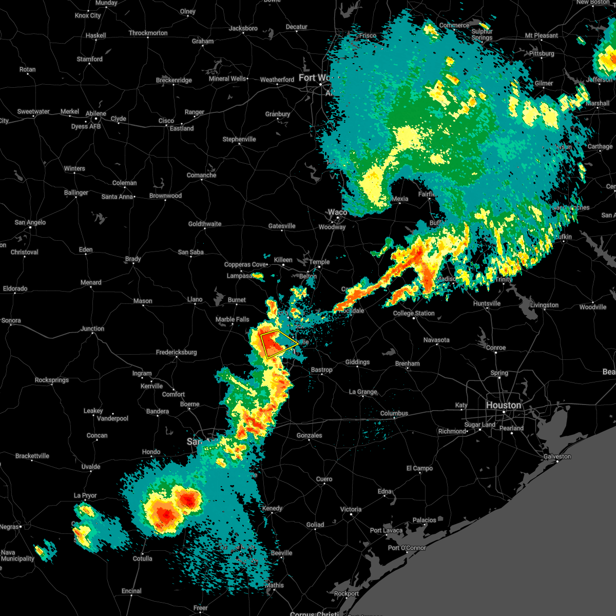 At 1116 pm cdt, a severe thunderstorm was located near anderson mill, moving east at 15 mph (radar indicated). Hazards include 60 mph wind gusts and quarter size hail. Hail damage to vehicles is expected. expect wind damage to roofs, siding, and trees. locations impacted include, austin, cedar park, anderson mill, lago vista, bee cave, west lake hills, hudson bend, barton creek, mansfield dam, jonestown, volente, wells branch, jollyville, camp mabry, lost creek and brushy creek. hail threat, radar indicated max hail size, 1. 00 in wind threat, radar indicated max wind gust, 60 mph. At 1116 pm cdt, a severe thunderstorm was located near anderson mill, moving east at 15 mph (radar indicated). Hazards include 60 mph wind gusts and quarter size hail. Hail damage to vehicles is expected. expect wind damage to roofs, siding, and trees. locations impacted include, austin, cedar park, anderson mill, lago vista, bee cave, west lake hills, hudson bend, barton creek, mansfield dam, jonestown, volente, wells branch, jollyville, camp mabry, lost creek and brushy creek. hail threat, radar indicated max hail size, 1. 00 in wind threat, radar indicated max wind gust, 60 mph.
|
| 5/21/2022 10:58 PM CDT |
 At 1057 pm cdt, a severe thunderstorm was located over hudson bend, or near anderson mill, moving east at 10 mph (radar indicated). Hazards include 60 mph wind gusts and quarter size hail. Hail damage to vehicles is expected. Expect wind damage to roofs, siding, and trees. At 1057 pm cdt, a severe thunderstorm was located over hudson bend, or near anderson mill, moving east at 10 mph (radar indicated). Hazards include 60 mph wind gusts and quarter size hail. Hail damage to vehicles is expected. Expect wind damage to roofs, siding, and trees.
|
| 5/5/2022 6:16 PM CDT |
 At 615 pm cdt, a severe thunderstorm was located near payton, or near blanco, moving east at 45 mph (radar indicated). Hazards include 60 mph wind gusts and quarter size hail. Hail damage to vehicles is expected. Expect wind damage to roofs, siding, and trees. At 615 pm cdt, a severe thunderstorm was located near payton, or near blanco, moving east at 45 mph (radar indicated). Hazards include 60 mph wind gusts and quarter size hail. Hail damage to vehicles is expected. Expect wind damage to roofs, siding, and trees.
|
| 5/5/2022 5:11 PM CDT |
 At 511 pm cdt, a severe thunderstorm was located over leander, or near cedar park, moving east at 30 mph (public). Hazards include ping pong ball size hail and 60 mph wind gusts. People and animals outdoors will be injured. expect hail damage to roofs, siding, windows, and vehicles. expect wind damage to roofs, siding, and trees. locations impacted include, austin, round rock, cedar park, georgetown, pflugerville, anderson mill, windemere, leander, liberty hill, jonestown, brushy creek, wells branch, jollyville and seward junction. hail threat, observed max hail size, 1. 50 in wind threat, radar indicated max wind gust, 60 mph. At 511 pm cdt, a severe thunderstorm was located over leander, or near cedar park, moving east at 30 mph (public). Hazards include ping pong ball size hail and 60 mph wind gusts. People and animals outdoors will be injured. expect hail damage to roofs, siding, windows, and vehicles. expect wind damage to roofs, siding, and trees. locations impacted include, austin, round rock, cedar park, georgetown, pflugerville, anderson mill, windemere, leander, liberty hill, jonestown, brushy creek, wells branch, jollyville and seward junction. hail threat, observed max hail size, 1. 50 in wind threat, radar indicated max wind gust, 60 mph.
|
| 5/5/2022 5:08 PM CDT |
 At 508 pm cdt, a severe thunderstorm was located over leander, or near cedar park, moving east at 30 mph (radar indicated). Hazards include 60 mph wind gusts and quarter size hail. Hail damage to vehicles is expected. expect wind damage to roofs, siding, and trees. locations impacted include, austin, round rock, cedar park, georgetown, pflugerville, anderson mill, windemere, leander, liberty hill, jonestown, brushy creek, wells branch, jollyville and seward junction. hail threat, radar indicated max hail size, 1. 00 in wind threat, radar indicated max wind gust, 60 mph. At 508 pm cdt, a severe thunderstorm was located over leander, or near cedar park, moving east at 30 mph (radar indicated). Hazards include 60 mph wind gusts and quarter size hail. Hail damage to vehicles is expected. expect wind damage to roofs, siding, and trees. locations impacted include, austin, round rock, cedar park, georgetown, pflugerville, anderson mill, windemere, leander, liberty hill, jonestown, brushy creek, wells branch, jollyville and seward junction. hail threat, radar indicated max hail size, 1. 00 in wind threat, radar indicated max wind gust, 60 mph.
|
| 5/5/2022 4:53 PM CDT |
 At 453 pm cdt, a severe thunderstorm was located near liberty hill, or 8 miles southeast of bertram, moving southeast at 25 mph (radar indicated). Hazards include 60 mph wind gusts and quarter size hail. Hail damage to vehicles is expected. Expect wind damage to roofs, siding, and trees. At 453 pm cdt, a severe thunderstorm was located near liberty hill, or 8 miles southeast of bertram, moving southeast at 25 mph (radar indicated). Hazards include 60 mph wind gusts and quarter size hail. Hail damage to vehicles is expected. Expect wind damage to roofs, siding, and trees.
|
| 3/21/2022 8:58 PM CDT | Quarter sized hail reported 12.7 miles E of Austin, TX, public report of quarter size hail near bee cave. |
| 3/21/2022 8:49 PM CDT |
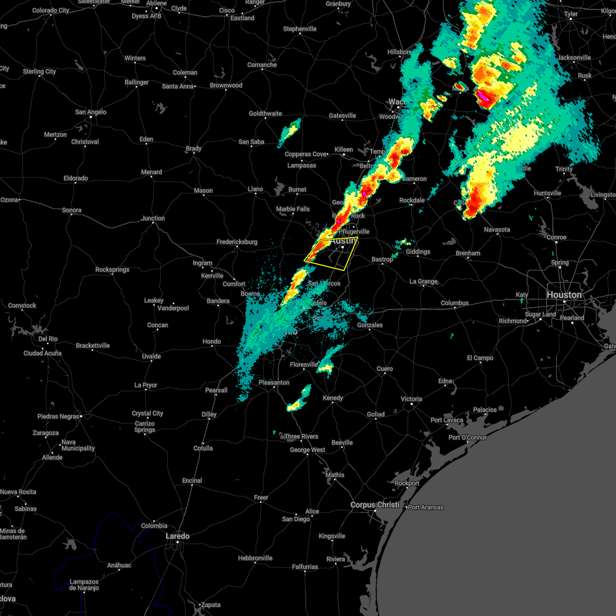 At 849 pm cdt, severe thunderstorms were located along a line extending from near bee cave to near dripping springs, moving east at 25 mph (radar indicated). Hazards include 60 mph wind gusts and quarter size hail. Hail damage to vehicles is expected. Expect wind damage to roofs, siding, and trees. At 849 pm cdt, severe thunderstorms were located along a line extending from near bee cave to near dripping springs, moving east at 25 mph (radar indicated). Hazards include 60 mph wind gusts and quarter size hail. Hail damage to vehicles is expected. Expect wind damage to roofs, siding, and trees.
|
| 3/21/2022 8:44 PM CDT |
 At 844 pm cdt, severe thunderstorms were located along a line extending from near round rock to near mansfield dam, moving northeast at 20 mph (radar indicated). Hazards include 60 mph wind gusts and quarter size hail. Hail damage to vehicles is expected. Expect wind damage to roofs, siding, and trees. At 844 pm cdt, severe thunderstorms were located along a line extending from near round rock to near mansfield dam, moving northeast at 20 mph (radar indicated). Hazards include 60 mph wind gusts and quarter size hail. Hail damage to vehicles is expected. Expect wind damage to roofs, siding, and trees.
|
| 3/21/2022 6:19 PM CDT |
 At 619 pm cdt, a severe thunderstorm capable of producing a tornado was located near wyldwood, or 7 miles east of austin bergstrom int airport, moving northeast at 35 mph (radar indicated rotation). Hazards include tornado and quarter size hail. Flying debris will be dangerous to those caught without shelter. mobile homes will be damaged or destroyed. damage to roofs, windows, and vehicles will occur. tree damage is likely. Locations impacted include, austin, elgin, austin bergstrom int airport, wyldwood, hornsby bend, webberville, garfield and del valle. At 619 pm cdt, a severe thunderstorm capable of producing a tornado was located near wyldwood, or 7 miles east of austin bergstrom int airport, moving northeast at 35 mph (radar indicated rotation). Hazards include tornado and quarter size hail. Flying debris will be dangerous to those caught without shelter. mobile homes will be damaged or destroyed. damage to roofs, windows, and vehicles will occur. tree damage is likely. Locations impacted include, austin, elgin, austin bergstrom int airport, wyldwood, hornsby bend, webberville, garfield and del valle.
|
| 3/21/2022 6:06 PM CDT |
 At 606 pm cdt, a severe thunderstorm was located over austin, moving northeast at 40 mph (radar indicated). Hazards include golf ball size hail and 60 mph wind gusts. People and animals outdoors will be injured. expect hail damage to roofs, siding, windows, and vehicles. Expect wind damage to roofs, siding, and trees. At 606 pm cdt, a severe thunderstorm was located over austin, moving northeast at 40 mph (radar indicated). Hazards include golf ball size hail and 60 mph wind gusts. People and animals outdoors will be injured. expect hail damage to roofs, siding, windows, and vehicles. Expect wind damage to roofs, siding, and trees.
|
| 3/21/2022 5:59 PM CDT |
 At 559 pm cdt, severe thunderstorms capable of producing both tornadoes and extensive straight line wind damage were located over round rock, moving northeast at 35 mph (radar indicated rotation). Hazards include tornado. Flying debris will be dangerous to those caught without shelter. mobile homes will be damaged or destroyed. damage to roofs, windows, and vehicles will occur. Tree damage is likely. At 559 pm cdt, severe thunderstorms capable of producing both tornadoes and extensive straight line wind damage were located over round rock, moving northeast at 35 mph (radar indicated rotation). Hazards include tornado. Flying debris will be dangerous to those caught without shelter. mobile homes will be damaged or destroyed. damage to roofs, windows, and vehicles will occur. Tree damage is likely.
|
| 3/21/2022 5:58 PM CDT |
 At 558 pm cdt, severe thunderstorms capable of producing both tornadoes and extensive straight line wind damage were located near onion creek, or near buda, moving northeast at 35 mph (radar indicated rotation). Hazards include tornado. Flying debris will be dangerous to those caught without shelter. mobile homes will be damaged or destroyed. damage to roofs, windows, and vehicles will occur. Tree damage is likely. At 558 pm cdt, severe thunderstorms capable of producing both tornadoes and extensive straight line wind damage were located near onion creek, or near buda, moving northeast at 35 mph (radar indicated rotation). Hazards include tornado. Flying debris will be dangerous to those caught without shelter. mobile homes will be damaged or destroyed. damage to roofs, windows, and vehicles will occur. Tree damage is likely.
|
| 3/21/2022 5:51 PM CDT |
 At 551 pm cdt, a severe thunderstorm capable of producing a tornado was located over shady hollow, or over tanglewood forest, moving northeast at 35 mph (radar indicated rotation). Hazards include tornado and quarter size hail. Flying debris will be dangerous to those caught without shelter. mobile homes will be damaged or destroyed. damage to roofs, windows, and vehicles will occur. tree damage is likely. Locations impacted include, austin, buda, tanglewood forest, austin bergstrom int airport, west lake hills, rollingwood, bear creek, onion creek, barton creek, shady hollow, hornsby bend, manchaca, sunset valley, san leanna, hays, creedmoor, del valle, pilot knob, camp mabry and mckinney falls state park. At 551 pm cdt, a severe thunderstorm capable of producing a tornado was located over shady hollow, or over tanglewood forest, moving northeast at 35 mph (radar indicated rotation). Hazards include tornado and quarter size hail. Flying debris will be dangerous to those caught without shelter. mobile homes will be damaged or destroyed. damage to roofs, windows, and vehicles will occur. tree damage is likely. Locations impacted include, austin, buda, tanglewood forest, austin bergstrom int airport, west lake hills, rollingwood, bear creek, onion creek, barton creek, shady hollow, hornsby bend, manchaca, sunset valley, san leanna, hays, creedmoor, del valle, pilot knob, camp mabry and mckinney falls state park.
|
| 3/21/2022 5:46 PM CDT |
 At 545 pm cdt, severe thunderstorms were located along a line extending from near florence to near anderson mill, moving east at 20 mph (radar indicated). Hazards include 60 mph wind gusts and nickel size hail. expect damage to roofs, siding, and trees At 545 pm cdt, severe thunderstorms were located along a line extending from near florence to near anderson mill, moving east at 20 mph (radar indicated). Hazards include 60 mph wind gusts and nickel size hail. expect damage to roofs, siding, and trees
|
| 3/21/2022 5:40 PM CDT |
 At 540 pm cdt, a severe thunderstorm capable of producing a tornado was located near buda, moving northeast at 35 mph (radar indicated rotation). Hazards include tornado and ping pong ball size hail. Flying debris will be dangerous to those caught without shelter. mobile homes will be damaged or destroyed. damage to roofs, windows, and vehicles will occur. Tree damage is likely. At 540 pm cdt, a severe thunderstorm capable of producing a tornado was located near buda, moving northeast at 35 mph (radar indicated rotation). Hazards include tornado and ping pong ball size hail. Flying debris will be dangerous to those caught without shelter. mobile homes will be damaged or destroyed. damage to roofs, windows, and vehicles will occur. Tree damage is likely.
|
| 3/21/2022 5:36 PM CDT |
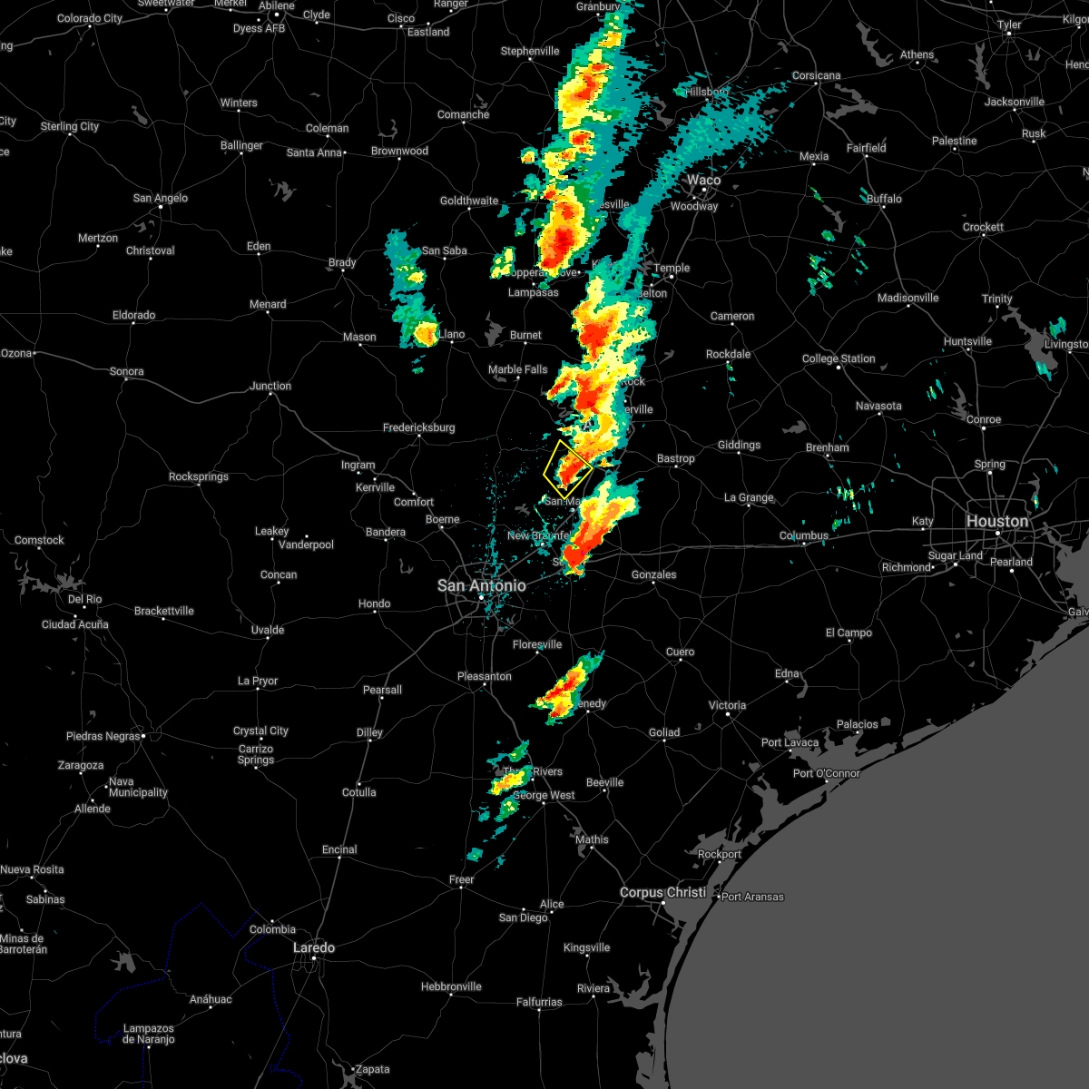 At 536 pm cdt, a severe thunderstorm was located over driftwood, or near dripping springs, moving northeast at 30 mph (radar indicated). Hazards include 60 mph wind gusts and quarter size hail. Hail damage to vehicles is expected. expect wind damage to roofs, siding, and trees. Locations impacted include, buda, dripping springs, wimberley, bear creek, driftwood, mountain city, hays and hays city. At 536 pm cdt, a severe thunderstorm was located over driftwood, or near dripping springs, moving northeast at 30 mph (radar indicated). Hazards include 60 mph wind gusts and quarter size hail. Hail damage to vehicles is expected. expect wind damage to roofs, siding, and trees. Locations impacted include, buda, dripping springs, wimberley, bear creek, driftwood, mountain city, hays and hays city.
|
| 3/21/2022 5:35 PM CDT |
 At 535 pm cdt, a severe thunderstorm was located near anderson mill, moving northeast at 30 mph (radar indicated). Hazards include 60 mph wind gusts and quarter size hail. Hail damage to vehicles is expected. expect wind damage to roofs, siding, and trees. Locations impacted include, austin, round rock, cedar park, georgetown, pflugerville, anderson mill, windemere, leander, hutto, lakeway, lago vista, hudson bend, liberty hill, georgetown dam, mansfield dam, jonestown, point venture, volente, brushy creek and wells branch. At 535 pm cdt, a severe thunderstorm was located near anderson mill, moving northeast at 30 mph (radar indicated). Hazards include 60 mph wind gusts and quarter size hail. Hail damage to vehicles is expected. expect wind damage to roofs, siding, and trees. Locations impacted include, austin, round rock, cedar park, georgetown, pflugerville, anderson mill, windemere, leander, hutto, lakeway, lago vista, hudson bend, liberty hill, georgetown dam, mansfield dam, jonestown, point venture, volente, brushy creek and wells branch.
|
| 3/21/2022 5:31 PM CDT |
 At 530 pm cdt, a severe thunderstorm was located over hudson bend, or near anderson mill, moving northeast at 30 mph (radar indicated). Hazards include 60 mph wind gusts and quarter size hail. Hail damage to vehicles is expected. expect wind damage to roofs, siding, and trees. Locations impacted include, austin, round rock, cedar park, georgetown, pflugerville, anderson mill, windemere, leander, hutto, lakeway, lago vista, bee cave, west lake hills, hudson bend, the hills, liberty hill, georgetown dam, mansfield dam, barton creek and jonestown. At 530 pm cdt, a severe thunderstorm was located over hudson bend, or near anderson mill, moving northeast at 30 mph (radar indicated). Hazards include 60 mph wind gusts and quarter size hail. Hail damage to vehicles is expected. expect wind damage to roofs, siding, and trees. Locations impacted include, austin, round rock, cedar park, georgetown, pflugerville, anderson mill, windemere, leander, hutto, lakeway, lago vista, bee cave, west lake hills, hudson bend, the hills, liberty hill, georgetown dam, mansfield dam, barton creek and jonestown.
|
| 3/21/2022 5:28 PM CDT |
 At 528 pm cdt, a severe thunderstorm capable of producing a tornado was located over wimberley, moving north at 25 mph (radar indicated rotation). Hazards include tornado and ping pong ball size hail. Flying debris will be dangerous to those caught without shelter. mobile homes will be damaged or destroyed. damage to roofs, windows, and vehicles will occur. tree damage is likely. Locations impacted include, buda, dripping springs, wimberley, woodcreek, bear creek, driftwood, hays and hays city. At 528 pm cdt, a severe thunderstorm capable of producing a tornado was located over wimberley, moving north at 25 mph (radar indicated rotation). Hazards include tornado and ping pong ball size hail. Flying debris will be dangerous to those caught without shelter. mobile homes will be damaged or destroyed. damage to roofs, windows, and vehicles will occur. tree damage is likely. Locations impacted include, buda, dripping springs, wimberley, woodcreek, bear creek, driftwood, hays and hays city.
|
| 3/21/2022 5:21 PM CDT |
 At 521 pm cdt, a confirmed tornado was located over wimberley, moving north at 25 mph (radar confirmed tornado). Hazards include damaging tornado and ping pong ball size hail. Flying debris will be dangerous to those caught without shelter. mobile homes will be damaged or destroyed. damage to roofs, windows, and vehicles will occur. tree damage is likely. Locations impacted include, san marcos, buda, dripping springs, wimberley, woodcreek, bear creek, driftwood, hays, mount gainor and hays city. At 521 pm cdt, a confirmed tornado was located over wimberley, moving north at 25 mph (radar confirmed tornado). Hazards include damaging tornado and ping pong ball size hail. Flying debris will be dangerous to those caught without shelter. mobile homes will be damaged or destroyed. damage to roofs, windows, and vehicles will occur. tree damage is likely. Locations impacted include, san marcos, buda, dripping springs, wimberley, woodcreek, bear creek, driftwood, hays, mount gainor and hays city.
|
| 3/21/2022 5:04 PM CDT |
 At 504 pm cdt, a severe thunderstorm was located 7 miles west of the hills, or 10 miles north of dripping springs, moving northeast at 30 mph (radar indicated). Hazards include ping pong ball size hail and 60 mph wind gusts. People and animals outdoors will be injured. expect hail damage to roofs, siding, windows, and vehicles. Expect wind damage to roofs, siding, and trees. At 504 pm cdt, a severe thunderstorm was located 7 miles west of the hills, or 10 miles north of dripping springs, moving northeast at 30 mph (radar indicated). Hazards include ping pong ball size hail and 60 mph wind gusts. People and animals outdoors will be injured. expect hail damage to roofs, siding, windows, and vehicles. Expect wind damage to roofs, siding, and trees.
|
| 3/21/2022 4:55 PM CDT |
 At 455 pm cdt, a severe thunderstorm was located over canyon lake, or near canyon lake dam, moving northeast at 30 mph (radar indicated). Hazards include 60 mph wind gusts and quarter size hail. Hail damage to vehicles is expected. expect wind damage to roofs, siding, and trees. Locations impacted include, buda, dripping springs, wimberley, canyon lake dam, canyon lake, woodcreek, bear creek, fischer, driftwood, mountain city, hays, startzville, sattler, mount gainor and hays city. At 455 pm cdt, a severe thunderstorm was located over canyon lake, or near canyon lake dam, moving northeast at 30 mph (radar indicated). Hazards include 60 mph wind gusts and quarter size hail. Hail damage to vehicles is expected. expect wind damage to roofs, siding, and trees. Locations impacted include, buda, dripping springs, wimberley, canyon lake dam, canyon lake, woodcreek, bear creek, fischer, driftwood, mountain city, hays, startzville, sattler, mount gainor and hays city.
|
| 3/21/2022 4:54 PM CDT |
 At 454 pm cdt, a severe thunderstorm was located near pedernales falls state park, or 12 miles northwest of dripping springs, moving northeast at 35 mph (radar indicated). Hazards include 60 mph wind gusts and quarter size hail. Hail damage to vehicles is expected. expect wind damage to roofs, siding, and trees. Locations impacted include, lakeway, lago vista, hudson bend, the hills, spicewood, henly, pedernales falls state park, cypress mill, jonestown, briarcliff, point venture and volente. At 454 pm cdt, a severe thunderstorm was located near pedernales falls state park, or 12 miles northwest of dripping springs, moving northeast at 35 mph (radar indicated). Hazards include 60 mph wind gusts and quarter size hail. Hail damage to vehicles is expected. expect wind damage to roofs, siding, and trees. Locations impacted include, lakeway, lago vista, hudson bend, the hills, spicewood, henly, pedernales falls state park, cypress mill, jonestown, briarcliff, point venture and volente.
|
| 3/21/2022 4:47 PM CDT |
 At 447 pm cdt, a severe thunderstorm was located over canyon lake, or near canyon lake dam, moving northeast at 30 mph (radar indicated). Hazards include 60 mph wind gusts and quarter size hail. Hail damage to vehicles is expected. Expect wind damage to roofs, siding, and trees. At 447 pm cdt, a severe thunderstorm was located over canyon lake, or near canyon lake dam, moving northeast at 30 mph (radar indicated). Hazards include 60 mph wind gusts and quarter size hail. Hail damage to vehicles is expected. Expect wind damage to roofs, siding, and trees.
|
| 3/21/2022 4:39 PM CDT |
 At 439 pm cdt, a severe thunderstorm was located near henly, or 12 miles northeast of blanco, moving northeast at 35 mph (radar indicated). Hazards include 60 mph wind gusts and nickel size hail. Expect damage to roofs, siding, and trees. locations impacted include, blanco, lakeway, lago vista, hudson bend, the hills, johnson city, spicewood, twin sisters, cypress mill, henly, payton, pedernales falls state park, smithwick, jonestown, briarcliff, point venture and volente. hail threat, radar indicated max hail size, 0. 88 in wind threat, radar indicated max wind gust, 60 mph. At 439 pm cdt, a severe thunderstorm was located near henly, or 12 miles northeast of blanco, moving northeast at 35 mph (radar indicated). Hazards include 60 mph wind gusts and nickel size hail. Expect damage to roofs, siding, and trees. locations impacted include, blanco, lakeway, lago vista, hudson bend, the hills, johnson city, spicewood, twin sisters, cypress mill, henly, payton, pedernales falls state park, smithwick, jonestown, briarcliff, point venture and volente. hail threat, radar indicated max hail size, 0. 88 in wind threat, radar indicated max wind gust, 60 mph.
|
| 3/21/2022 4:20 PM CDT |
 At 420 pm cdt, a severe thunderstorm was located over blanco, moving northeast at 35 mph (radar indicated). Hazards include 60 mph wind gusts and quarter size hail. Hail damage to vehicles is expected. Expect wind damage to roofs, siding, and trees. At 420 pm cdt, a severe thunderstorm was located over blanco, moving northeast at 35 mph (radar indicated). Hazards include 60 mph wind gusts and quarter size hail. Hail damage to vehicles is expected. Expect wind damage to roofs, siding, and trees.
|
| 12/18/2021 8:27 AM CST |
 At 826 am cst, a severe thunderstorm was located near uhland, or near kyle, moving east at 30 mph (radar indicated). Hazards include quarter size hail. damage to vehicles is expected At 826 am cst, a severe thunderstorm was located near uhland, or near kyle, moving east at 30 mph (radar indicated). Hazards include quarter size hail. damage to vehicles is expected
|
| 9/6/2021 4:17 PM CDT |
 At 417 pm cdt, a severe thunderstorm was located near buda, moving southwest at 20 mph (radar indicated). Hazards include 60 mph wind gusts and quarter size hail. Hail damage to vehicles is expected. Expect wind damage to roofs, siding, and trees. At 417 pm cdt, a severe thunderstorm was located near buda, moving southwest at 20 mph (radar indicated). Hazards include 60 mph wind gusts and quarter size hail. Hail damage to vehicles is expected. Expect wind damage to roofs, siding, and trees.
|
| 6/21/2021 10:35 PM CDT |
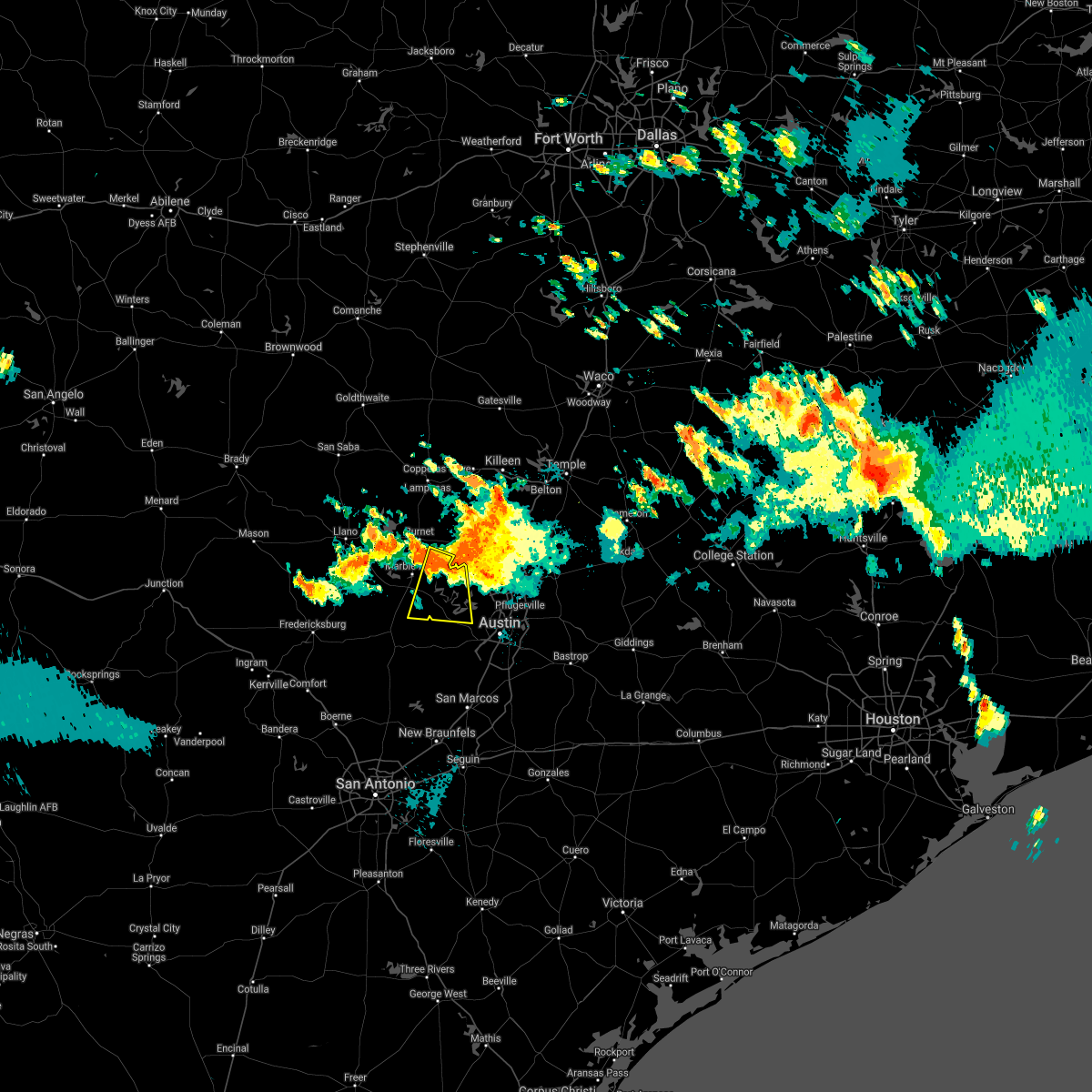 At 1035 pm cdt, a severe thunderstorm was located near smithwick, or 11 miles south of bertram, moving south at 25 mph (radar indicated). Hazards include 60 mph wind gusts and quarter size hail. Hail damage to vehicles is expected. Expect wind damage to roofs, siding, and trees. At 1035 pm cdt, a severe thunderstorm was located near smithwick, or 11 miles south of bertram, moving south at 25 mph (radar indicated). Hazards include 60 mph wind gusts and quarter size hail. Hail damage to vehicles is expected. Expect wind damage to roofs, siding, and trees.
|
| 6/2/2021 10:00 PM CDT |
 At 1000 pm cdt, severe thunderstorms were located along a line extending from near round rock to near windemere to near austin, moving east at 15 mph (radar indicated). Hazards include 60 mph wind gusts and quarter size hail. Hail damage to vehicles is expected. expect wind damage to roofs, siding, and trees. Locations impacted include, austin, round rock, cedar park, georgetown, pflugerville, anderson mill, windemere, leander, camp mabry, brushy creek, wells branch and jollyville. At 1000 pm cdt, severe thunderstorms were located along a line extending from near round rock to near windemere to near austin, moving east at 15 mph (radar indicated). Hazards include 60 mph wind gusts and quarter size hail. Hail damage to vehicles is expected. expect wind damage to roofs, siding, and trees. Locations impacted include, austin, round rock, cedar park, georgetown, pflugerville, anderson mill, windemere, leander, camp mabry, brushy creek, wells branch and jollyville.
|
| 6/2/2021 9:33 PM CDT |
 At 933 pm cdt, severe thunderstorms were located along a line extending from near liberty hill to near lago vista to near hudson bend, moving east at 30 mph (radar indicated). Hazards include 60 mph wind gusts and quarter size hail. Hail damage to vehicles is expected. expect wind damage to roofs, siding, and trees. Locations impacted include, austin, round rock, cedar park, georgetown, pflugerville, anderson mill, windemere, leander, lakeway, lago vista, hudson bend, liberty hill, mansfield dam, jonestown, briarcliff, point venture, volente, brushy creek, wells branch and jollyville. At 933 pm cdt, severe thunderstorms were located along a line extending from near liberty hill to near lago vista to near hudson bend, moving east at 30 mph (radar indicated). Hazards include 60 mph wind gusts and quarter size hail. Hail damage to vehicles is expected. expect wind damage to roofs, siding, and trees. Locations impacted include, austin, round rock, cedar park, georgetown, pflugerville, anderson mill, windemere, leander, lakeway, lago vista, hudson bend, liberty hill, mansfield dam, jonestown, briarcliff, point venture, volente, brushy creek, wells branch and jollyville.
|
| 6/2/2021 9:17 PM CDT |
 At 917 pm cdt, severe thunderstorms were located along a line extending from oatmeal to near smithwick to near spicewood, moving east at 25 mph (radar indicated). Hazards include 60 mph wind gusts and quarter size hail. Hail damage to vehicles is expected. Expect wind damage to roofs, siding, and trees. At 917 pm cdt, severe thunderstorms were located along a line extending from oatmeal to near smithwick to near spicewood, moving east at 25 mph (radar indicated). Hazards include 60 mph wind gusts and quarter size hail. Hail damage to vehicles is expected. Expect wind damage to roofs, siding, and trees.
|
| 5/28/2021 7:38 PM CDT |
 At 738 pm cdt, severe thunderstorms were located along a line extending from near coupland to 6 miles northwest of camp swift to 10 miles west of rosanky, moving east at 30 mph (radar indicated). Hazards include ping pong ball size hail and 60 mph wind gusts. People and animals outdoors will be injured. expect hail damage to roofs, siding, windows, and vehicles. expect wind damage to roofs, siding, and trees. Locations impacted include, austin, round rock, georgetown, pflugerville, lockhart, elgin, bastrop, lexington, austin bergstrom int airport, windemere, hutto, manor, uhland, mustang ridge, niederwald, fedor, camp swift, circle d-kc estates, cedar creek and paige. At 738 pm cdt, severe thunderstorms were located along a line extending from near coupland to 6 miles northwest of camp swift to 10 miles west of rosanky, moving east at 30 mph (radar indicated). Hazards include ping pong ball size hail and 60 mph wind gusts. People and animals outdoors will be injured. expect hail damage to roofs, siding, windows, and vehicles. expect wind damage to roofs, siding, and trees. Locations impacted include, austin, round rock, georgetown, pflugerville, lockhart, elgin, bastrop, lexington, austin bergstrom int airport, windemere, hutto, manor, uhland, mustang ridge, niederwald, fedor, camp swift, circle d-kc estates, cedar creek and paige.
|
| 5/28/2021 7:18 PM CDT |
 At 718 pm cdt, severe thunderstorms were located along a line extending from near pflugerville to near manor to near mustang ridge, moving east at 35 mph (radar indicated). Hazards include golf ball size hail and 60 mph wind gusts. People and animals outdoors will be injured. expect hail damage to roofs, siding, windows, and vehicles. expect wind damage to roofs, siding, and trees. Locations impacted include, austin, round rock, cedar park, georgetown, pflugerville, kyle, buda, lockhart, elgin, bastrop, lexington, tanglewood forest, austin bergstrom int airport, windemere, anderson mill, hutto, manor, west lake hills, rollingwood and uhland. At 718 pm cdt, severe thunderstorms were located along a line extending from near pflugerville to near manor to near mustang ridge, moving east at 35 mph (radar indicated). Hazards include golf ball size hail and 60 mph wind gusts. People and animals outdoors will be injured. expect hail damage to roofs, siding, windows, and vehicles. expect wind damage to roofs, siding, and trees. Locations impacted include, austin, round rock, cedar park, georgetown, pflugerville, kyle, buda, lockhart, elgin, bastrop, lexington, tanglewood forest, austin bergstrom int airport, windemere, anderson mill, hutto, manor, west lake hills, rollingwood and uhland.
|
| 5/28/2021 7:14 PM CDT | Corrects previous non-tstm wnd gst report from 6 s wells branch. estimated 60 mph gusts at rundberg and i-35... about an inch of water on i-35 reported as well with tor in travis county TX, 5.8 miles SW of Austin, TX |
| 5/28/2021 7:11 PM CDT | Asos station kaus austin-bergstrom intl arp in travis county TX, 8.7 miles NNW of Austin, TX |
| 5/28/2021 7:01 PM CDT |
 At 701 pm cdt, severe thunderstorms were located along a line extending from near round rock to near austin to onion creek, moving east at 30 mph (radar indicated). Hazards include 60 mph wind gusts and quarter size hail. Hail damage to vehicles is expected. Expect wind damage to roofs, siding, and trees. At 701 pm cdt, severe thunderstorms were located along a line extending from near round rock to near austin to onion creek, moving east at 30 mph (radar indicated). Hazards include 60 mph wind gusts and quarter size hail. Hail damage to vehicles is expected. Expect wind damage to roofs, siding, and trees.
|
| 5/28/2021 6:51 PM CDT |
 At 650 pm cdt, severe thunderstorms were located along a line extending from near sun city to near round rock to west lake hills to shady hollow, moving southeast at 40 mph (radar indicated). Hazards include 70 mph wind gusts and quarter size hail. Hail damage to vehicles is expected. expect considerable tree damage. wind damage is also likely to mobile homes, roofs, and outbuildings. Locations impacted include, austin, round rock, cedar park, georgetown, pflugerville, taylor, granger, tanglewood forest, serenada, anderson mill, austin bergstrom int airport, windemere, leander, hutto, lakeway, manor, lago vista, bee cave, west lake hills and hudson bend. At 650 pm cdt, severe thunderstorms were located along a line extending from near sun city to near round rock to west lake hills to shady hollow, moving southeast at 40 mph (radar indicated). Hazards include 70 mph wind gusts and quarter size hail. Hail damage to vehicles is expected. expect considerable tree damage. wind damage is also likely to mobile homes, roofs, and outbuildings. Locations impacted include, austin, round rock, cedar park, georgetown, pflugerville, taylor, granger, tanglewood forest, serenada, anderson mill, austin bergstrom int airport, windemere, leander, hutto, lakeway, manor, lago vista, bee cave, west lake hills and hudson bend.
|
| 5/28/2021 6:38 PM CDT | Cwop mesonet station near villa montana way reported 67 mph wind gus in travis county TX, 10.9 miles SE of Austin, TX |
| 5/28/2021 6:29 PM CDT |
 At 628 pm cdt, severe thunderstorms were located along a line extending from near liberty hill to lago vista to near cypress mill, moving southeast at 30 mph (radar indicated). Hazards include tennis ball size hail and 70 mph wind gusts. People and animals outdoors will be injured. expect hail damage to roofs, siding, windows, and vehicles. expect considerable tree damage. wind damage is also likely to mobile homes, roofs, and outbuildings. Locations impacted include, austin, round rock, cedar park, georgetown, pflugerville, taylor, burnet, marble falls, granger, bertram, round mountain, tanglewood forest, serenada, anderson mill, austin bergstrom int airport, windemere, leander, hutto, lakeway and manor. At 628 pm cdt, severe thunderstorms were located along a line extending from near liberty hill to lago vista to near cypress mill, moving southeast at 30 mph (radar indicated). Hazards include tennis ball size hail and 70 mph wind gusts. People and animals outdoors will be injured. expect hail damage to roofs, siding, windows, and vehicles. expect considerable tree damage. wind damage is also likely to mobile homes, roofs, and outbuildings. Locations impacted include, austin, round rock, cedar park, georgetown, pflugerville, taylor, burnet, marble falls, granger, bertram, round mountain, tanglewood forest, serenada, anderson mill, austin bergstrom int airport, windemere, leander, hutto, lakeway and manor.
|
| 5/28/2021 6:12 PM CDT |
 At 611 pm cdt, severe thunderstorms were located along a line extending from bertram to near smithwick to near round mountain, moving southeast at 35 mph (radar indicated). Hazards include 70 mph wind gusts and ping pong ball size hail. People and animals outdoors will be injured. expect hail damage to roofs, siding, windows, and vehicles. expect considerable tree damage. Wind damage is also likely to mobile homes, roofs, and outbuildings. At 611 pm cdt, severe thunderstorms were located along a line extending from bertram to near smithwick to near round mountain, moving southeast at 35 mph (radar indicated). Hazards include 70 mph wind gusts and ping pong ball size hail. People and animals outdoors will be injured. expect hail damage to roofs, siding, windows, and vehicles. expect considerable tree damage. Wind damage is also likely to mobile homes, roofs, and outbuildings.
|
| 5/18/2021 4:33 PM CDT |
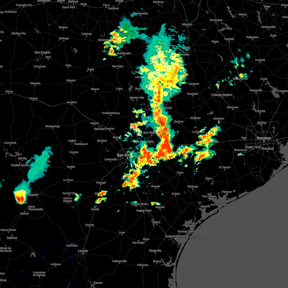 At 433 pm cdt, severe thunderstorms were located along a line extending from austin bergstrom int airport to 6 miles northeast of lockhart, moving northeast at 25 mph (radar indicated). Hazards include 60 mph wind gusts and quarter size hail. Hail damage to vehicles is expected. expect wind damage to roofs, siding, and trees. Locations impacted include, austin, lockhart, austin bergstrom int airport, mustang ridge, niederwald, creedmoor, maha, pilot knob, lytton springs, mendoza, mckinney falls state park, dale and del valle. At 433 pm cdt, severe thunderstorms were located along a line extending from austin bergstrom int airport to 6 miles northeast of lockhart, moving northeast at 25 mph (radar indicated). Hazards include 60 mph wind gusts and quarter size hail. Hail damage to vehicles is expected. expect wind damage to roofs, siding, and trees. Locations impacted include, austin, lockhart, austin bergstrom int airport, mustang ridge, niederwald, creedmoor, maha, pilot knob, lytton springs, mendoza, mckinney falls state park, dale and del valle.
|
| 5/18/2021 4:27 PM CDT |
 At 427 pm cdt, severe thunderstorms were located along a line extending from austin bergstrom int airport to near palmeto state park, moving northeast at 35 mph (radar indicated). Hazards include 60 mph wind gusts and quarter size hail. Hail damage to vehicles is expected. Expect wind damage to roofs, siding, and trees. At 427 pm cdt, severe thunderstorms were located along a line extending from austin bergstrom int airport to near palmeto state park, moving northeast at 35 mph (radar indicated). Hazards include 60 mph wind gusts and quarter size hail. Hail damage to vehicles is expected. Expect wind damage to roofs, siding, and trees.
|
| 5/18/2021 4:20 PM CDT |
 At 419 pm cdt, severe thunderstorms were located along a line extending from onion creek to lockhart, moving east at 35 mph (radar indicated). Hazards include 60 mph wind gusts and quarter size hail. Hail damage to vehicles is expected. expect wind damage to roofs, siding, and trees. Locations impacted include, austin, san marcos, kyle, buda, lockhart, austin bergstrom int airport, martindale, uhland, mustang ridge, niederwald, onion creek, shady hollow, manchaca, mountain city, san leanna, hays, creedmoor, maha, maxwell and reedville. At 419 pm cdt, severe thunderstorms were located along a line extending from onion creek to lockhart, moving east at 35 mph (radar indicated). Hazards include 60 mph wind gusts and quarter size hail. Hail damage to vehicles is expected. expect wind damage to roofs, siding, and trees. Locations impacted include, austin, san marcos, kyle, buda, lockhart, austin bergstrom int airport, martindale, uhland, mustang ridge, niederwald, onion creek, shady hollow, manchaca, mountain city, san leanna, hays, creedmoor, maha, maxwell and reedville.
|
| 5/18/2021 4:08 PM CDT |
 At 407 pm cdt, severe thunderstorms were located along a line extending from near buda to near lockhart, moving east at 30 mph (radar indicated). Hazards include 60 mph wind gusts and quarter size hail. Hail damage to vehicles is expected. expect wind damage to roofs, siding, and trees. Locations impacted include, austin, san marcos, kyle, buda, lockhart, austin bergstrom int airport, martindale, uhland, mustang ridge, niederwald, onion creek, shady hollow, manchaca, mountain city, san leanna, hays, creedmoor, maha, maxwell and reedville. At 407 pm cdt, severe thunderstorms were located along a line extending from near buda to near lockhart, moving east at 30 mph (radar indicated). Hazards include 60 mph wind gusts and quarter size hail. Hail damage to vehicles is expected. expect wind damage to roofs, siding, and trees. Locations impacted include, austin, san marcos, kyle, buda, lockhart, austin bergstrom int airport, martindale, uhland, mustang ridge, niederwald, onion creek, shady hollow, manchaca, mountain city, san leanna, hays, creedmoor, maha, maxwell and reedville.
|
| 5/18/2021 3:49 PM CDT |
 At 349 pm cdt, severe thunderstorms were located along a line extending from near wimberley to san marcos, moving northeast at 20 mph (radar indicated). Hazards include 60 mph wind gusts and half dollar size hail. Hail damage to vehicles is expected. expect wind damage to roofs, siding, and trees. Locations impacted include, austin, san marcos, kyle, buda, lockhart, wimberley, austin bergstrom int airport, woodcreek, martindale, uhland, mustang ridge, niederwald, onion creek, shady hollow, manchaca, mountain city, san leanna, hays, creedmoor and maha. At 349 pm cdt, severe thunderstorms were located along a line extending from near wimberley to san marcos, moving northeast at 20 mph (radar indicated). Hazards include 60 mph wind gusts and half dollar size hail. Hail damage to vehicles is expected. expect wind damage to roofs, siding, and trees. Locations impacted include, austin, san marcos, kyle, buda, lockhart, wimberley, austin bergstrom int airport, woodcreek, martindale, uhland, mustang ridge, niederwald, onion creek, shady hollow, manchaca, mountain city, san leanna, hays, creedmoor and maha.
|
| 5/18/2021 3:40 PM CDT |
 At 339 pm cdt, severe thunderstorms were located along a line extending from near driftwood to near zorn, moving east at 25 mph (radar indicated). Hazards include 60 mph wind gusts and quarter size hail. Hail damage to vehicles is expected. Expect wind damage to roofs, siding, and trees. At 339 pm cdt, severe thunderstorms were located along a line extending from near driftwood to near zorn, moving east at 25 mph (radar indicated). Hazards include 60 mph wind gusts and quarter size hail. Hail damage to vehicles is expected. Expect wind damage to roofs, siding, and trees.
|
| 5/17/2021 1:52 PM CDT |
 The severe thunderstorm warning for southwestern williamson and western travis counties will expire at 200 pm cdt, the storm which prompted the warning has weakened below severe limits, and no longer poses an immediate threat to life or property. therefore, the warning will be allowed to expire. however hail, gusty winds and heavy rain are still possible with this thunderstorm. The severe thunderstorm warning for southwestern williamson and western travis counties will expire at 200 pm cdt, the storm which prompted the warning has weakened below severe limits, and no longer poses an immediate threat to life or property. therefore, the warning will be allowed to expire. however hail, gusty winds and heavy rain are still possible with this thunderstorm.
|
| 5/17/2021 1:29 PM CDT |
 At 128 pm cdt, a severe thunderstorm was located over lago vista, or 11 miles west of anderson mill, moving southeast at 25 mph (radar indicated). Hazards include 60 mph wind gusts and quarter size hail. Hail damage to vehicles is expected. expect wind damage to roofs, siding, and trees. Locations impacted include, austin, round rock, cedar park, pflugerville, anderson mill, windemere, leander, lakeway, lago vista, bee cave, west lake hills, hudson bend, the hills, rollingwood, barton creek, shady hollow, mansfield dam, jonestown, briarcliff and point venture. At 128 pm cdt, a severe thunderstorm was located over lago vista, or 11 miles west of anderson mill, moving southeast at 25 mph (radar indicated). Hazards include 60 mph wind gusts and quarter size hail. Hail damage to vehicles is expected. expect wind damage to roofs, siding, and trees. Locations impacted include, austin, round rock, cedar park, pflugerville, anderson mill, windemere, leander, lakeway, lago vista, bee cave, west lake hills, hudson bend, the hills, rollingwood, barton creek, shady hollow, mansfield dam, jonestown, briarcliff and point venture.
|
| 5/17/2021 1:00 PM CDT |
 At 100 pm cdt, a severe thunderstorm was located over smithwick, or 8 miles east of marble falls, moving southeast at 30 mph (radar indicated). Hazards include 60 mph wind gusts and quarter size hail. Hail damage to vehicles is expected. Expect wind damage to roofs, siding, and trees. At 100 pm cdt, a severe thunderstorm was located over smithwick, or 8 miles east of marble falls, moving southeast at 30 mph (radar indicated). Hazards include 60 mph wind gusts and quarter size hail. Hail damage to vehicles is expected. Expect wind damage to roofs, siding, and trees.
|
| 5/11/2021 9:01 PM CDT |
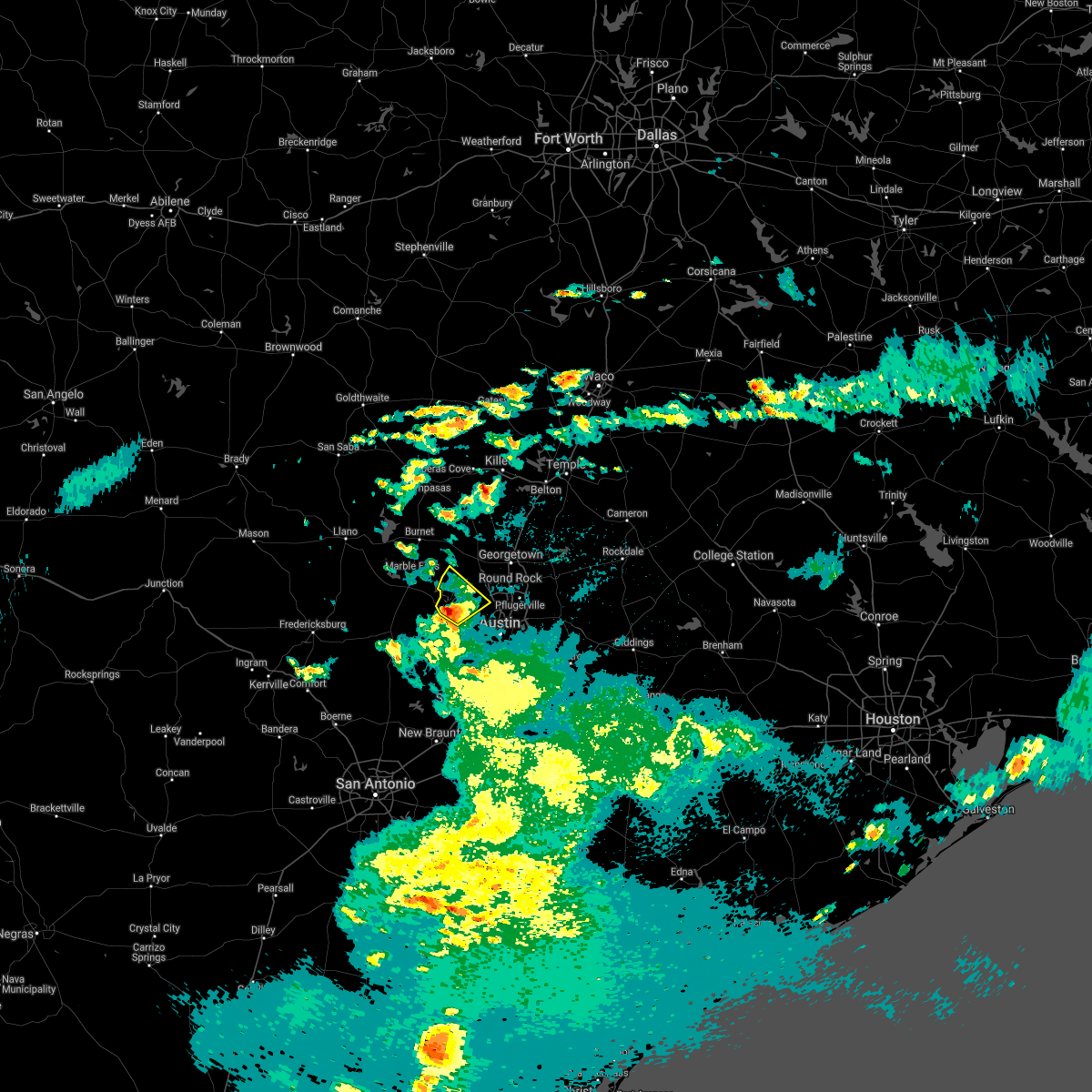 At 900 pm cdt, a severe thunderstorm was located near briarcliff, or 13 miles west of anderson mill, moving northeast at 25 mph (radar indicated). Hazards include quarter size hail. Damage to vehicles is expected. Locations impacted include, austin, lakeway, lago vista, bee cave, hudson bend, the hills, mansfield dam, jonestown, briarcliff, point venture and volente. At 900 pm cdt, a severe thunderstorm was located near briarcliff, or 13 miles west of anderson mill, moving northeast at 25 mph (radar indicated). Hazards include quarter size hail. Damage to vehicles is expected. Locations impacted include, austin, lakeway, lago vista, bee cave, hudson bend, the hills, mansfield dam, jonestown, briarcliff, point venture and volente.
|
| 5/11/2021 8:48 PM CDT |
 At 848 pm cdt, a severe thunderstorm was located 7 miles southeast of spicewood, or 12 miles north of dripping springs, moving northeast at 25 mph (radar indicated). Hazards include quarter size hail. damage to vehicles is expected At 848 pm cdt, a severe thunderstorm was located 7 miles southeast of spicewood, or 12 miles north of dripping springs, moving northeast at 25 mph (radar indicated). Hazards include quarter size hail. damage to vehicles is expected
|
| 5/4/2021 7:25 AM CDT |
 At 725 am cdt, a severe thunderstorm was located over austin bergstrom int airport, moving northeast at 35 mph (radar indicated). Hazards include quarter size hail. damage to vehicles is expected At 725 am cdt, a severe thunderstorm was located over austin bergstrom int airport, moving northeast at 35 mph (radar indicated). Hazards include quarter size hail. damage to vehicles is expected
|
| 5/4/2021 6:55 AM CDT |
 At 655 am cdt, a severe thunderstorm was located over uhland, or near kyle, moving east at 35 mph (trained weather spotters). Hazards include quarter size hail. Damage to vehicles is expected. Locations impacted include, san marcos, kyle, lockhart, bastrop, martindale, uhland, mustang ridge, niederwald, cedar creek, wyldwood, camp swift, webberville, creedmoor, phelan, hills prairie, garfield, rockne, watterson, maha and maxwell. At 655 am cdt, a severe thunderstorm was located over uhland, or near kyle, moving east at 35 mph (trained weather spotters). Hazards include quarter size hail. Damage to vehicles is expected. Locations impacted include, san marcos, kyle, lockhart, bastrop, martindale, uhland, mustang ridge, niederwald, cedar creek, wyldwood, camp swift, webberville, creedmoor, phelan, hills prairie, garfield, rockne, watterson, maha and maxwell.
|
| 5/4/2021 6:41 AM CDT |
 At 641 am cdt, a severe thunderstorm was located near san marcos, moving northeast at 35 mph (radar indicated). Hazards include quarter size hail. damage to vehicles is expected At 641 am cdt, a severe thunderstorm was located near san marcos, moving northeast at 35 mph (radar indicated). Hazards include quarter size hail. damage to vehicles is expected
|
| 4/28/2021 10:32 PM CDT |
 At 1032 pm cdt, a severe thunderstorm was located over buda, moving northeast at 45 mph (public). Hazards include 60 mph wind gusts and quarter size hail. Hail damage to vehicles is expected. expect wind damage to roofs, siding, and trees. Locations impacted include, austin, kyle, buda, austin bergstrom int airport, manor, uhland, mustang ridge, niederwald, onion creek, cedar creek, wyldwood, hornsby bend, manchaca, mountain city, san leanna, webberville, hays, creedmoor, garfield and maha. At 1032 pm cdt, a severe thunderstorm was located over buda, moving northeast at 45 mph (public). Hazards include 60 mph wind gusts and quarter size hail. Hail damage to vehicles is expected. expect wind damage to roofs, siding, and trees. Locations impacted include, austin, kyle, buda, austin bergstrom int airport, manor, uhland, mustang ridge, niederwald, onion creek, cedar creek, wyldwood, hornsby bend, manchaca, mountain city, san leanna, webberville, hays, creedmoor, garfield and maha.
|
| 4/28/2021 10:21 PM CDT |
 At 1020 pm cdt, a severe thunderstorm was located near san marcos, moving northeast at 45 mph (public). Hazards include golf ball size hail and 60 mph wind gusts. People and animals outdoors will be injured. expect hail damage to roofs, siding, windows, and vehicles. Expect wind damage to roofs, siding, and trees. At 1020 pm cdt, a severe thunderstorm was located near san marcos, moving northeast at 45 mph (public). Hazards include golf ball size hail and 60 mph wind gusts. People and animals outdoors will be injured. expect hail damage to roofs, siding, windows, and vehicles. Expect wind damage to roofs, siding, and trees.
|
| 4/15/2021 4:46 PM CDT |
 At 445 pm cdt, a severe thunderstorm was located just northwest of elgin, moving southeast at 40 mph (trained weather spotters). Hazards include tennis ball size hail. People and animals outdoors will be injured. expect damage to roofs, siding, windows, and vehicles. Locations impacted include, elgin, giddings, manor, fedor, paige, circle d-kc estates, camp swift, coupland, knobb springs, serbin, rices crossing, blue, mcdade, cedar hills, loebau, hills, lincoln, butler, manheim and bastrop state park. At 445 pm cdt, a severe thunderstorm was located just northwest of elgin, moving southeast at 40 mph (trained weather spotters). Hazards include tennis ball size hail. People and animals outdoors will be injured. expect damage to roofs, siding, windows, and vehicles. Locations impacted include, elgin, giddings, manor, fedor, paige, circle d-kc estates, camp swift, coupland, knobb springs, serbin, rices crossing, blue, mcdade, cedar hills, loebau, hills, lincoln, butler, manheim and bastrop state park.
|
| 4/15/2021 4:36 PM CDT |
 At 435 pm cdt, a severe thunderstorm was located near pflugerville, moving southeast at 45 mph (trained weather spotters). Hazards include tennis ball size hail and 60 mph wind gusts. People and animals outdoors will be injured. expect hail damage to roofs, siding, windows, and vehicles. Expect wind damage to roofs, siding, and trees. At 435 pm cdt, a severe thunderstorm was located near pflugerville, moving southeast at 45 mph (trained weather spotters). Hazards include tennis ball size hail and 60 mph wind gusts. People and animals outdoors will be injured. expect hail damage to roofs, siding, windows, and vehicles. Expect wind damage to roofs, siding, and trees.
|
| 4/15/2021 4:29 PM CDT |
 At 429 pm cdt, a severe thunderstorm was located over pflugerville, moving southeast at 45 mph (trained weather spotters). Hazards include two inch hail and 60 mph wind gusts. People and animals outdoors will be injured. expect hail damage to roofs, siding, windows, and vehicles. expect wind damage to roofs, siding, and trees. Locations impacted include, austin, round rock, pflugerville, taylor, elgin, windemere, hutto, manor, coupland, hornsby bend, webberville, rices crossing, beyarsville, wells branch and garfield. At 429 pm cdt, a severe thunderstorm was located over pflugerville, moving southeast at 45 mph (trained weather spotters). Hazards include two inch hail and 60 mph wind gusts. People and animals outdoors will be injured. expect hail damage to roofs, siding, windows, and vehicles. expect wind damage to roofs, siding, and trees. Locations impacted include, austin, round rock, pflugerville, taylor, elgin, windemere, hutto, manor, coupland, hornsby bend, webberville, rices crossing, beyarsville, wells branch and garfield.
|
| 4/15/2021 4:25 PM CDT | Hen Egg sized hail reported 13.5 miles SSW of Austin, TX |
| 4/15/2021 4:18 PM CDT |
 At 418 pm cdt, a severe thunderstorm was located over round rock, moving southeast at 45 mph (radar indicated). Hazards include two inch hail and 60 mph wind gusts. People and animals outdoors will be injured. expect hail damage to roofs, siding, windows, and vehicles. expect wind damage to roofs, siding, and trees. Locations impacted include, austin, round rock, cedar park, georgetown, pflugerville, taylor, elgin, anderson mill, windemere, hutto, manor, georgetown dam, coupland, hornsby bend, webberville, rices crossing, brushy creek, beyarsville, wells branch and jollyville. At 418 pm cdt, a severe thunderstorm was located over round rock, moving southeast at 45 mph (radar indicated). Hazards include two inch hail and 60 mph wind gusts. People and animals outdoors will be injured. expect hail damage to roofs, siding, windows, and vehicles. expect wind damage to roofs, siding, and trees. Locations impacted include, austin, round rock, cedar park, georgetown, pflugerville, taylor, elgin, anderson mill, windemere, hutto, manor, georgetown dam, coupland, hornsby bend, webberville, rices crossing, brushy creek, beyarsville, wells branch and jollyville.
|
| 4/15/2021 4:17 PM CDT | Golf Ball sized hail reported 13 miles S of Austin, TX, golf ball size hail at oconner and 620. |
| 4/15/2021 4:09 PM CDT |
 At 408 pm cdt, a severe thunderstorm was located near leander, or near cedar park, moving southeast at 45 mph (radar indicated). Hazards include golf ball size hail and 60 mph wind gusts. People and animals outdoors will be injured. expect hail damage to roofs, siding, windows, and vehicles. expect wind damage to roofs, siding, and trees. Locations impacted include, austin, round rock, cedar park, georgetown, pflugerville, taylor, elgin, anderson mill, windemere, leander, hutto, manor, liberty hill, georgetown dam, coupland, hornsby bend, jonestown, webberville, rices crossing and brushy creek. At 408 pm cdt, a severe thunderstorm was located near leander, or near cedar park, moving southeast at 45 mph (radar indicated). Hazards include golf ball size hail and 60 mph wind gusts. People and animals outdoors will be injured. expect hail damage to roofs, siding, windows, and vehicles. expect wind damage to roofs, siding, and trees. Locations impacted include, austin, round rock, cedar park, georgetown, pflugerville, taylor, elgin, anderson mill, windemere, leander, hutto, manor, liberty hill, georgetown dam, coupland, hornsby bend, jonestown, webberville, rices crossing and brushy creek.
|
| 4/15/2021 3:56 PM CDT |
 At 356 pm cdt, a severe thunderstorm was located over liberty hill, or 10 miles southeast of bertram, moving southeast at 45 mph (public). Hazards include tennis ball size hail and 60 mph wind gusts. People and animals outdoors will be injured. expect hail damage to roofs, siding, windows, and vehicles. Expect wind damage to roofs, siding, and trees. At 356 pm cdt, a severe thunderstorm was located over liberty hill, or 10 miles southeast of bertram, moving southeast at 45 mph (public). Hazards include tennis ball size hail and 60 mph wind gusts. People and animals outdoors will be injured. expect hail damage to roofs, siding, windows, and vehicles. Expect wind damage to roofs, siding, and trees.
|
| 3/25/2021 4:32 AM CDT | Golf Ball sized hail reported 3.9 miles SW of Austin, TX, golf ball size hail near the intersection of i-35 and hwy 183 in the st. johns area via social media picture. |
| 3/25/2021 4:28 AM CDT | Hen Egg sized hail reported 9.3 miles SW of Austin, TX, pictures of several 2 inch hail stones at intersection of samsung blvd and parmer lane. time estimated by radar. |
| 3/25/2021 4:27 AM CDT | Ping Pong Ball sized hail reported 5.9 miles WSW of Austin, TX, photo of ping pong size hail via social media. |
| 3/25/2021 4:23 AM CDT | Half Dollar sized hail reported 2.6 miles WSW of Austin, TX, trained spotter measured hail of 1.25 inch in diameter. |
| 3/25/2021 4:21 AM CDT | Hen Egg sized hail reported 3.9 miles WSW of Austin, TX, 2 inch hail stone measured in ne austin via social media. time estimated by radar. |
| 3/25/2021 4:21 AM CDT | Hen Egg sized hail reported 7.1 miles SW of Austin, TX, cocorahs observer measured hail ranging from 1.5 to 2 inches in diameter. |
| 3/25/2021 4:17 AM CDT | Half Dollar sized hail reported 0.7 miles SW of Austin, TX, social media picture of 1.25 inch diameter hail at intersection of speedway and 31st street. |
| 3/25/2021 4:17 AM CDT | Quarter sized hail reported 1 miles NNW of Austin, TX, 1 inch diameter hail falling near the kxan studio. |
| 3/25/2021 4:17 AM CDT |
 At 416 am cdt, a severe thunderstorm was located near austin, moving northeast at 55 mph (radar indicated). Hazards include quarter size hail. damage to vehicles is expected At 416 am cdt, a severe thunderstorm was located near austin, moving northeast at 55 mph (radar indicated). Hazards include quarter size hail. damage to vehicles is expected
|
| 3/23/2021 2:01 AM CDT |
 At 201 am cdt, a severe thunderstorm was located near lockhart, moving east at 40 mph (trained weather spotters). Hazards include golf ball size hail and 60 mph wind gusts. People and animals outdoors will be injured. expect hail damage to roofs, siding, windows, and vehicles. expect wind damage to roofs, siding, and trees. Locations impacted include, san marcos, kyle, buda, lockhart, bastrop, luling, martindale, uhland, mustang ridge, kingsbury, niederwald, staples, fentress, cedar creek, palmeto state park, onion creek, zorn, wyldwood, geronimo and manchaca. At 201 am cdt, a severe thunderstorm was located near lockhart, moving east at 40 mph (trained weather spotters). Hazards include golf ball size hail and 60 mph wind gusts. People and animals outdoors will be injured. expect hail damage to roofs, siding, windows, and vehicles. expect wind damage to roofs, siding, and trees. Locations impacted include, san marcos, kyle, buda, lockhart, bastrop, luling, martindale, uhland, mustang ridge, kingsbury, niederwald, staples, fentress, cedar creek, palmeto state park, onion creek, zorn, wyldwood, geronimo and manchaca.
|
| 3/23/2021 1:52 AM CDT |
 At 151 am cdt, a severe thunderstorm was located near martindale, or near lockhart, moving east at 40 mph (trained weather spotters). Hazards include ping pong ball size hail and 60 mph wind gusts. People and animals outdoors will be injured. expect hail damage to roofs, siding, windows, and vehicles. expect wind damage to roofs, siding, and trees. Locations impacted include, san marcos, kyle, buda, lockhart, bastrop, luling, martindale, uhland, mustang ridge, kingsbury, niederwald, staples, fentress, cedar creek, palmeto state park, onion creek, zorn, wyldwood, geronimo and manchaca. At 151 am cdt, a severe thunderstorm was located near martindale, or near lockhart, moving east at 40 mph (trained weather spotters). Hazards include ping pong ball size hail and 60 mph wind gusts. People and animals outdoors will be injured. expect hail damage to roofs, siding, windows, and vehicles. expect wind damage to roofs, siding, and trees. Locations impacted include, san marcos, kyle, buda, lockhart, bastrop, luling, martindale, uhland, mustang ridge, kingsbury, niederwald, staples, fentress, cedar creek, palmeto state park, onion creek, zorn, wyldwood, geronimo and manchaca.
|
| 3/23/2021 1:33 AM CDT |
 At 133 am cdt, a severe thunderstorm was located over san marcos, moving east at 40 mph (trained weather spotters). Hazards include golf ball size hail and 60 mph wind gusts. People and animals outdoors will be injured. expect hail damage to roofs, siding, windows, and vehicles. expect wind damage to roofs, siding, and trees. Locations impacted include, new braunfels, san marcos, kyle, buda, lockhart, bastrop, luling, wimberley, canyon lake, woodcreek, martindale, uhland, mustang ridge, kingsbury, niederwald, staples, fentress, cedar creek, palmeto state park and driftwood. At 133 am cdt, a severe thunderstorm was located over san marcos, moving east at 40 mph (trained weather spotters). Hazards include golf ball size hail and 60 mph wind gusts. People and animals outdoors will be injured. expect hail damage to roofs, siding, windows, and vehicles. expect wind damage to roofs, siding, and trees. Locations impacted include, new braunfels, san marcos, kyle, buda, lockhart, bastrop, luling, wimberley, canyon lake, woodcreek, martindale, uhland, mustang ridge, kingsbury, niederwald, staples, fentress, cedar creek, palmeto state park and driftwood.
|
| 3/23/2021 1:26 AM CDT |
 At 125 am cdt, a severe thunderstorm was located near san marcos, moving east at 40 mph (radar indicated). Hazards include 60 mph wind gusts and quarter size hail. Hail damage to vehicles is expected. Expect wind damage to roofs, siding, and trees. At 125 am cdt, a severe thunderstorm was located near san marcos, moving east at 40 mph (radar indicated). Hazards include 60 mph wind gusts and quarter size hail. Hail damage to vehicles is expected. Expect wind damage to roofs, siding, and trees.
|
| 8/22/2020 6:44 AM CDT |
 At 643 am cdt, severe thunderstorms were located along a line extending from near buda to near wimberley to fischer, moving south at 35 mph (radar indicated). Hazards include 60 mph wind gusts. expect damage to roofs, siding, and trees At 643 am cdt, severe thunderstorms were located along a line extending from near buda to near wimberley to fischer, moving south at 35 mph (radar indicated). Hazards include 60 mph wind gusts. expect damage to roofs, siding, and trees
|
| 8/22/2020 6:31 AM CDT |
 At 631 am cdt, severe thunderstorms were located along a line extending from near tanglewood forest to near henly, moving south at 35 mph (radar indicated). Hazards include 60 mph wind gusts. Expect damage to roofs, siding, and trees. Locations impacted include, austin, san marcos, kyle, buda, dripping springs, wimberley, tanglewood forest, lakeway, bee cave, west lake hills, the hills, woodcreek, rollingwood, uhland, mustang ridge, niederwald, bear creek, barton creek, henly and pedernales falls state park. At 631 am cdt, severe thunderstorms were located along a line extending from near tanglewood forest to near henly, moving south at 35 mph (radar indicated). Hazards include 60 mph wind gusts. Expect damage to roofs, siding, and trees. Locations impacted include, austin, san marcos, kyle, buda, dripping springs, wimberley, tanglewood forest, lakeway, bee cave, west lake hills, the hills, woodcreek, rollingwood, uhland, mustang ridge, niederwald, bear creek, barton creek, henly and pedernales falls state park.
|
| 8/22/2020 6:04 AM CDT |
 At 604 am cdt, severe thunderstorms were located along a line extending from mansfield dam to near cypress mill, moving south at 35 mph (radar indicated). Hazards include 60 mph wind gusts. expect damage to roofs, siding, and trees At 604 am cdt, severe thunderstorms were located along a line extending from mansfield dam to near cypress mill, moving south at 35 mph (radar indicated). Hazards include 60 mph wind gusts. expect damage to roofs, siding, and trees
|
| 8/2/2020 1:51 PM CDT |
 The national weather service in austin san antonio has issued a * severe thunderstorm warning for. western caldwell county in south central texas. southeastern hays county in south central texas. northeastern guadalupe county in south central texas. Until 245 pm cdt. The national weather service in austin san antonio has issued a * severe thunderstorm warning for. western caldwell county in south central texas. southeastern hays county in south central texas. northeastern guadalupe county in south central texas. Until 245 pm cdt.
|
| 7/31/2020 4:25 PM CDT | Broadcast media reports minor wind damage near the area of interstate 35 and slaughter lane. large tree limbs were blown dow in travis county TX, 8.8 miles NNE of Austin, TX |
| 7/26/2020 3:18 PM CDT |
 At 317 pm cdt, a severe thunderstorm was located over taylor, moving west at 20 mph (radar indicated). Hazards include 60 mph wind gusts. expect damage to roofs, siding, and trees At 317 pm cdt, a severe thunderstorm was located over taylor, moving west at 20 mph (radar indicated). Hazards include 60 mph wind gusts. expect damage to roofs, siding, and trees
|
| 5/27/2020 8:10 PM CDT |
 At 810 pm cdt, a severe thunderstorm was located over niederwald, or near kyle, moving southeast at 30 mph (radar indicated). Hazards include 60 mph wind gusts and quarter size hail. Hail damage to vehicles is expected. Expect wind damage to roofs, siding, and trees. At 810 pm cdt, a severe thunderstorm was located over niederwald, or near kyle, moving southeast at 30 mph (radar indicated). Hazards include 60 mph wind gusts and quarter size hail. Hail damage to vehicles is expected. Expect wind damage to roofs, siding, and trees.
|
| 5/27/2020 8:04 PM CDT |
 At 804 pm cdt, a severe thunderstorm was located over austin bergstrom int airport, moving southeast at 30 mph (radar indicated). Hazards include quarter size hail. damage to vehicles is expected At 804 pm cdt, a severe thunderstorm was located over austin bergstrom int airport, moving southeast at 30 mph (radar indicated). Hazards include quarter size hail. damage to vehicles is expected
|
| 5/24/2020 9:32 PM CDT |
 At 931 pm cdt, severe thunderstorms were located along a line extending from 7 miles southwest of the hills to near zorn to near st. hedwig, moving east at 25 mph (radar indicated). Hazards include 60 mph wind gusts and nickel size hail. Expect damage to roofs, siding, and trees. Locations impacted include, san antonio, austin, new braunfels, san marcos, schertz, kyle, seguin, cibolo, universal city, live oak, buda, lockhart, selma, luling, dripping springs, wimberley, tanglewood forest, austin bergstrom int airport, randolph afb and canyon lake dam. At 931 pm cdt, severe thunderstorms were located along a line extending from 7 miles southwest of the hills to near zorn to near st. hedwig, moving east at 25 mph (radar indicated). Hazards include 60 mph wind gusts and nickel size hail. Expect damage to roofs, siding, and trees. Locations impacted include, san antonio, austin, new braunfels, san marcos, schertz, kyle, seguin, cibolo, universal city, live oak, buda, lockhart, selma, luling, dripping springs, wimberley, tanglewood forest, austin bergstrom int airport, randolph afb and canyon lake dam.
|
| 5/24/2020 8:54 PM CDT |
 At 853 pm cdt, severe thunderstorms were located along a line extending from near johnson city to near garden ridge to stinson municipal airport, moving east at 45 mph (radar indicated). Hazards include 60 mph wind gusts and nickel size hail. expect damage to roofs, siding, and trees At 853 pm cdt, severe thunderstorms were located along a line extending from near johnson city to near garden ridge to stinson municipal airport, moving east at 45 mph (radar indicated). Hazards include 60 mph wind gusts and nickel size hail. expect damage to roofs, siding, and trees
|
| 5/24/2020 7:55 PM CDT |
 At 755 pm cdt, a severe thunderstorm was located near austin bergstrom int airport, moving north at 10 mph (trained weather spotters). Hazards include quarter size hail. damage to vehicles is expected At 755 pm cdt, a severe thunderstorm was located near austin bergstrom int airport, moving north at 10 mph (trained weather spotters). Hazards include quarter size hail. damage to vehicles is expected
|
| 5/24/2020 7:40 PM CDT | Quarter sized hail reported 7.2 miles N of Austin, TX, reports of quarter sized hail still ongoing across south austin. |
| 5/24/2020 7:35 PM CDT | Half Dollar sized hail reported 9.8 miles NNW of Austin, TX, picture of golf ball size hail received via social media. |
| 5/24/2020 7:21 PM CDT | Quarter sized hail reported 1.4 miles NW of Austin, TX, report from mping: quarter (1.00 in.). |
| 5/24/2020 7:16 PM CDT |
 At 716 pm cdt, a severe thunderstorm was located near windemere, moving north at 25 mph (trained weather spotters). Hazards include quarter size hail. Damage to vehicles is expected. Locations impacted include, austin, round rock, cedar park, georgetown, pflugerville, tanglewood forest, windemere, austin bergstrom int airport, anderson mill, hutto, manor, west lake hills, rollingwood, hornsby bend, sunset valley, brushy creek, wells branch, del valle, pilot knob and jollyville. At 716 pm cdt, a severe thunderstorm was located near windemere, moving north at 25 mph (trained weather spotters). Hazards include quarter size hail. Damage to vehicles is expected. Locations impacted include, austin, round rock, cedar park, georgetown, pflugerville, tanglewood forest, windemere, austin bergstrom int airport, anderson mill, hutto, manor, west lake hills, rollingwood, hornsby bend, sunset valley, brushy creek, wells branch, del valle, pilot knob and jollyville.
|
| 5/24/2020 6:54 PM CDT |
 At 653 pm cdt, a severe thunderstorm was located near austin, moving north at 25 mph (trained weather spotters). Hazards include quarter size hail. damage to vehicles is expected At 653 pm cdt, a severe thunderstorm was located near austin, moving north at 25 mph (trained weather spotters). Hazards include quarter size hail. damage to vehicles is expected
|
| 5/24/2020 6:44 PM CDT |
 At 644 pm cdt, a severe thunderstorm was located near austin, moving north at 15 mph (trained weather spotters). Hazards include quarter size hail. Damage to vehicles is expected. Locations impacted include, austin, round rock, pflugerville, windemere, austin bergstrom int airport, manor, west lake hills, rollingwood, hornsby bend, sunset valley, wells branch, del valle, pilot knob, camp mabry, mckinney falls state park, jollyville and lost creek. At 644 pm cdt, a severe thunderstorm was located near austin, moving north at 15 mph (trained weather spotters). Hazards include quarter size hail. Damage to vehicles is expected. Locations impacted include, austin, round rock, pflugerville, windemere, austin bergstrom int airport, manor, west lake hills, rollingwood, hornsby bend, sunset valley, wells branch, del valle, pilot knob, camp mabry, mckinney falls state park, jollyville and lost creek.
|
| 5/24/2020 6:29 PM CDT |
 At 629 pm cdt, a severe thunderstorm was located near austin, moving north at 15 mph (trained weather spotters). Hazards include quarter size hail. Damage to vehicles is expected. Locations impacted include, austin, round rock, cedar park, pflugerville, windemere, austin bergstrom int airport, manor, west lake hills, rollingwood, barton creek, hornsby bend, sunset valley, wells branch, del valle, pilot knob, camp mabry, mckinney falls state park, lost creek and jollyville. At 629 pm cdt, a severe thunderstorm was located near austin, moving north at 15 mph (trained weather spotters). Hazards include quarter size hail. Damage to vehicles is expected. Locations impacted include, austin, round rock, cedar park, pflugerville, windemere, austin bergstrom int airport, manor, west lake hills, rollingwood, barton creek, hornsby bend, sunset valley, wells branch, del valle, pilot knob, camp mabry, mckinney falls state park, lost creek and jollyville.
|
| 5/24/2020 6:05 PM CDT | Ping Pong Ball sized hail reported 3.8 miles NNE of Austin, TX, report from mping: ping pong ball (1.50 in.). |
| 5/24/2020 6:00 PM CDT | Ping Pong Ball sized hail reported 5.9 miles NNE of Austin, TX, trained spotter observed hail 1.5 inches. |
| 5/24/2020 5:58 PM CDT | Half Dollar sized hail reported 4.7 miles NNE of Austin, TX, report from mping: half dollar (1.25 in.). |
| 5/24/2020 5:58 PM CDT | Quarter sized hail reported 6 miles NNE of Austin, TX, 1 inch hail reported. |
| 5/24/2020 5:58 PM CDT |
 At 557 pm cdt, a severe thunderstorm was located over austin bergstrom int airport, moving north at 20 mph (trained weather spotters). Hazards include quarter size hail. damage to vehicles is expected At 557 pm cdt, a severe thunderstorm was located over austin bergstrom int airport, moving north at 20 mph (trained weather spotters). Hazards include quarter size hail. damage to vehicles is expected
|
| 5/15/2020 11:20 PM CDT | Storm damage reported in hays county TX, 14.4 miles ENE of Austin, TX |
| 5/15/2020 11:08 PM CDT |
 At 1107 pm cdt, severe thunderstorms were located along a line extending from lake victor to near fischer to near windcrest to near lacoste, moving east at 30 mph (radar indicated). Hazards include 60 mph wind gusts and quarter size hail. Hail damage to vehicles is expected. expect wind damage to roofs, siding, and trees. Locations impacted include, san antonio, austin, new braunfels, cedar park, san marcos, schertz, cibolo, universal city, live oak, selma, burnet, marble falls, kingsland, dripping springs, wimberley, blanco, bertram, round mountain, san antonio int airport and randolph afb. At 1107 pm cdt, severe thunderstorms were located along a line extending from lake victor to near fischer to near windcrest to near lacoste, moving east at 30 mph (radar indicated). Hazards include 60 mph wind gusts and quarter size hail. Hail damage to vehicles is expected. expect wind damage to roofs, siding, and trees. Locations impacted include, san antonio, austin, new braunfels, cedar park, san marcos, schertz, cibolo, universal city, live oak, selma, burnet, marble falls, kingsland, dripping springs, wimberley, blanco, bertram, round mountain, san antonio int airport and randolph afb.
|
| 5/15/2020 10:31 PM CDT |
 At 1031 pm cdt, severe thunderstorms were located along a line extending from 6 miles north of tow to near twin sisters to cross mountain to quihi, moving east at 30 mph (radar indicated). Hazards include 60 mph wind gusts and quarter size hail. Hail damage to vehicles is expected. Expect wind damage to roofs, siding, and trees. At 1031 pm cdt, severe thunderstorms were located along a line extending from 6 miles north of tow to near twin sisters to cross mountain to quihi, moving east at 30 mph (radar indicated). Hazards include 60 mph wind gusts and quarter size hail. Hail damage to vehicles is expected. Expect wind damage to roofs, siding, and trees.
|
| 5/12/2020 9:06 AM CDT |
 At 905 am cdt, severe thunderstorms were located along a line extending from near martindale to 12 miles northeast of luling, moving northeast at 20 mph (radar indicated). Hazards include 60 mph wind gusts and penny size hail. expect damage to roofs, siding, and trees At 905 am cdt, severe thunderstorms were located along a line extending from near martindale to 12 miles northeast of luling, moving northeast at 20 mph (radar indicated). Hazards include 60 mph wind gusts and penny size hail. expect damage to roofs, siding, and trees
|
| 4/29/2020 5:28 AM CDT |
 The severe thunderstorm warning for williamson, central caldwell, central hays, travis, blanco, northeastern gillespie, llano, bastrop, lee, central fayette and burnet counties will expire at 530 am cdt, the storms which prompted the warning have weakened below severe limits, and no longer pose an immediate threat to life or property. therefore, the warning will be allowed to expire. however small hail, gusty winds and heavy rain are still possible with these thunderstorms. a severe thunderstorm watch remains in effect until 900 am cdt for south central texas. to report severe weather, contact your nearest law enforcement agency. they will relay your report to the national weather service austin san antonio. The severe thunderstorm warning for williamson, central caldwell, central hays, travis, blanco, northeastern gillespie, llano, bastrop, lee, central fayette and burnet counties will expire at 530 am cdt, the storms which prompted the warning have weakened below severe limits, and no longer pose an immediate threat to life or property. therefore, the warning will be allowed to expire. however small hail, gusty winds and heavy rain are still possible with these thunderstorms. a severe thunderstorm watch remains in effect until 900 am cdt for south central texas. to report severe weather, contact your nearest law enforcement agency. they will relay your report to the national weather service austin san antonio.
|
| 4/29/2020 5:05 AM CDT |
 At 505 am cdt, severe thunderstorms were located along a line extending from near field creek to near horseshoe bay to near austin bergstrom int airport to bastrop to 8 miles south of lake somerville state park & trailway, moving south at 40 mph (radar indicated). Hazards include 60 mph wind gusts and nickel size hail. Expect damage to roofs, siding, and trees. Locations impacted include, austin, round rock, cedar park, georgetown, pflugerville, kyle, taylor, buda, lockhart, elgin, bastrop, burnet, marble falls, kingsland, giddings, la grange, smithville, llano, dripping springs and granger. At 505 am cdt, severe thunderstorms were located along a line extending from near field creek to near horseshoe bay to near austin bergstrom int airport to bastrop to 8 miles south of lake somerville state park & trailway, moving south at 40 mph (radar indicated). Hazards include 60 mph wind gusts and nickel size hail. Expect damage to roofs, siding, and trees. Locations impacted include, austin, round rock, cedar park, georgetown, pflugerville, kyle, taylor, buda, lockhart, elgin, bastrop, burnet, marble falls, kingsland, giddings, la grange, smithville, llano, dripping springs and granger.
|
| 4/29/2020 4:35 AM CDT |
 At 435 am cdt, severe thunderstorms were located along a line extending from tow to pflugerville to near elgin to near caldwell, moving south at 40 mph (radar indicated). Hazards include 60 mph wind gusts and quarter size hail. Hail damage to vehicles is expected. Expect wind damage to roofs, siding, and trees. At 435 am cdt, severe thunderstorms were located along a line extending from tow to pflugerville to near elgin to near caldwell, moving south at 40 mph (radar indicated). Hazards include 60 mph wind gusts and quarter size hail. Hail damage to vehicles is expected. Expect wind damage to roofs, siding, and trees.
|
| 4/29/2020 4:23 AM CDT |
 At 423 am cdt, severe thunderstorms were located along a line extending from rockdale to near taylor to near bend, moving south at 35 mph (radar indicated). Hazards include 60 mph wind gusts and quarter size hail. Hail damage to vehicles is expected. expect wind damage to roofs, siding, and trees. Locations impacted include, round rock, cedar park, georgetown, pflugerville, taylor, burnet, granger, bertram, lexington, serenada, windemere, buchanan dam, leander, hutto, bartlett, liberty hill, jarrell, florence, thrall and buchanan lake village. At 423 am cdt, severe thunderstorms were located along a line extending from rockdale to near taylor to near bend, moving south at 35 mph (radar indicated). Hazards include 60 mph wind gusts and quarter size hail. Hail damage to vehicles is expected. expect wind damage to roofs, siding, and trees. Locations impacted include, round rock, cedar park, georgetown, pflugerville, taylor, burnet, granger, bertram, lexington, serenada, windemere, buchanan dam, leander, hutto, bartlett, liberty hill, jarrell, florence, thrall and buchanan lake village.
|
| 4/29/2020 3:54 AM CDT |
 At 353 am cdt, severe thunderstorms were located along a line extending from near rogers to salado to 13 miles southwest of evant, moving southeast at 35 mph (radar indicated). Hazards include 70 mph wind gusts and ping pong ball size hail. People and animals outdoors will be injured. expect hail damage to roofs, siding, windows, and vehicles. expect considerable tree damage. Wind damage is also likely to mobile homes, roofs, and outbuildings. At 353 am cdt, severe thunderstorms were located along a line extending from near rogers to salado to 13 miles southwest of evant, moving southeast at 35 mph (radar indicated). Hazards include 70 mph wind gusts and ping pong ball size hail. People and animals outdoors will be injured. expect hail damage to roofs, siding, windows, and vehicles. expect considerable tree damage. Wind damage is also likely to mobile homes, roofs, and outbuildings.
|
| 4/22/2020 10:54 AM CDT |
 At 1053 am cdt, a severe thunderstorm was located over pflugerville, moving east at 50 mph (public. quarter sized hail observed). Hazards include 60 mph wind gusts and quarter size hail. Hail damage to vehicles is expected. expect wind damage to roofs, siding, and trees. Locations impacted include, austin, round rock, pflugerville, taylor, elgin, windemere, hutto, manor, thrall, coupland, rices crossing, laneport, hoxie, beyarsville, wells branch, waterloo, hare, noack, sandoval and brushy creek. At 1053 am cdt, a severe thunderstorm was located over pflugerville, moving east at 50 mph (public. quarter sized hail observed). Hazards include 60 mph wind gusts and quarter size hail. Hail damage to vehicles is expected. expect wind damage to roofs, siding, and trees. Locations impacted include, austin, round rock, pflugerville, taylor, elgin, windemere, hutto, manor, thrall, coupland, rices crossing, laneport, hoxie, beyarsville, wells branch, waterloo, hare, noack, sandoval and brushy creek.
|
| 4/22/2020 10:39 AM CDT |
 At 1038 am cdt, a severe thunderstorm was located near anderson mill, and is nearly stationary (public. quarter sized hail observed). Hazards include 60 mph wind gusts and quarter size hail. Hail damage to vehicles is expected. expect wind damage to roofs, siding, and trees. Locations impacted include, austin, round rock, cedar park, pflugerville, taylor, elgin, anderson mill, windemere, hutto, manor, west lake hills, thrall, coupland, barton creek, volente, laneport, wells branch, waterloo, sandoval and rices crossing. At 1038 am cdt, a severe thunderstorm was located near anderson mill, and is nearly stationary (public. quarter sized hail observed). Hazards include 60 mph wind gusts and quarter size hail. Hail damage to vehicles is expected. expect wind damage to roofs, siding, and trees. Locations impacted include, austin, round rock, cedar park, pflugerville, taylor, elgin, anderson mill, windemere, hutto, manor, west lake hills, thrall, coupland, barton creek, volente, laneport, wells branch, waterloo, sandoval and rices crossing.
|
| 4/22/2020 10:35 AM CDT | Quarter sized hail reported 11.5 miles S of Austin, TX |
| 4/22/2020 10:26 AM CDT |
 At 1026 am cdt, a severe thunderstorm was located over mansfield dam, or 8 miles southwest of anderson mill, moving east at 50 mph (radar indicated). Hazards include 60 mph wind gusts and quarter size hail. Hail damage to vehicles is expected. Expect wind damage to roofs, siding, and trees. At 1026 am cdt, a severe thunderstorm was located over mansfield dam, or 8 miles southwest of anderson mill, moving east at 50 mph (radar indicated). Hazards include 60 mph wind gusts and quarter size hail. Hail damage to vehicles is expected. Expect wind damage to roofs, siding, and trees.
|
| 4/12/2020 6:11 AM CDT |
 The tornado warning for southwestern williamson and northwestern travis counties will expire at 615 am cdt, the storm which prompted the warning has weakened below severe limits, and no longer appears capable of producing a tornado. therefore, the warning will be allowed to expire. however heavy rain is still possible with this thunderstorm and we will continue to watch for any potential additional spin-ups. a tornado watch remains in effect until 800 am cdt for south central texas. The tornado warning for southwestern williamson and northwestern travis counties will expire at 615 am cdt, the storm which prompted the warning has weakened below severe limits, and no longer appears capable of producing a tornado. therefore, the warning will be allowed to expire. however heavy rain is still possible with this thunderstorm and we will continue to watch for any potential additional spin-ups. a tornado watch remains in effect until 800 am cdt for south central texas.
|
| 4/12/2020 5:55 AM CDT |
 At 554 am cdt, a severe thunderstorm capable of producing a tornado was located near smithwick, or 12 miles west of cedar park, moving east at 40 mph (radar indicated rotation). Hazards include tornado. Flying debris will be dangerous to those caught without shelter. mobile homes will be damaged or destroyed. damage to roofs, windows, and vehicles will occur. tree damage is likely. Locations impacted include, cedar park, anderson mill, leander, lago vista, hudson bend, liberty hill, jonestown, briarcliff, volente, seward junction, jollyville and brushy creek. At 554 am cdt, a severe thunderstorm capable of producing a tornado was located near smithwick, or 12 miles west of cedar park, moving east at 40 mph (radar indicated rotation). Hazards include tornado. Flying debris will be dangerous to those caught without shelter. mobile homes will be damaged or destroyed. damage to roofs, windows, and vehicles will occur. tree damage is likely. Locations impacted include, cedar park, anderson mill, leander, lago vista, hudson bend, liberty hill, jonestown, briarcliff, volente, seward junction, jollyville and brushy creek.
|
| 4/12/2020 5:40 AM CDT |
 At 540 am cdt, a severe thunderstorm capable of producing a tornado was located over spicewood, or 7 miles southeast of marble falls, moving east at 35 mph (radar indicated rotation). Hazards include tornado. Flying debris will be dangerous to those caught without shelter. mobile homes will be damaged or destroyed. damage to roofs, windows, and vehicles will occur. Tree damage is likely. At 540 am cdt, a severe thunderstorm capable of producing a tornado was located over spicewood, or 7 miles southeast of marble falls, moving east at 35 mph (radar indicated rotation). Hazards include tornado. Flying debris will be dangerous to those caught without shelter. mobile homes will be damaged or destroyed. damage to roofs, windows, and vehicles will occur. Tree damage is likely.
|
| 4/9/2020 3:18 PM CDT |
 At 317 pm cdt, a severe thunderstorm was located near woodcreek, or near wimberley, moving east at 20 mph (radar indicated). Hazards include quarter size hail. Damage to vehicles is expected. Locations impacted include, dripping springs, driftwood and mount gainor. At 317 pm cdt, a severe thunderstorm was located near woodcreek, or near wimberley, moving east at 20 mph (radar indicated). Hazards include quarter size hail. Damage to vehicles is expected. Locations impacted include, dripping springs, driftwood and mount gainor.
|
| 4/9/2020 2:48 PM CDT |
 At 248 pm cdt, a severe thunderstorm was located near twin sisters, or near blanco, moving northeast at 20 mph (radar indicated). Hazards include quarter size hail. damage to vehicles is expected At 248 pm cdt, a severe thunderstorm was located near twin sisters, or near blanco, moving northeast at 20 mph (radar indicated). Hazards include quarter size hail. damage to vehicles is expected
|
| 4/9/2020 2:23 PM CDT |
 At 222 pm cdt, severe thunderstorms were located along a line extending from near fort hood to near mahomet to near marble falls, moving east at 40 mph (radar indicated). Hazards include 60 mph wind gusts. expect damage to roofs, siding, and trees At 222 pm cdt, severe thunderstorms were located along a line extending from near fort hood to near mahomet to near marble falls, moving east at 40 mph (radar indicated). Hazards include 60 mph wind gusts. expect damage to roofs, siding, and trees
|
| 4/3/2020 4:25 PM CDT |
 At 425 pm cdt, a severe thunderstorm was located over san marcos, moving northeast at 20 mph (radar indicated). Hazards include 60 mph wind gusts and quarter size hail. Hail damage to vehicles is expected. Expect wind damage to roofs, siding, and trees. At 425 pm cdt, a severe thunderstorm was located over san marcos, moving northeast at 20 mph (radar indicated). Hazards include 60 mph wind gusts and quarter size hail. Hail damage to vehicles is expected. Expect wind damage to roofs, siding, and trees.
|
| 10/24/2019 7:48 PM CDT |
 At 747 pm cdt, a severe thunderstorm was located near mustang ridge, or near austin bergstrom int airport, moving east at 30 mph. the austin bergstrom airport reported a wind gust of 53 knots or 61 mph with the storm as it moved through (radar indicated). Hazards include 60 mph wind gusts and quarter size hail. Hail damage to vehicles is expected. Expect wind damage to roofs, siding, and trees. At 747 pm cdt, a severe thunderstorm was located near mustang ridge, or near austin bergstrom int airport, moving east at 30 mph. the austin bergstrom airport reported a wind gust of 53 knots or 61 mph with the storm as it moved through (radar indicated). Hazards include 60 mph wind gusts and quarter size hail. Hail damage to vehicles is expected. Expect wind damage to roofs, siding, and trees.
|
| 9/10/2019 4:43 PM CDT |
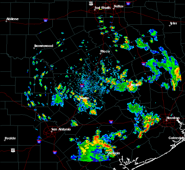 At 443 pm cdt, a severe thunderstorm was located over manor, or 7 miles southeast of pflugerville, moving north at 15 mph (radar indicated). Hazards include 60 mph wind gusts. expect damage to roofs, siding, and trees At 443 pm cdt, a severe thunderstorm was located over manor, or 7 miles southeast of pflugerville, moving north at 15 mph (radar indicated). Hazards include 60 mph wind gusts. expect damage to roofs, siding, and trees
|
| 7/8/2019 5:50 PM CDT |
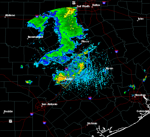 At 549 pm cdt, a severe thunderstorm was located over mansfield dam, or 7 miles southwest of anderson mill, moving east at 15 mph (radar indicated). Hazards include 60 mph wind gusts and quarter size hail. Hail damage to vehicles is expected. Expect wind damage to roofs, siding, and trees. At 549 pm cdt, a severe thunderstorm was located over mansfield dam, or 7 miles southwest of anderson mill, moving east at 15 mph (radar indicated). Hazards include 60 mph wind gusts and quarter size hail. Hail damage to vehicles is expected. Expect wind damage to roofs, siding, and trees.
|
| 6/17/2019 12:15 AM CDT |
 At 1214 am cdt, a severe thunderstorm was located over round rock, moving east at 20 mph (radar indicated). Hazards include 60 mph wind gusts and penny size hail. Expect damage to roofs, siding, and trees. Locations impacted include, austin, round rock, cedar park, georgetown, pflugerville, taylor, anderson mill, windemere, leander, hutto, manor, coupland, rices crossing, brushy creek, wells branch and jollyville. At 1214 am cdt, a severe thunderstorm was located over round rock, moving east at 20 mph (radar indicated). Hazards include 60 mph wind gusts and penny size hail. Expect damage to roofs, siding, and trees. Locations impacted include, austin, round rock, cedar park, georgetown, pflugerville, taylor, anderson mill, windemere, leander, hutto, manor, coupland, rices crossing, brushy creek, wells branch and jollyville.
|
| 6/16/2019 11:57 PM CDT |
 At 1157 pm cdt, a severe thunderstorm was located near round rock, moving southeast at 15 mph (radar indicated). Hazards include 60 mph wind gusts and quarter size hail. Hail damage to vehicles is expected. Expect wind damage to roofs, siding, and trees. At 1157 pm cdt, a severe thunderstorm was located near round rock, moving southeast at 15 mph (radar indicated). Hazards include 60 mph wind gusts and quarter size hail. Hail damage to vehicles is expected. Expect wind damage to roofs, siding, and trees.
|
| 6/9/2019 7:56 PM CDT | Reported through spotternetwor in travis county TX, 10.3 miles NNE of Austin, TX |
| 6/9/2019 7:56 PM CDT |
 At 756 pm cdt, severe thunderstorms were located along a line extending from near rosanky to near spring branch, moving south at 40 mph (radar indicated). Hazards include 60 mph wind gusts and quarter size hail. Hail damage to vehicles is expected. expect wind damage to roofs, siding, and trees. Locations impacted include, san antonio, austin, new braunfels, san marcos, schertz, kyle, seguin, cibolo, universal city, live oak, buda, lockhart, selma, bastrop, luling, smithville, dripping springs, wimberley, blanco and flatonia. At 756 pm cdt, severe thunderstorms were located along a line extending from near rosanky to near spring branch, moving south at 40 mph (radar indicated). Hazards include 60 mph wind gusts and quarter size hail. Hail damage to vehicles is expected. expect wind damage to roofs, siding, and trees. Locations impacted include, san antonio, austin, new braunfels, san marcos, schertz, kyle, seguin, cibolo, universal city, live oak, buda, lockhart, selma, bastrop, luling, smithville, dripping springs, wimberley, blanco and flatonia.
|
| 6/9/2019 7:46 PM CDT |
 At 745 pm cdt, severe thunderstorms were located along a line extending from near bastrop to twin sisters, moving south at 40 mph (radar indicated). Hazards include 60 mph wind gusts and quarter size hail. Hail damage to vehicles is expected. Expect wind damage to roofs, siding, and trees. At 745 pm cdt, severe thunderstorms were located along a line extending from near bastrop to twin sisters, moving south at 40 mph (radar indicated). Hazards include 60 mph wind gusts and quarter size hail. Hail damage to vehicles is expected. Expect wind damage to roofs, siding, and trees.
|
| 6/9/2019 7:42 PM CDT | Tree down on 15th street near red river st. that is blocking two lane in travis county TX, 1.4 miles NW of Austin, TX |
| 6/9/2019 7:37 PM CDT | Large tree down blocking ohlen roa in travis county TX, 4.9 miles SSW of Austin, TX |
| 6/9/2019 7:37 PM CDT | Storm damage reported in travis county TX, 8.8 miles NW of Austin, TX |
| 6/9/2019 7:24 PM CDT |
 At 723 pm cdt, severe thunderstorms were located along a line extending from near bastrop to near bear creek, moving south at 60 mph (radar indicated). Hazards include 60 mph wind gusts and quarter size hail. Hail damage to vehicles is expected. expect wind damage to roofs, siding, and trees. Locations impacted include, austin, round rock, cedar park, pflugerville, kyle, buda, elgin, bastrop, dripping springs, tanglewood forest, anderson mill, austin bergstrom int airport, windemere, leander, lakeway, manor, lago vista, bee cave, west lake hills and hudson bend. At 723 pm cdt, severe thunderstorms were located along a line extending from near bastrop to near bear creek, moving south at 60 mph (radar indicated). Hazards include 60 mph wind gusts and quarter size hail. Hail damage to vehicles is expected. expect wind damage to roofs, siding, and trees. Locations impacted include, austin, round rock, cedar park, pflugerville, kyle, buda, elgin, bastrop, dripping springs, tanglewood forest, anderson mill, austin bergstrom int airport, windemere, leander, lakeway, manor, lago vista, bee cave, west lake hills and hudson bend.
|
| 6/9/2019 7:21 PM CDT | Storm damage reported in travis county TX, 11.8 miles SE of Austin, TX |
| 6/9/2019 7:12 PM CDT | Large tree limbs knocked dow in williamson county TX, 10.3 miles S of Austin, TX |
| 6/9/2019 7:00 PM CDT |
 At 700 pm cdt, severe thunderstorms were located along a line extending from near elgin to lago vista, moving south at 30 mph (radar indicated). Hazards include 60 mph wind gusts and quarter size hail. Hail damage to vehicles is expected. Expect wind damage to roofs, siding, and trees. At 700 pm cdt, severe thunderstorms were located along a line extending from near elgin to lago vista, moving south at 30 mph (radar indicated). Hazards include 60 mph wind gusts and quarter size hail. Hail damage to vehicles is expected. Expect wind damage to roofs, siding, and trees.
|
| 6/9/2019 6:38 PM CDT |
 At 638 pm cdt, severe thunderstorms were located along a line extending from near smithwick to near elgin, moving southwest at 80 mph (radar indicated). Hazards include 70 mph wind gusts and quarter size hail. Hail damage to vehicles is expected. expect considerable tree damage. wind damage is also likely to mobile homes, roofs, and outbuildings. Locations impacted include, austin, round rock, cedar park, georgetown, anderson mill, leander, hutto, liberty hill, georgetown dam, coupland, rices crossing, brushy creek, jollyville and seward junction. At 638 pm cdt, severe thunderstorms were located along a line extending from near smithwick to near elgin, moving southwest at 80 mph (radar indicated). Hazards include 70 mph wind gusts and quarter size hail. Hail damage to vehicles is expected. expect considerable tree damage. wind damage is also likely to mobile homes, roofs, and outbuildings. Locations impacted include, austin, round rock, cedar park, georgetown, anderson mill, leander, hutto, liberty hill, georgetown dam, coupland, rices crossing, brushy creek, jollyville and seward junction.
|
| 6/9/2019 6:38 PM CDT |
 At 636 pm cdt, a severe squall line capable of producing both tornadoes and extensive straight line wind damage was located 7 miles east of smithwick, or 10 miles south of bertram, moving south at 30 mph. straight line wind damage and additional tornadoes may extend as far west as 5 miles west of spicewood through 715 pm cdt (radar indicated rotation). Hazards include tornado. Flying debris will be dangerous to those caught without shelter. mobile homes will be damaged or destroyed. damage to roofs, windows, and vehicles will occur. tree damage is likely. Locations impacted include, austin, cedar park, bertram, anderson mill, leander, lago vista, hudson bend, liberty hill, spicewood, oatmeal, smithwick, jonestown, briarcliff, volente and seward junction. At 636 pm cdt, a severe squall line capable of producing both tornadoes and extensive straight line wind damage was located 7 miles east of smithwick, or 10 miles south of bertram, moving south at 30 mph. straight line wind damage and additional tornadoes may extend as far west as 5 miles west of spicewood through 715 pm cdt (radar indicated rotation). Hazards include tornado. Flying debris will be dangerous to those caught without shelter. mobile homes will be damaged or destroyed. damage to roofs, windows, and vehicles will occur. tree damage is likely. Locations impacted include, austin, cedar park, bertram, anderson mill, leander, lago vista, hudson bend, liberty hill, spicewood, oatmeal, smithwick, jonestown, briarcliff, volente and seward junction.
|
| 6/9/2019 6:27 PM CDT |
 At 624 pm cdt, a funnel cloud was located near liberty hill, or near bertram, moving south at 30 mph (law enforcement confirmed tornado). Hazards include damaging tornado. Flying debris will be dangerous to those caught without shelter. mobile homes will be damaged or destroyed. damage to roofs, windows, and vehicles will occur. Tree damage is likely. At 624 pm cdt, a funnel cloud was located near liberty hill, or near bertram, moving south at 30 mph (law enforcement confirmed tornado). Hazards include damaging tornado. Flying debris will be dangerous to those caught without shelter. mobile homes will be damaged or destroyed. damage to roofs, windows, and vehicles will occur. Tree damage is likely.
|
| 6/9/2019 6:11 PM CDT |
 At 611 pm cdt, severe thunderstorms were located along a line extending from jarrell to near thorndale, moving southwest at 30 mph (radar indicated). Hazards include 70 mph wind gusts and quarter size hail. Hail damage to vehicles is expected. expect considerable tree damage. Wind damage is also likely to mobile homes, roofs, and outbuildings. At 611 pm cdt, severe thunderstorms were located along a line extending from jarrell to near thorndale, moving southwest at 30 mph (radar indicated). Hazards include 70 mph wind gusts and quarter size hail. Hail damage to vehicles is expected. expect considerable tree damage. Wind damage is also likely to mobile homes, roofs, and outbuildings.
|
| 6/6/2019 4:49 PM CDT |
 The national weather service in austin san antonio has issued a * severe thunderstorm warning for. southeastern travis county in south central texas. northwestern bastrop county in south central texas. until 515 pm cdt. At 449 pm cdt, a severe thunderstorm was located near tanglewood. The national weather service in austin san antonio has issued a * severe thunderstorm warning for. southeastern travis county in south central texas. northwestern bastrop county in south central texas. until 515 pm cdt. At 449 pm cdt, a severe thunderstorm was located near tanglewood.
|
| 6/6/2019 3:38 PM CDT |
 At 337 pm cdt, a severe thunderstorm was located near wyldwood, or 7 miles southeast of austin bergstrom int airport, moving east at 15 mph (radar indicated). Hazards include 60 mph wind gusts and quarter size hail. Hail damage to vehicles is expected. Expect wind damage to roofs, siding, and trees. At 337 pm cdt, a severe thunderstorm was located near wyldwood, or 7 miles southeast of austin bergstrom int airport, moving east at 15 mph (radar indicated). Hazards include 60 mph wind gusts and quarter size hail. Hail damage to vehicles is expected. Expect wind damage to roofs, siding, and trees.
|
| 6/6/2019 3:31 PM CDT | Quarter sized hail reported 8.9 miles SW of Austin, TX, parmer at dessau. |
| 6/6/2019 3:25 PM CDT |
 At 325 pm cdt, a severe thunderstorm was located near manor, or near pflugerville, moving east at 30 mph (radar indicated). Hazards include 70 mph wind gusts and quarter size hail. Hail damage to vehicles is expected. expect considerable tree damage. Wind damage is also likely to mobile homes, roofs, and outbuildings. At 325 pm cdt, a severe thunderstorm was located near manor, or near pflugerville, moving east at 30 mph (radar indicated). Hazards include 70 mph wind gusts and quarter size hail. Hail damage to vehicles is expected. expect considerable tree damage. Wind damage is also likely to mobile homes, roofs, and outbuildings.
|
| 6/6/2019 3:17 PM CDT |
 At 315 pm cdt, several public reports of penny sized hail with the storm moving across the austin area. also, strong winds and heavy rainfall have been reported. the storm still capable of producing wind gusts up to 60 mph and quarter size hail (trained weather spotters). Hazards include 60 mph wind gusts and quarter size hail. Hail damage to vehicles is expected. expect wind damage to roofs, siding, and trees. Locations impacted include, austin, pflugerville, tanglewood forest, austin bergstrom int airport, manor, west lake hills, rollingwood, onion creek, barton creek, wyldwood, shady hollow, hornsby bend, manchaca, sunset valley, san leanna, webberville, del valle, pilot knob, camp mabry and mckinney falls state park. At 315 pm cdt, several public reports of penny sized hail with the storm moving across the austin area. also, strong winds and heavy rainfall have been reported. the storm still capable of producing wind gusts up to 60 mph and quarter size hail (trained weather spotters). Hazards include 60 mph wind gusts and quarter size hail. Hail damage to vehicles is expected. expect wind damage to roofs, siding, and trees. Locations impacted include, austin, pflugerville, tanglewood forest, austin bergstrom int airport, manor, west lake hills, rollingwood, onion creek, barton creek, wyldwood, shady hollow, hornsby bend, manchaca, sunset valley, san leanna, webberville, del valle, pilot knob, camp mabry and mckinney falls state park.
|
| 6/6/2019 2:49 PM CDT |
 The national weather service in austin san antonio has issued a * severe thunderstorm warning for. central travis county in south central texas. northwestern bastrop county in south central texas. until 345 pm cdt. At 249 pm cdt, a severe thunderstorm was located over barton creek,. The national weather service in austin san antonio has issued a * severe thunderstorm warning for. central travis county in south central texas. northwestern bastrop county in south central texas. until 345 pm cdt. At 249 pm cdt, a severe thunderstorm was located over barton creek,.
|
| 5/8/2019 12:21 PM CDT |
 At 1221 pm cdt, a severe thunderstorm was located near hutto, or 7 miles northeast of pflugerville, moving northeast at 60 mph (radar indicated). Hazards include 60 mph wind gusts. expect damage to roofs, siding, and trees At 1221 pm cdt, a severe thunderstorm was located near hutto, or 7 miles northeast of pflugerville, moving northeast at 60 mph (radar indicated). Hazards include 60 mph wind gusts. expect damage to roofs, siding, and trees
|
| 5/8/2019 12:09 PM CDT |
 At 1158 am cdt, a severe thunderstorm was located near hudson bend, or near anderson mill, moving northeast at 35 mph (radar indicated). Hazards include 60 mph wind gusts. expect damage to roofs, siding, and trees At 1158 am cdt, a severe thunderstorm was located near hudson bend, or near anderson mill, moving northeast at 35 mph (radar indicated). Hazards include 60 mph wind gusts. expect damage to roofs, siding, and trees
|
| 5/8/2019 11:58 AM CDT |
 At 1158 am cdt, a severe thunderstorm was located near hudson bend, or near anderson mill, moving northeast at 35 mph (radar indicated). Hazards include 60 mph wind gusts. expect damage to roofs, siding, and trees At 1158 am cdt, a severe thunderstorm was located near hudson bend, or near anderson mill, moving northeast at 35 mph (radar indicated). Hazards include 60 mph wind gusts. expect damage to roofs, siding, and trees
|
| 5/8/2019 11:30 AM CDT |
 At 1130 am cdt, a severe thunderstorm was located over spicewood, or 11 miles southeast of marble falls, moving east at 40 mph (radar indicated). Hazards include 60 mph wind gusts. Expect damage to roofs, siding, and trees. Locations impacted include, austin, cedar park, marble falls, round mountain, anderson mill, leander, lakeway, lago vista, bee cave, granite shoals, horseshoe bay, hudson bend, the hills, meadowlakes, spicewood, cypress mill, pedernales falls state park, smithwick, mansfield dam and jonestown. At 1130 am cdt, a severe thunderstorm was located over spicewood, or 11 miles southeast of marble falls, moving east at 40 mph (radar indicated). Hazards include 60 mph wind gusts. Expect damage to roofs, siding, and trees. Locations impacted include, austin, cedar park, marble falls, round mountain, anderson mill, leander, lakeway, lago vista, bee cave, granite shoals, horseshoe bay, hudson bend, the hills, meadowlakes, spicewood, cypress mill, pedernales falls state park, smithwick, mansfield dam and jonestown.
|
| 5/8/2019 11:15 AM CDT |
 At 1115 am cdt, a severe thunderstorm was located over round mountain, moving east at 45 mph (radar indicated). Hazards include 60 mph wind gusts. Expect damage to roofs, siding, and trees. Locations impacted include, austin, cedar park, marble falls, round mountain, anderson mill, leander, lakeway, lago vista, bee cave, granite shoals, horseshoe bay, hudson bend, the hills, meadowlakes, highland haven, spicewood, cypress mill, pedernales falls state park, sandy and smithwick. At 1115 am cdt, a severe thunderstorm was located over round mountain, moving east at 45 mph (radar indicated). Hazards include 60 mph wind gusts. Expect damage to roofs, siding, and trees. Locations impacted include, austin, cedar park, marble falls, round mountain, anderson mill, leander, lakeway, lago vista, bee cave, granite shoals, horseshoe bay, hudson bend, the hills, meadowlakes, highland haven, spicewood, cypress mill, pedernales falls state park, sandy and smithwick.
|
| 5/8/2019 10:59 AM CDT |
 At 1058 am cdt, a severe thunderstorm was located over blowout, or 13 miles west of round mountain, moving east at 35 mph (radar indicated). Hazards include 60 mph wind gusts. expect damage to roofs, siding, and trees At 1058 am cdt, a severe thunderstorm was located over blowout, or 13 miles west of round mountain, moving east at 35 mph (radar indicated). Hazards include 60 mph wind gusts. expect damage to roofs, siding, and trees
|
| 5/3/2019 7:49 PM CDT |
 The national weather service in austin san antonio has issued a * severe thunderstorm warning for. north central caldwell county in south central texas. southeastern travis county in south central texas. bastrop county in south central texas. Southeastern lee county in south central texas. The national weather service in austin san antonio has issued a * severe thunderstorm warning for. north central caldwell county in south central texas. southeastern travis county in south central texas. bastrop county in south central texas. Southeastern lee county in south central texas.
|
| 5/3/2019 7:22 PM CDT |
 At 722 pm cdt, a severe thunderstorm was located over barton creek, or near tanglewood forest, moving east at 15 mph (radar indicated). Hazards include 60 mph wind gusts and quarter size hail. Hail damage to vehicles is expected. expect wind damage to roofs, siding, and trees. Locations impacted include, austin, buda, dripping springs, tanglewood forest, lakeway, bee cave, west lake hills, hudson bend, the hills, bear creek, onion creek, barton creek, driftwood, mansfield dam, shady hollow, manchaca, sunset valley, san leanna, hays and lost creek. At 722 pm cdt, a severe thunderstorm was located over barton creek, or near tanglewood forest, moving east at 15 mph (radar indicated). Hazards include 60 mph wind gusts and quarter size hail. Hail damage to vehicles is expected. expect wind damage to roofs, siding, and trees. Locations impacted include, austin, buda, dripping springs, tanglewood forest, lakeway, bee cave, west lake hills, hudson bend, the hills, bear creek, onion creek, barton creek, driftwood, mansfield dam, shady hollow, manchaca, sunset valley, san leanna, hays and lost creek.
|
| 5/3/2019 6:43 PM CDT |
 The national weather service in austin san antonio has issued a * severe thunderstorm warning for. northern hays county in south central texas. southwestern travis county in south central texas. until 745 pm cdt. At 643 pm cdt, a severe thunderstorm was located over dripping. The national weather service in austin san antonio has issued a * severe thunderstorm warning for. northern hays county in south central texas. southwestern travis county in south central texas. until 745 pm cdt. At 643 pm cdt, a severe thunderstorm was located over dripping.
|
| 4/17/2019 11:41 PM CDT |
 The severe thunderstorm warning for western williamson, northwestern travis, southeastern llano and burnet counties will expire at 1145 pm cdt, the storms which prompted the warning have weakened below severe limits, and no longer pose an immediate threat to life or property. therefore, the warning will be allowed to expire. frequent lightning and wind gusts over 40 mph will still be possible with this line of storms. a severe thunderstorm watch remains in effect until 200 am cdt for south central texas. The severe thunderstorm warning for western williamson, northwestern travis, southeastern llano and burnet counties will expire at 1145 pm cdt, the storms which prompted the warning have weakened below severe limits, and no longer pose an immediate threat to life or property. therefore, the warning will be allowed to expire. frequent lightning and wind gusts over 40 mph will still be possible with this line of storms. a severe thunderstorm watch remains in effect until 200 am cdt for south central texas.
|
| 4/17/2019 11:17 PM CDT |
 At 1115 pm cdt, severe thunderstorms were located along a line extending from near briggs to spicewood, moving east at 40 mph. this line of storms may produce a brief tornado with rotating winds noted on radar 4 miles west of andice (radar indicated). Hazards include 60 mph wind gusts and penny size hail. Expect damage to roofs, siding, and trees. Locations impacted include, cedar park, georgetown, burnet, marble falls, kingsland, bertram, buchanan dam, leander, lago vista, granite shoals, horseshoe bay, meadowlakes, liberty hill, florence, highland haven, inks lake state park, spicewood, watson, lake victor and joppa. At 1115 pm cdt, severe thunderstorms were located along a line extending from near briggs to spicewood, moving east at 40 mph. this line of storms may produce a brief tornado with rotating winds noted on radar 4 miles west of andice (radar indicated). Hazards include 60 mph wind gusts and penny size hail. Expect damage to roofs, siding, and trees. Locations impacted include, cedar park, georgetown, burnet, marble falls, kingsland, bertram, buchanan dam, leander, lago vista, granite shoals, horseshoe bay, meadowlakes, liberty hill, florence, highland haven, inks lake state park, spicewood, watson, lake victor and joppa.
|
| 4/17/2019 10:51 PM CDT |
 At 1050 pm cdt, severe thunderstorms were located along a line extending from near lampasas to near horseshoe bay, moving east at 40 mph (radar indicated). Hazards include 60 mph wind gusts and penny size hail. expect damage to roofs, siding, and trees At 1050 pm cdt, severe thunderstorms were located along a line extending from near lampasas to near horseshoe bay, moving east at 40 mph (radar indicated). Hazards include 60 mph wind gusts and penny size hail. expect damage to roofs, siding, and trees
|
| 4/13/2019 11:37 AM CDT | Metar report of 1/4 inch hail at bergstrom airpor in travis county TX, 8.5 miles NNW of Austin, TX |
| 4/13/2019 10:45 AM CDT |
 At 1044 am cdt, a severe thunderstorm was located over wimberley, moving northeast at 40 mph (radar indicated). Hazards include 60 mph wind gusts and quarter size hail. Hail damage to vehicles is expected. expect wind damage to roofs, siding, and trees. Locations impacted include, kyle, buda, dripping springs, wimberley, woodcreek, niederwald, bear creek, driftwood, mountain city, hays and hays city. At 1044 am cdt, a severe thunderstorm was located over wimberley, moving northeast at 40 mph (radar indicated). Hazards include 60 mph wind gusts and quarter size hail. Hail damage to vehicles is expected. expect wind damage to roofs, siding, and trees. Locations impacted include, kyle, buda, dripping springs, wimberley, woodcreek, niederwald, bear creek, driftwood, mountain city, hays and hays city.
|
| 4/13/2019 10:29 AM CDT |
 At 1028 am cdt, a severe thunderstorm was located over canyon lake dam, moving northeast at 40 mph (radar indicated). Hazards include 60 mph wind gusts and quarter size hail. Hail damage to vehicles is expected. Expect wind damage to roofs, siding, and trees. At 1028 am cdt, a severe thunderstorm was located over canyon lake dam, moving northeast at 40 mph (radar indicated). Hazards include 60 mph wind gusts and quarter size hail. Hail damage to vehicles is expected. Expect wind damage to roofs, siding, and trees.
|
| 4/6/2019 9:11 PM CDT |
 At 911 pm cdt, a severe thunderstorm was located near kyle, moving northeast at 15 mph. several reports of quarter to half dollar sized hail have come in from around the san marcos area (trained weather spotters). Hazards include 60 mph wind gusts and half dollar size hail. Hail damage to vehicles is expected. expect wind damage to roofs, siding, and trees. Locations impacted include, san marcos, kyle, buda, lockhart, wimberley, canyon lake, martindale, uhland, mustang ridge, niederwald, zorn, mountain city, hays, hunter, san marcos regional airport, maxwell, reedville, redwood, hays city and mendoza. At 911 pm cdt, a severe thunderstorm was located near kyle, moving northeast at 15 mph. several reports of quarter to half dollar sized hail have come in from around the san marcos area (trained weather spotters). Hazards include 60 mph wind gusts and half dollar size hail. Hail damage to vehicles is expected. expect wind damage to roofs, siding, and trees. Locations impacted include, san marcos, kyle, buda, lockhart, wimberley, canyon lake, martindale, uhland, mustang ridge, niederwald, zorn, mountain city, hays, hunter, san marcos regional airport, maxwell, reedville, redwood, hays city and mendoza.
|
| 4/6/2019 8:54 PM CDT |
 At 853 pm cdt, a severe thunderstorm was located over san marcos, moving northeast at 15 mph. this storm has a history of producing quarter sized hail (radar indicated). Hazards include 60 mph wind gusts and quarter size hail. Hail damage to vehicles is expected. Expect wind damage to roofs, siding, and trees. At 853 pm cdt, a severe thunderstorm was located over san marcos, moving northeast at 15 mph. this storm has a history of producing quarter sized hail (radar indicated). Hazards include 60 mph wind gusts and quarter size hail. Hail damage to vehicles is expected. Expect wind damage to roofs, siding, and trees.
|
| 8/20/2018 6:23 PM CDT |
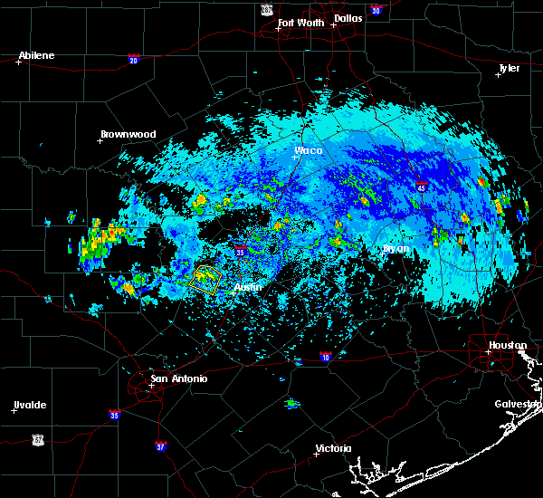 The severe thunderstorm warning for northwestern travis county will expire at 630 pm cdt, the storm which prompted the warning has weakened below severe limits, and no longer poses an immediate threat to life or property. therefore, the warning will be allowed to expire. The severe thunderstorm warning for northwestern travis county will expire at 630 pm cdt, the storm which prompted the warning has weakened below severe limits, and no longer poses an immediate threat to life or property. therefore, the warning will be allowed to expire.
|
| 8/20/2018 6:13 PM CDT |
 At 613 pm cdt, a severe thunderstorm was located near lago vista, or 12 miles west of cedar park, moving southwest at 10 mph (radar indicated). Hazards include 60 mph wind gusts. Expect damage to roofs, siding, and trees. Locations impacted include, austin, cedar park, leander, lakeway, lago vista, bee cave, hudson bend, the hills, mansfield dam, jonestown, briarcliff, point venture and volente. At 613 pm cdt, a severe thunderstorm was located near lago vista, or 12 miles west of cedar park, moving southwest at 10 mph (radar indicated). Hazards include 60 mph wind gusts. Expect damage to roofs, siding, and trees. Locations impacted include, austin, cedar park, leander, lakeway, lago vista, bee cave, hudson bend, the hills, mansfield dam, jonestown, briarcliff, point venture and volente.
|
| 8/20/2018 5:48 PM CDT |
 At 548 pm cdt, a severe thunderstorm was located near lago vista, or 9 miles west of cedar park, and is nearly stationary (radar indicated). Hazards include 60 mph wind gusts and quarter size hail. Hail damage to vehicles is expected. Expect wind damage to roofs, siding, and trees. At 548 pm cdt, a severe thunderstorm was located near lago vista, or 9 miles west of cedar park, and is nearly stationary (radar indicated). Hazards include 60 mph wind gusts and quarter size hail. Hail damage to vehicles is expected. Expect wind damage to roofs, siding, and trees.
|
| 6/4/2018 12:42 AM CDT | High winds and large tree limbs reported dow in travis county TX, 8.8 miles S of Austin, TX |
| 6/4/2018 12:35 AM CDT |
 At 1234 am cdt, severe thunderstorms were located along a line extending from manor to near liberty hill, moving west at 20 mph (radar indicated). Hazards include 60 mph wind gusts and nickel size hail. Expect damage to roofs, siding, and trees. Locations impacted include, austin, round rock, cedar park, georgetown, pflugerville, anderson mill, serenada, windemere, leander, hutto, lakeway, manor, lago vista, bee cave, west lake hills, hudson bend, the hills, liberty hill, weir and barton creek. At 1234 am cdt, severe thunderstorms were located along a line extending from manor to near liberty hill, moving west at 20 mph (radar indicated). Hazards include 60 mph wind gusts and nickel size hail. Expect damage to roofs, siding, and trees. Locations impacted include, austin, round rock, cedar park, georgetown, pflugerville, anderson mill, serenada, windemere, leander, hutto, lakeway, manor, lago vista, bee cave, west lake hills, hudson bend, the hills, liberty hill, weir and barton creek.
|
| 6/4/2018 12:07 AM CDT |
 At 1207 am cdt, a severe thunderstorm was located near round rock, moving west at 25 mph (radar indicated). Hazards include 60 mph wind gusts and quarter size hail. Hail damage to vehicles is expected. Expect wind damage to roofs, siding, and trees. At 1207 am cdt, a severe thunderstorm was located near round rock, moving west at 25 mph (radar indicated). Hazards include 60 mph wind gusts and quarter size hail. Hail damage to vehicles is expected. Expect wind damage to roofs, siding, and trees.
|
| 5/4/2018 9:42 AM CDT | Twitter photo of a large tree in the tarrytown neighborhood in austi in travis county TX, 1.4 miles ESE of Austin, TX |
| 5/4/2018 9:24 AM CDT |
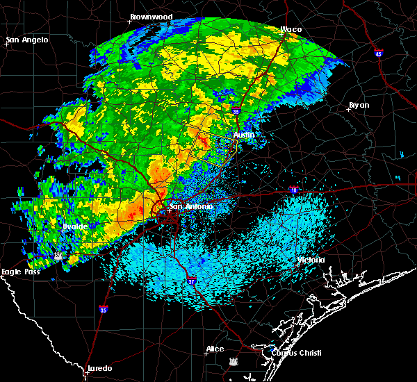 At 921 am cdt, a severe thunderstorm was located over bear creek, or near tanglewood forest, moving east at 30 mph (radar indicated). Hazards include 60 mph wind gusts and penny size hail. Expect damage to roofs, siding, and trees. Locations impacted include, austin, kyle, buda, dripping springs, tanglewood forest, lakeway, bee cave, west lake hills, the hills, rollingwood, bear creek, barton creek, henly, shady hollow, onion creek, driftwood, briarcliff, manchaca, point venture and mountain city. At 921 am cdt, a severe thunderstorm was located over bear creek, or near tanglewood forest, moving east at 30 mph (radar indicated). Hazards include 60 mph wind gusts and penny size hail. Expect damage to roofs, siding, and trees. Locations impacted include, austin, kyle, buda, dripping springs, tanglewood forest, lakeway, bee cave, west lake hills, the hills, rollingwood, bear creek, barton creek, henly, shady hollow, onion creek, driftwood, briarcliff, manchaca, point venture and mountain city.
|
| 5/4/2018 9:21 AM CDT | Mping report of 3" tree limb damage and power poles broke in travis county TX, 15.7 miles ENE of Austin, TX |
| 5/4/2018 8:45 AM CDT |
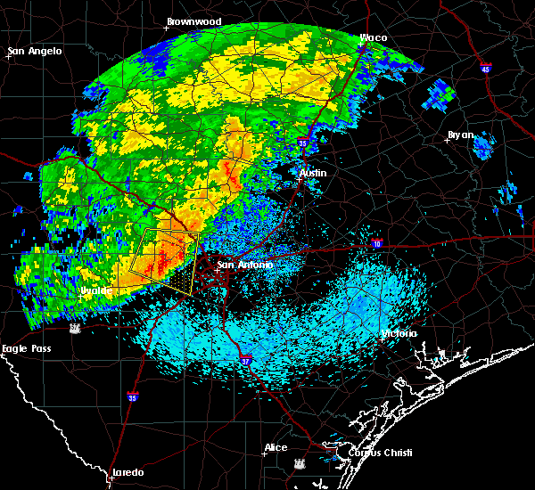 At 845 am cdt, a severe thunderstorm was located near pedernales falls state park, or 11 miles northwest of dripping springs, moving east at 30 mph (radar indicated). Hazards include 60 mph wind gusts and penny size hail. expect damage to roofs, siding, and trees At 845 am cdt, a severe thunderstorm was located near pedernales falls state park, or 11 miles northwest of dripping springs, moving east at 30 mph (radar indicated). Hazards include 60 mph wind gusts and penny size hail. expect damage to roofs, siding, and trees
|
| 4/6/2018 11:58 PM CDT |
 At 1149 pm cdt, the public reported quarter sized hail at the intersection of highways 79 and 130. at 1157 pm cdt, severe thunderstorms were located along a line extending from near thorndale to pflugerville, moving southeast at 25 mph (public). Hazards include 60 mph wind gusts and quarter size hail. Hail damage to vehicles is expected. expect wind damage to roofs, siding, and trees. Locations impacted include, round rock, pflugerville, taylor, windemere, hutto, manor, thrall, coupland, rices crossing, beyarsville, noack, sandoval, brushy creek and wells branch. At 1149 pm cdt, the public reported quarter sized hail at the intersection of highways 79 and 130. at 1157 pm cdt, severe thunderstorms were located along a line extending from near thorndale to pflugerville, moving southeast at 25 mph (public). Hazards include 60 mph wind gusts and quarter size hail. Hail damage to vehicles is expected. expect wind damage to roofs, siding, and trees. Locations impacted include, round rock, pflugerville, taylor, windemere, hutto, manor, thrall, coupland, rices crossing, beyarsville, noack, sandoval, brushy creek and wells branch.
|
| 4/6/2018 11:47 PM CDT |
 At 1144 pm cdt, severe thunderstorms were located along a line extending from near thorndale to near round rock, moving southeast at 25 mph. the strongest cell within this line was located between round rock and hutto (radar indicated). Hazards include 60 mph wind gusts and quarter size hail. Hail damage to vehicles is expected. expect wind damage to roofs, siding, and trees. Locations impacted include, round rock, georgetown, pflugerville, taylor, hutto, manor, thrall, coupland, rices crossing, laneport, hoxie, beyarsville, waterloo, hare, jonah, noack, sandoval, wells branch and brushy creek. At 1144 pm cdt, severe thunderstorms were located along a line extending from near thorndale to near round rock, moving southeast at 25 mph. the strongest cell within this line was located between round rock and hutto (radar indicated). Hazards include 60 mph wind gusts and quarter size hail. Hail damage to vehicles is expected. expect wind damage to roofs, siding, and trees. Locations impacted include, round rock, georgetown, pflugerville, taylor, hutto, manor, thrall, coupland, rices crossing, laneport, hoxie, beyarsville, waterloo, hare, jonah, noack, sandoval, wells branch and brushy creek.
|
| 4/6/2018 11:32 PM CDT |
 At 1132 pm cdt, severe thunderstorms were located along a line extending from near granger dam to near georgetown, moving southeast at 25 mph (radar indicated). Hazards include 60 mph wind gusts and quarter size hail. Hail damage to vehicles is expected. Expect wind damage to roofs, siding, and trees. At 1132 pm cdt, severe thunderstorms were located along a line extending from near granger dam to near georgetown, moving southeast at 25 mph (radar indicated). Hazards include 60 mph wind gusts and quarter size hail. Hail damage to vehicles is expected. Expect wind damage to roofs, siding, and trees.
|
| 7/24/2017 3:54 PM CDT |
 The severe thunderstorm warning for southwestern williamson and northwestern travis counties will expire at 400 pm cdt, the storm which prompted the warning has weakened below severe limits, and no longer poses an immediate threat to life or property. therefore the warning will be allowed to expire. however gusty winds are still possible with this thunderstorm. The severe thunderstorm warning for southwestern williamson and northwestern travis counties will expire at 400 pm cdt, the storm which prompted the warning has weakened below severe limits, and no longer poses an immediate threat to life or property. therefore the warning will be allowed to expire. however gusty winds are still possible with this thunderstorm.
|
| 7/24/2017 3:16 PM CDT |
 At 316 pm cdt, a severe thunderstorm was located over cedar park, moving southwest at 15 mph (radar indicated). Hazards include 60 mph wind gusts and quarter size hail. Hail damage to vehicles is expected. Expect wind damage to roofs, siding, and trees. At 316 pm cdt, a severe thunderstorm was located over cedar park, moving southwest at 15 mph (radar indicated). Hazards include 60 mph wind gusts and quarter size hail. Hail damage to vehicles is expected. Expect wind damage to roofs, siding, and trees.
|
| 7/15/2017 4:57 PM CDT | Reports of tree damage near highway 183 and duval road in northwest austi in travis county TX, 8.8 miles S of Austin, TX |
| 5/28/2017 7:45 PM CDT |
 At 745 pm cdt, a severe thunderstorm was located near austin bergstrom int ap, moving east at 15 mph (radar indicated). Hazards include 60 mph wind gusts and quarter size hail. Hail damage to vehicles is expected. expect wind damage to roofs, siding, and trees. Locations impacted include, austin, buda, elgin, austin bergstrom int ap, manor, uhland, mustang ridge, niederwald, onion creek, cedar creek, wyldwood, camp swift, sunset valley, san leanna, webberville, creedmoor, maha, del valle, pilot knob and cedar hills. At 745 pm cdt, a severe thunderstorm was located near austin bergstrom int ap, moving east at 15 mph (radar indicated). Hazards include 60 mph wind gusts and quarter size hail. Hail damage to vehicles is expected. expect wind damage to roofs, siding, and trees. Locations impacted include, austin, buda, elgin, austin bergstrom int ap, manor, uhland, mustang ridge, niederwald, onion creek, cedar creek, wyldwood, camp swift, sunset valley, san leanna, webberville, creedmoor, maha, del valle, pilot knob and cedar hills.
|
| 5/28/2017 7:35 PM CDT | Quarter sized hail reported 7.6 miles NNW of Austin, TX, received a photo on social media of quarter sized hail near the intersection of burleson road and mckinney falls parkway. |
| 5/28/2017 7:31 PM CDT |
 At 730 pm cdt, a severe thunderstorm was located near austin bergstrom int ap, moving southeast at 20 mph. a trained spotter reported some limbs down east of the town of manor with this storm in addition to some hail (radar indicated). Hazards include 60 mph wind gusts and quarter size hail. Hail damage to vehicles is expected. expect wind damage to roofs, siding, and trees. Locations impacted include, austin, pflugerville, kyle, buda, elgin, tanglewood forest, austin bergstrom int ap, manor, west lake hills, rollingwood, uhland, mustang ridge, niederwald, shady hollow, onion creek, cedar creek, wyldwood, camp swift, sunset valley and san leanna. At 730 pm cdt, a severe thunderstorm was located near austin bergstrom int ap, moving southeast at 20 mph. a trained spotter reported some limbs down east of the town of manor with this storm in addition to some hail (radar indicated). Hazards include 60 mph wind gusts and quarter size hail. Hail damage to vehicles is expected. expect wind damage to roofs, siding, and trees. Locations impacted include, austin, pflugerville, kyle, buda, elgin, tanglewood forest, austin bergstrom int ap, manor, west lake hills, rollingwood, uhland, mustang ridge, niederwald, shady hollow, onion creek, cedar creek, wyldwood, camp swift, sunset valley and san leanna.
|
| 5/28/2017 7:20 PM CDT |
 At 719 pm cdt, a severe thunderstorm was located near austin bergstrom int ap, moving southeast at 30 mph (radar indicated). Hazards include 60 mph wind gusts and quarter size hail. Hail damage to vehicles is expected. expect wind damage to roofs, siding, and trees. Locations impacted include, austin, round rock, pflugerville, kyle, buda, elgin, tanglewood forest, austin bergstrom int ap, windemere, manor, bee cave, west lake hills, rollingwood, uhland, mustang ridge, niederwald, bear creek, barton creek, shady hollow and onion creek. At 719 pm cdt, a severe thunderstorm was located near austin bergstrom int ap, moving southeast at 30 mph (radar indicated). Hazards include 60 mph wind gusts and quarter size hail. Hail damage to vehicles is expected. expect wind damage to roofs, siding, and trees. Locations impacted include, austin, round rock, pflugerville, kyle, buda, elgin, tanglewood forest, austin bergstrom int ap, windemere, manor, bee cave, west lake hills, rollingwood, uhland, mustang ridge, niederwald, bear creek, barton creek, shady hollow and onion creek.
|
| 5/28/2017 7:00 PM CDT |
 At 700 pm cdt, a severe thunderstorm was located over austin bergstrom int ap, moving southeast at 20 mph (radar indicated). Hazards include 60 mph wind gusts and quarter size hail. Hail damage to vehicles is expected. Expect wind damage to roofs, siding, and trees. At 700 pm cdt, a severe thunderstorm was located over austin bergstrom int ap, moving southeast at 20 mph (radar indicated). Hazards include 60 mph wind gusts and quarter size hail. Hail damage to vehicles is expected. Expect wind damage to roofs, siding, and trees.
|
| 5/28/2017 6:55 PM CDT | Reports of a down-burst resulting in tree limb damage from twitte in travis county TX, 3.5 miles W of Austin, TX |
| 5/28/2017 6:45 PM CDT | Tree snapped in the front yard of a residence in the wells branch area received via kxan social medi in travis county TX, 11.6 miles SSW of Austin, TX |
| 5/28/2017 6:12 PM CDT |
 At 612 pm cdt, a severe thunderstorm was located near austin, moving northeast at 5 mph (radar indicated). Hazards include 60 mph wind gusts and quarter size hail. Hail damage to vehicles is expected. Expect wind damage to roofs, siding, and trees. At 612 pm cdt, a severe thunderstorm was located near austin, moving northeast at 5 mph (radar indicated). Hazards include 60 mph wind gusts and quarter size hail. Hail damage to vehicles is expected. Expect wind damage to roofs, siding, and trees.
|
| 5/23/2017 6:11 PM CDT |
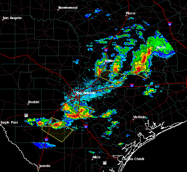 At 611 pm cdt, a severe thunderstorm was located over buda, moving east at 55 mph (radar indicated). Hazards include 60 mph wind gusts and quarter size hail. Hail damage to vehicles is expected. Expect wind damage to roofs, siding, and trees. At 611 pm cdt, a severe thunderstorm was located over buda, moving east at 55 mph (radar indicated). Hazards include 60 mph wind gusts and quarter size hail. Hail damage to vehicles is expected. Expect wind damage to roofs, siding, and trees.
|
| 5/23/2017 5:19 PM CDT |
 At 519 pm cdt, a severe thunderstorm was located near pflugerville, moving east at 60 mph (radar indicated). Hazards include 60 mph wind gusts and quarter size hail. Hail damage to vehicles is expected. Expect wind damage to roofs, siding, and trees. At 519 pm cdt, a severe thunderstorm was located near pflugerville, moving east at 60 mph (radar indicated). Hazards include 60 mph wind gusts and quarter size hail. Hail damage to vehicles is expected. Expect wind damage to roofs, siding, and trees.
|
| 5/11/2017 5:24 PM CDT | Ping Pong Ball sized hail reported 9.7 miles SSW of Austin, TX, report and picture from twitter user. no street references available. |
| 5/11/2017 5:18 PM CDT |
 At 518 pm cdt, a severe thunderstorm was located near windemere, moving northeast at 45 mph (trained weather spotters). Hazards include 60 mph wind gusts and quarter size hail. Hail damage to vehicles is expected. expect wind damage to roofs, siding, and trees. Locations impacted include, austin, round rock, pflugerville, anderson mill, windemere, hutto, coupland, rices crossing, brushy creek, wells branch and jollyville. At 518 pm cdt, a severe thunderstorm was located near windemere, moving northeast at 45 mph (trained weather spotters). Hazards include 60 mph wind gusts and quarter size hail. Hail damage to vehicles is expected. expect wind damage to roofs, siding, and trees. Locations impacted include, austin, round rock, pflugerville, anderson mill, windemere, hutto, coupland, rices crossing, brushy creek, wells branch and jollyville.
|
| 5/11/2017 5:15 PM CDT | Ping Pong Ball sized hail reported 5.9 miles SSE of Austin, TX, ping pong ball sized hail near tx 360 at lakewood dr. |
| 5/11/2017 5:15 PM CDT | Quarter sized hail reported 5.4 miles S of Austin, TX, quarter sized hail... mesa dr at paintrock dr. |
| 5/11/2017 5:07 PM CDT | Quarter sized hail reported 5.9 miles SSE of Austin, TX, corrected time. time estimated with radar. |
| 5/11/2017 5:05 PM CDT | Quarter sized hail reported 5.9 miles SSE of Austin, TX, time estimated with radar. |
| 5/11/2017 5:05 PM CDT |
 At 505 pm cdt, a severe thunderstorm was located over west lake hills, or near austin, moving northeast at 45 mph (radar indicated). Hazards include 60 mph wind gusts and quarter size hail. Hail damage to vehicles is expected. Expect wind damage to roofs, siding, and trees. At 505 pm cdt, a severe thunderstorm was located over west lake hills, or near austin, moving northeast at 45 mph (radar indicated). Hazards include 60 mph wind gusts and quarter size hail. Hail damage to vehicles is expected. Expect wind damage to roofs, siding, and trees.
|
| 4/11/2017 11:09 AM CDT |
 At 1108 am cdt, a severe thunderstorm was located over dripping springs, moving southeast at 15 mph (trained weather spotters reported quarter size hail in dripping springs). Hazards include quarter size hail. Damage to vehicles is expected. Locations impacted include, wimberley, dripping springs, woodcreek, bear creek, driftwood and mount gainor. At 1108 am cdt, a severe thunderstorm was located over dripping springs, moving southeast at 15 mph (trained weather spotters reported quarter size hail in dripping springs). Hazards include quarter size hail. Damage to vehicles is expected. Locations impacted include, wimberley, dripping springs, woodcreek, bear creek, driftwood and mount gainor.
|
| 4/11/2017 10:57 AM CDT |
 The severe thunderstorm warning for southwestern williamson, north central hays and western travis counties will expire at 1100 am cdt, the storm which prompted the warning has weakened below severe limits, and no longer poses an immediate threat to life or property. therefore the warning will be allowed to expire. however heavy rain is still possible with this thunderstorm. The severe thunderstorm warning for southwestern williamson, north central hays and western travis counties will expire at 1100 am cdt, the storm which prompted the warning has weakened below severe limits, and no longer poses an immediate threat to life or property. therefore the warning will be allowed to expire. however heavy rain is still possible with this thunderstorm.
|
| 4/11/2017 10:55 AM CDT |
 At 1055 am cdt, a severe thunderstorm was located over dripping springs, moving southeast at 15 mph (radar indicated). Hazards include quarter size hail. damage to vehicles is expected At 1055 am cdt, a severe thunderstorm was located over dripping springs, moving southeast at 15 mph (radar indicated). Hazards include quarter size hail. damage to vehicles is expected
|
| 4/11/2017 10:26 AM CDT |
 At 1025 am cdt, a severe thunderstorm was located over lakeway, or 11 miles southwest of anderson mill, moving east at 30 mph (radar indicated). Hazards include half dollar size hail. Damage to vehicles is expected. Locations impacted include, austin, round rock, cedar park, tanglewood forest, anderson mill, leander, lakeway, lago vista, bee cave, west lake hills, the hills, rollingwood, barton creek, hudson bend, mansfield dam, onion creek, shady hollow, jonestown, briarcliff and sunset valley. At 1025 am cdt, a severe thunderstorm was located over lakeway, or 11 miles southwest of anderson mill, moving east at 30 mph (radar indicated). Hazards include half dollar size hail. Damage to vehicles is expected. Locations impacted include, austin, round rock, cedar park, tanglewood forest, anderson mill, leander, lakeway, lago vista, bee cave, west lake hills, the hills, rollingwood, barton creek, hudson bend, mansfield dam, onion creek, shady hollow, jonestown, briarcliff and sunset valley.
|
| 4/11/2017 10:08 AM CDT |
 At 1008 am cdt, a severe thunderstorm was located 7 miles southeast of spicewood, or 13 miles north of dripping springs, moving east at 30 mph (radar indicated). Hazards include half dollar size hail. damage to vehicles is expected At 1008 am cdt, a severe thunderstorm was located 7 miles southeast of spicewood, or 13 miles north of dripping springs, moving east at 30 mph (radar indicated). Hazards include half dollar size hail. damage to vehicles is expected
|
| 4/2/2017 10:28 AM CDT | The severe thunderstorm warning for northwestern caldwell, east central hays, southeastern travis and west central bastrop counties will expire at 1030 am cdt, the storms which prompted the warning have weakened below severe limits, and no longer pose an immediate threat to life or property. therefore the warning will be allowed to expire. a tornado watch remains in effect until 100 pm cdt for south central texas. |
| 4/2/2017 10:17 AM CDT | At 1015 am cdt, severe thunderstorms were located along a line extending from near elgin to 7 miles southwest of cedar creek, moving northeast at 20 mph (radar indicated). Hazards include 60 mph wind gusts and penny size hail. Expect damage to roofs, siding, and trees. locations impacted include, austin, san marcos, lockhart, buda, austin bergstrom int ap, manor, martindale, uhland, mustang ridge, niederwald, onion creek, cedar creek, wyldwood, webberville, creedmoor, rockne, maha, maxwell, reedville and red rock. A tornado watch remains in effect until 100 pm cdt for south central texas. |
| 4/2/2017 9:58 AM CDT | At 958 am cdt, severe thunderstorms were located along a line extending from near florence to near cedar creek, moving northeast at 40 mph (radar indicated). Hazards include 60 mph wind gusts and penny size hail. Expect damage to roofs, siding, and trees. locations impacted include, austin, round rock, san marcos, cedar park, georgetown, pflugerville, lockhart, buda, austin bergstrom int ap, anderson mill, serenada, windemere, leander, manor, rollingwood, florence, martindale, uhland, liberty hill and mustang ridge. A tornado watch remains in effect until 100 pm cdt for south central texas. |
| 4/2/2017 9:48 AM CDT | At 948 am cdt, severe thunderstorms were located along a line extending from near watson to near manor, moving northeast at 35 mph (radar indicated). Hazards include 60 mph wind gusts and nickel size hail. expect damage to roofs, siding, and trees |
| 4/2/2017 9:43 AM CDT | Spotter estimated wind gusts up to 60 mph near parmer ln at rr 62 in williamson county TX, 12.9 miles S of Austin, TX |
| 4/2/2017 9:40 AM CDT | 5 inch tree limb blown down landing on car in driveway with vehicle damaged. estimated winds of 50 to 60 mph. near intersection of sans souci cove and sans souci place in travis county TX, 8.2 miles S of Austin, TX |
| 4/2/2017 9:38 AM CDT | Quarter sized hail reported 9.8 miles E of Austin, TX |
| 4/2/2017 9:38 AM CDT | At 937 am cdt, a severe squall line capable of producing both tornadoes and extensive straight line wind damage was located over cedar park, moving northeast at 40 mph (radar indicated rotation). Hazards include tornado. Flying debris will be dangerous to those caught without shelter. mobile homes will be damaged or destroyed. damage to roofs, windows, and vehicles will occur. tree damage is likely. Locations impacted include, austin, round rock, cedar park, anderson mill, leander, brushy creek and jollyville. |
| 4/2/2017 9:33 AM CDT | Mping report of minor wind damage such as small tree limbs broken in travis county TX, 12.8 miles SSE of Austin, TX |
| 4/2/2017 9:32 AM CDT | At 931 am cdt, severe thunderstorms were located along a line extending from liberty hill to near uhland, moving northeast at 40 mph (radar indicated). Hazards include 60 mph wind gusts and nickel size hail. expect damage to roofs, siding, and trees |
| 4/2/2017 9:30 AM CDT | Storm damage reported in williamson county TX, 11.5 miles SSE of Austin, TX |
| 4/2/2017 9:30 AM CDT | Tree limbs down at sundancer grill. time estimated from rada in travis county TX, 14 miles ESE of Austin, TX |
| 4/2/2017 9:24 AM CDT | Power line snapped in half near hudson bend middle school. time estimated from rada in travis county TX, 13.3 miles ESE of Austin, TX |
| 4/2/2017 9:24 AM CDT | At 924 am cdt, severe thunderstorms capable of producing both tornadoes and extensive straight line wind damage were located over hudson bend, or 8 miles west of anderson mill, moving northeast at 40 mph (radar indicated rotation). Hazards include tornado. Flying debris will be dangerous to those caught without shelter. mobile homes will be damaged or destroyed. damage to roofs, windows, and vehicles will occur. Tree damage is likely. |
| 4/2/2017 9:15 AM CDT | Tree limbs blown down by estimated 60 mph winds in travis county TX, 14.9 miles ESE of Austin, TX |
| 4/2/2017 9:12 AM CDT | At 912 am cdt, severe thunderstorms were located along a line extending from near oatmeal to near canyon lake dam, moving northeast at 45 mph (radar indicated). Hazards include 60 mph wind gusts and nickel size hail. Expect damage to roofs, siding, and trees. locations impacted include, austin, new braunfels, san marcos, kyle, wimberley, dripping springs, canyon lake dam, lakeway, lago vista, canyon lake, bee cave, the hills, woodcreek, bear creek, spicewood, hudson bend, henly, pedernales falls state park, shady hollow and fischer. A tornado watch remains in effect until 100 pm cdt for south central texas. |
| 4/2/2017 8:58 AM CDT | At 858 am cdt, severe thunderstorms were located along a line extending from near marble falls to 7 miles southeast of smithson valley, moving northeast at 40 mph (radar indicated). Hazards include 60 mph wind gusts and nickel size hail. expect damage to roofs, siding, and trees |
| 2/20/2017 12:27 AM CST |
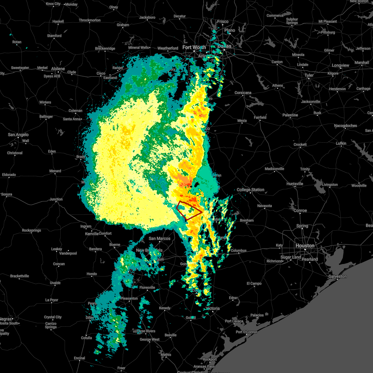 The tornado warning for northeastern travis and north central bastrop counties will expire at 1230 am cst. the tornadic thunderstorm which prompted the warning has moved out of the warned area. therefore, the warning will be allowed to expire. A severe thunderstorm watch remains in effect until 200 am cst for south central texas. The tornado warning for northeastern travis and north central bastrop counties will expire at 1230 am cst. the tornadic thunderstorm which prompted the warning has moved out of the warned area. therefore, the warning will be allowed to expire. A severe thunderstorm watch remains in effect until 200 am cst for south central texas.
|
| 2/20/2017 12:25 AM CST |
 The severe thunderstorm warning for northeastern caldwell, southeastern travis and western bastrop counties will expire at 1230 am cst, the storms which prompted the warning have moved out of the area. therefore the warning will be allowed to expire. a severe thunderstorm watch remains in effect until 200 am cst for south central texas. The severe thunderstorm warning for northeastern caldwell, southeastern travis and western bastrop counties will expire at 1230 am cst, the storms which prompted the warning have moved out of the area. therefore the warning will be allowed to expire. a severe thunderstorm watch remains in effect until 200 am cst for south central texas.
|
| 2/20/2017 12:22 AM CST |
 At 1221 am cst, severe thunderstorms were located along a line extending from near bartlett to near bastrop, moving east at 45 mph (radar indicated). Hazards include 60 mph wind gusts and penny size hail. expect damage to roofs, siding, and trees At 1221 am cst, severe thunderstorms were located along a line extending from near bartlett to near bastrop, moving east at 45 mph (radar indicated). Hazards include 60 mph wind gusts and penny size hail. expect damage to roofs, siding, and trees
|
| 2/20/2017 12:15 AM CST |
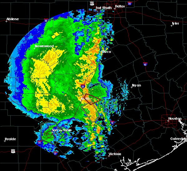 At 1214 am cst, a severe squall line capable of producing both tornadoes and extensive straight line wind damage was located over elgin, moving east at 60 mph (radar indicated rotation). Hazards include tornado. Flying debris will be dangerous to those caught without shelter. mobile homes will be damaged or destroyed. damage to roofs, windows, and vehicles will occur. tree damage is likely. Locations impacted include, pflugerville, elgin, manor, cedar hills and butler. At 1214 am cst, a severe squall line capable of producing both tornadoes and extensive straight line wind damage was located over elgin, moving east at 60 mph (radar indicated rotation). Hazards include tornado. Flying debris will be dangerous to those caught without shelter. mobile homes will be damaged or destroyed. damage to roofs, windows, and vehicles will occur. tree damage is likely. Locations impacted include, pflugerville, elgin, manor, cedar hills and butler.
|
| 2/20/2017 12:09 AM CST |
 The tornado warning for north central caldwell, south central travis and west central bastrop counties will expire at 1215 am cst, the tornadic thunderstorm which prompted the warning has moved out of the warned area. therefore, the warning will be allowed to expire. a tornado warning remains in effect until 1230 am cst for northeastern travis county and north central bastrop county. a severe thunderstorm watch remains in effect until 200 am cst for south central texas. The tornado warning for north central caldwell, south central travis and west central bastrop counties will expire at 1215 am cst, the tornadic thunderstorm which prompted the warning has moved out of the warned area. therefore, the warning will be allowed to expire. a tornado warning remains in effect until 1230 am cst for northeastern travis county and north central bastrop county. a severe thunderstorm watch remains in effect until 200 am cst for south central texas.
|
| 2/20/2017 12:07 AM CST |
 At 1207 am cst, severe thunderstorms were located along a line extending from 7 miles north of wyldwood to near rosanky, moving northeast at 70 mph (radar indicated). Hazards include 60 mph wind gusts and nickel size hail. Expect damage to roofs, siding, and trees. Locations impacted include, bastrop, austin bergstrom int ap, mustang ridge, cedar creek, rosanky, wyldwood, webberville, delhi, rockne, string prairie, watterson, maha, red rock, lytton springs, jeddo, st john colony, bateman, taylorsville and pilot knob. At 1207 am cst, severe thunderstorms were located along a line extending from 7 miles north of wyldwood to near rosanky, moving northeast at 70 mph (radar indicated). Hazards include 60 mph wind gusts and nickel size hail. Expect damage to roofs, siding, and trees. Locations impacted include, bastrop, austin bergstrom int ap, mustang ridge, cedar creek, rosanky, wyldwood, webberville, delhi, rockne, string prairie, watterson, maha, red rock, lytton springs, jeddo, st john colony, bateman, taylorsville and pilot knob.
|
| 2/20/2017 12:05 AM CST |
 At 1205 am cst, severe thunderstorms capable of producing both tornadoes and extensive straight line wind damage were located near manor, or 7 miles northeast of austin bergstrom int ap, moving northeast at 60 mph (radar indicated rotation). Hazards include tornado. Flying debris will be dangerous to those caught without shelter. mobile homes will be damaged or destroyed. damage to roofs, windows, and vehicles will occur. Tree damage is likely. At 1205 am cst, severe thunderstorms capable of producing both tornadoes and extensive straight line wind damage were located near manor, or 7 miles northeast of austin bergstrom int ap, moving northeast at 60 mph (radar indicated rotation). Hazards include tornado. Flying debris will be dangerous to those caught without shelter. mobile homes will be damaged or destroyed. damage to roofs, windows, and vehicles will occur. Tree damage is likely.
|
| 2/20/2017 12:00 AM CST | Media viewer reported porch awning ripped of in travis county TX, 13.5 miles NNW of Austin, TX |
| 2/19/2017 11:58 PM CST |
 At 1158 pm cst, a severe squall line capable of producing both tornadoes and extensive straight line wind damage was located near cedar creek, or 8 miles southeast of austin bergstrom int ap, moving northeast at 60 mph (radar indicated rotation). Hazards include tornado. Flying debris will be dangerous to those caught without shelter. mobile homes will be damaged or destroyed. damage to roofs, windows, and vehicles will occur. tree damage is likely. Locations impacted include, austin, austin bergstrom int ap, mustang ridge, niederwald, onion creek, creedmoor, maha, del valle, pilot knob and mendoza. At 1158 pm cst, a severe squall line capable of producing both tornadoes and extensive straight line wind damage was located near cedar creek, or 8 miles southeast of austin bergstrom int ap, moving northeast at 60 mph (radar indicated rotation). Hazards include tornado. Flying debris will be dangerous to those caught without shelter. mobile homes will be damaged or destroyed. damage to roofs, windows, and vehicles will occur. tree damage is likely. Locations impacted include, austin, austin bergstrom int ap, mustang ridge, niederwald, onion creek, creedmoor, maha, del valle, pilot knob and mendoza.
|
| 2/19/2017 11:53 PM CST |
 At 1152 pm cst, severe thunderstorms were located along a line extending from near mustang ridge to 6 miles southeast of lockhart, moving northeast at 30 mph (radar indicated). Hazards include 60 mph wind gusts and nickel size hail. expect damage to roofs, siding, and trees At 1152 pm cst, severe thunderstorms were located along a line extending from near mustang ridge to 6 miles southeast of lockhart, moving northeast at 30 mph (radar indicated). Hazards include 60 mph wind gusts and nickel size hail. expect damage to roofs, siding, and trees
|
| 2/19/2017 11:35 PM CST |
 At 1134 pm cst, a severe squall line capable of producing both tornadoes and extensive straight line wind damage was located near kyle, moving east at 45 mph (radar indicated rotation). Hazards include tornado. Flying debris will be dangerous to those caught without shelter. mobile homes will be damaged or destroyed. damage to roofs, windows, and vehicles will occur. tree damage is likely. Locations impacted include, austin, san marcos, kyle, buda, austin bergstrom int ap, uhland, mustang ridge, niederwald, onion creek, mountain city, creedmoor, maha, del valle, pilot knob and mendoza. At 1134 pm cst, a severe squall line capable of producing both tornadoes and extensive straight line wind damage was located near kyle, moving east at 45 mph (radar indicated rotation). Hazards include tornado. Flying debris will be dangerous to those caught without shelter. mobile homes will be damaged or destroyed. damage to roofs, windows, and vehicles will occur. tree damage is likely. Locations impacted include, austin, san marcos, kyle, buda, austin bergstrom int ap, uhland, mustang ridge, niederwald, onion creek, mountain city, creedmoor, maha, del valle, pilot knob and mendoza.
|
| 2/19/2017 11:29 PM CST |
 At 1129 pm cst, severe thunderstorms capable of producing both tornadoes and extensive straight line wind damage were located near san marcos, moving east at 45 mph (radar indicated rotation). Hazards include tornado. Flying debris will be dangerous to those caught without shelter. mobile homes will be damaged or destroyed. damage to roofs, windows, and vehicles will occur. Tree damage is likely. At 1129 pm cst, severe thunderstorms capable of producing both tornadoes and extensive straight line wind damage were located near san marcos, moving east at 45 mph (radar indicated rotation). Hazards include tornado. Flying debris will be dangerous to those caught without shelter. mobile homes will be damaged or destroyed. damage to roofs, windows, and vehicles will occur. Tree damage is likely.
|
| 5/26/2016 11:26 PM CDT |
 At 1126 pm cdt, a severe thunderstorm was located near cedar creek, or 7 miles southeast of austin bergstrom int ap, moving east at 25 mph (radar indicated). Hazards include 60 mph wind gusts and quarter size hail. Hail damage to vehicles is expected. Expect wind damage to roofs, siding, and trees. At 1126 pm cdt, a severe thunderstorm was located near cedar creek, or 7 miles southeast of austin bergstrom int ap, moving east at 25 mph (radar indicated). Hazards include 60 mph wind gusts and quarter size hail. Hail damage to vehicles is expected. Expect wind damage to roofs, siding, and trees.
|
| 5/26/2016 11:00 PM CDT | Quarter sized hail reported 8.1 miles NNW of Austin, TX, quarter sized hail reported in the austin bergstrom kaus asos observation |
| 5/26/2016 10:43 PM CDT |
 At 1042 pm cdt, a severe thunderstorm was located near mustang ridge, or near austin bergstrom int airport, and is nearly stationary (radar indicated). Hazards include 60 mph wind gusts and quarter size hail. Hail damage to vehicles is expected. Expect wind damage to roofs, siding, and trees. At 1042 pm cdt, a severe thunderstorm was located near mustang ridge, or near austin bergstrom int airport, and is nearly stationary (radar indicated). Hazards include 60 mph wind gusts and quarter size hail. Hail damage to vehicles is expected. Expect wind damage to roofs, siding, and trees.
|
| 5/26/2016 10:21 PM CDT |
 At 1020 pm cdt, a severe thunderstorm was located near onion creek, or 7 miles southwest of austin bergstrom int ap, and is nearly stationary (radar indicated). Hazards include 60 mph wind gusts and quarter size hail. Hail damage to vehicles is expected. expect wind damage to roofs, siding, and trees. very heavy rain will also casuse localized flash flooding. Locations impacted include, austin, austin bergstrom int ap, tanglewood forest, buda, mustang ridge, niederwald, shady hollow, onion creek, wyldwood, san leanna, webberville, hays, creedmoor, del valle, maha, pilot knob and manchaca. At 1020 pm cdt, a severe thunderstorm was located near onion creek, or 7 miles southwest of austin bergstrom int ap, and is nearly stationary (radar indicated). Hazards include 60 mph wind gusts and quarter size hail. Hail damage to vehicles is expected. expect wind damage to roofs, siding, and trees. very heavy rain will also casuse localized flash flooding. Locations impacted include, austin, austin bergstrom int ap, tanglewood forest, buda, mustang ridge, niederwald, shady hollow, onion creek, wyldwood, san leanna, webberville, hays, creedmoor, del valle, maha, pilot knob and manchaca.
|
| 5/26/2016 10:06 PM CDT |
 At 1006 pm cdt, a severe thunderstorm was located over onion creek, or near tanglewood forest, moving northeast at 20 mph (radar indicated). Hazards include 60 mph wind gusts and quarter size hail. Hail damage to vehicles is expected. Expect wind damage to roofs, siding, and trees. At 1006 pm cdt, a severe thunderstorm was located over onion creek, or near tanglewood forest, moving northeast at 20 mph (radar indicated). Hazards include 60 mph wind gusts and quarter size hail. Hail damage to vehicles is expected. Expect wind damage to roofs, siding, and trees.
|
| 5/26/2016 2:11 PM CDT |
 At 210 pm cdt, a severe thunderstorm was located near mustang ridge, or 8 miles south of austin bergstrom int ap, moving northeast at 25 mph (radar indicated). Hazards include 60 mph wind gusts and quarter size hail. Hail damage to vehicles is expected. expect wind damage to roofs, siding, and trees. Locations impacted include, austin, austin bergstrom int ap, mustang ridge, cedar creek, onion creek, wyldwood, san leanna, webberville, creedmoor, del valle, maha and pilot knob. At 210 pm cdt, a severe thunderstorm was located near mustang ridge, or 8 miles south of austin bergstrom int ap, moving northeast at 25 mph (radar indicated). Hazards include 60 mph wind gusts and quarter size hail. Hail damage to vehicles is expected. expect wind damage to roofs, siding, and trees. Locations impacted include, austin, austin bergstrom int ap, mustang ridge, cedar creek, onion creek, wyldwood, san leanna, webberville, creedmoor, del valle, maha and pilot knob.
|
| 5/26/2016 1:44 PM CDT |
 At 143 pm cdt, a severe thunderstorm was located over niederwald, or 11 miles northwest of lockhart, moving northeast at 35 mph (radar indicated). Hazards include 60 mph wind gusts and quarter size hail. Hail damage to vehicles is expected. Expect wind damage to roofs, siding, and trees. At 143 pm cdt, a severe thunderstorm was located over niederwald, or 11 miles northwest of lockhart, moving northeast at 35 mph (radar indicated). Hazards include 60 mph wind gusts and quarter size hail. Hail damage to vehicles is expected. Expect wind damage to roofs, siding, and trees.
|
| 4/30/2016 5:18 AM CDT |
 At 516 am cdt, severe thunderstorms were located along a line extending from near elgin to near circle d-kc estate to near rosanky, moving east at 40 mph (trained weather spotters). Hazards include 70 mph wind gusts and quarter size hail. Hail damage to vehicles is expected. expect considerable tree damage. wind damage is also likely to mobile homes, roofs, and outbuildings. Locations impacted include, austin, elgin, bastrop, giddings, la grange, smithville, lexington, cedar creek, circle d-kc estate, wyldwood, tanglewood, fedor, rosanky, circle d-kc estates, camp swift, paige, upton, webberville, manheim and blue. At 516 am cdt, severe thunderstorms were located along a line extending from near elgin to near circle d-kc estate to near rosanky, moving east at 40 mph (trained weather spotters). Hazards include 70 mph wind gusts and quarter size hail. Hail damage to vehicles is expected. expect considerable tree damage. wind damage is also likely to mobile homes, roofs, and outbuildings. Locations impacted include, austin, elgin, bastrop, giddings, la grange, smithville, lexington, cedar creek, circle d-kc estate, wyldwood, tanglewood, fedor, rosanky, circle d-kc estates, camp swift, paige, upton, webberville, manheim and blue.
|
| 4/30/2016 4:57 AM CDT |
 At 457 am cdt, severe thunderstorms were located along a line extending from near manor to near wyldwood to 8 miles west of rosanky, moving east at 40 mph (radar indicated). Hazards include 70 mph wind gusts and quarter size hail. Hail damage to vehicles is expected. expect considerable tree damage. Wind damage is also likely to mobile homes, roofs, and outbuildings. At 457 am cdt, severe thunderstorms were located along a line extending from near manor to near wyldwood to 8 miles west of rosanky, moving east at 40 mph (radar indicated). Hazards include 70 mph wind gusts and quarter size hail. Hail damage to vehicles is expected. expect considerable tree damage. Wind damage is also likely to mobile homes, roofs, and outbuildings.
|
| 4/30/2016 4:48 AM CDT | Kaus reported a 52 kt wind gus in travis county TX, 7.9 miles NW of Austin, TX |
| 4/30/2016 4:48 AM CDT | Austin fire department is reporting 15 power poles broken with lines down at the 3400 block of south us highway 18 in travis county TX, 7.6 miles NNW of Austin, TX |
| 4/30/2016 4:42 AM CDT |
 At 441 am cdt, a severe thunderstorm was located near mustang ridge, or 10 miles north of lockhart, moving east at 35 mph (trained weather spotters). Hazards include 60 mph wind gusts and quarter size hail. Hail damage to vehicles is expected. expect wind damage to roofs, siding, and trees. Locations impacted include, mustang ridge, cedar creek, wyldwood, maha, watterson, lytton springs, red rock, rockne, bateman, mendoza, dale and st john colony. At 441 am cdt, a severe thunderstorm was located near mustang ridge, or 10 miles north of lockhart, moving east at 35 mph (trained weather spotters). Hazards include 60 mph wind gusts and quarter size hail. Hail damage to vehicles is expected. expect wind damage to roofs, siding, and trees. Locations impacted include, mustang ridge, cedar creek, wyldwood, maha, watterson, lytton springs, red rock, rockne, bateman, mendoza, dale and st john colony.
|
| 4/30/2016 4:27 AM CDT |
 At 427 am cdt, a severe thunderstorm was located over kyle, or 9 miles northeast of san marcos, moving east at 30 mph (radar indicated). Hazards include 60 mph wind gusts and quarter size hail. Hail damage to vehicles is expected. Expect wind damage to roofs, siding, and trees. At 427 am cdt, a severe thunderstorm was located over kyle, or 9 miles northeast of san marcos, moving east at 30 mph (radar indicated). Hazards include 60 mph wind gusts and quarter size hail. Hail damage to vehicles is expected. Expect wind damage to roofs, siding, and trees.
|
| 4/30/2016 4:15 AM CDT |
 At 415 am cdt, a severe thunderstorm was located over buda, or 8 miles south of tanglewood forest, moving east at 40 mph (trained weather spotters). Hazards include golf ball size hail and 60 mph wind gusts. People and animals outdoors will be injured. expect hail damage to roofs, siding, windows, and vehicles. expect wind damage to roofs, siding, and trees. Locations impacted include, austin, san marcos, lockhart, wimberley, dripping springs, tanglewood forest, kyle, buda, west lake hills, woodcreek, rollingwood, uhland, mustang ridge, niederwald, bear creek, driftwood, shady hollow, onion creek, barton creek and sunset valley. At 415 am cdt, a severe thunderstorm was located over buda, or 8 miles south of tanglewood forest, moving east at 40 mph (trained weather spotters). Hazards include golf ball size hail and 60 mph wind gusts. People and animals outdoors will be injured. expect hail damage to roofs, siding, windows, and vehicles. expect wind damage to roofs, siding, and trees. Locations impacted include, austin, san marcos, lockhart, wimberley, dripping springs, tanglewood forest, kyle, buda, west lake hills, woodcreek, rollingwood, uhland, mustang ridge, niederwald, bear creek, driftwood, shady hollow, onion creek, barton creek and sunset valley.
|
| 4/30/2016 3:52 AM CDT |
 At 352 am cdt, a severe thunderstorm was located over wimberley, moving east at 40 mph (radar indicated). Hazards include two inch hail and 60 mph wind gusts. People and animals outdoors will be injured. expect hail damage to roofs, siding, windows, and vehicles. Expect wind damage to roofs, siding, and trees. At 352 am cdt, a severe thunderstorm was located over wimberley, moving east at 40 mph (radar indicated). Hazards include two inch hail and 60 mph wind gusts. People and animals outdoors will be injured. expect hail damage to roofs, siding, windows, and vehicles. Expect wind damage to roofs, siding, and trees.
|
| 4/27/2016 3:01 AM CDT | Trees and power lines downed as thunderstorm wind gusts of approx. 60 mph moved across north austi in travis county TX, 1.6 miles NNW of Austin, TX |
| 4/27/2016 2:45 AM CDT |
 At 244 am cdt, severe thunderstorms were located along a line extending from near coupland to niederwald to near new braunfels to windcrest, moving southeast at 55 mph. wind gusts of 51 mph were reported at rusty miller lago vista airport and 46 mph at austin bergstrom and san antonio international airports (radar indicated). Hazards include 60 mph wind gusts. Expect damage to roofs. siding. and trees. Locations impacted include, san antonio, austin, round rock, new braunfels, cedar park, pflugerville, san marcos, seguin, universal city, lockhart, elgin, bastrop, luling, wimberley, dripping springs, tanglewood forest, anderson mill, canyon lake dam, windemere and austin bergstrom int ap. At 244 am cdt, severe thunderstorms were located along a line extending from near coupland to niederwald to near new braunfels to windcrest, moving southeast at 55 mph. wind gusts of 51 mph were reported at rusty miller lago vista airport and 46 mph at austin bergstrom and san antonio international airports (radar indicated). Hazards include 60 mph wind gusts. Expect damage to roofs. siding. and trees. Locations impacted include, san antonio, austin, round rock, new braunfels, cedar park, pflugerville, san marcos, seguin, universal city, lockhart, elgin, bastrop, luling, wimberley, dripping springs, tanglewood forest, anderson mill, canyon lake dam, windemere and austin bergstrom int ap.
|
| 4/27/2016 2:22 AM CDT |
 At 221 am cdt, severe thunderstorms were located along a line extending from near leander to near driftwood to near timberwood park, moving east at 60 mph. this line will cross the i-35 corridor northeast of san antonio to austin and round rock (radar indicated). Hazards include 70 mph wind gusts. Expect considerable tree damage. damage is likely to mobile homes, roofs, and outbuildings. Locations impacted include, san antonio, austin, round rock, new braunfels, cedar park, pflugerville, san marcos, seguin, universal city, lockhart, elgin, bastrop, luling, wimberley, dripping springs, tanglewood forest, anderson mill, canyon lake dam, windemere and austin bergstrom int ap. At 221 am cdt, severe thunderstorms were located along a line extending from near leander to near driftwood to near timberwood park, moving east at 60 mph. this line will cross the i-35 corridor northeast of san antonio to austin and round rock (radar indicated). Hazards include 70 mph wind gusts. Expect considerable tree damage. damage is likely to mobile homes, roofs, and outbuildings. Locations impacted include, san antonio, austin, round rock, new braunfels, cedar park, pflugerville, san marcos, seguin, universal city, lockhart, elgin, bastrop, luling, wimberley, dripping springs, tanglewood forest, anderson mill, canyon lake dam, windemere and austin bergstrom int ap.
|
| 4/27/2016 2:04 AM CDT |
 At 202 am cdt, severe thunderstorms were located along a line extending from near smithwick to near johnson city to kreutzberg, moving east at 60 mph. this line of storms will cross the i-35 corridor between san antonio and round rock, including austin (radar indicated). Hazards include 70 mph wind gusts. Expect considerable tree damage. Damage is likely to mobile homes, roofs, and outbuildings. At 202 am cdt, severe thunderstorms were located along a line extending from near smithwick to near johnson city to kreutzberg, moving east at 60 mph. this line of storms will cross the i-35 corridor between san antonio and round rock, including austin (radar indicated). Hazards include 70 mph wind gusts. Expect considerable tree damage. Damage is likely to mobile homes, roofs, and outbuildings.
|
| 4/12/2016 10:57 PM CDT |
 At 1056 pm cdt, severe thunderstorms were located along a line extending from near austin bergstrom int ap to 12 miles east of lockhart to palmeto, moving east at 40 mph (radar indicated). Hazards include 60 mph wind gusts and quarter size hail. Hail damage to vehicles is expected. Expect wind damage to roofs, siding, and trees. At 1056 pm cdt, severe thunderstorms were located along a line extending from near austin bergstrom int ap to 12 miles east of lockhart to palmeto, moving east at 40 mph (radar indicated). Hazards include 60 mph wind gusts and quarter size hail. Hail damage to vehicles is expected. Expect wind damage to roofs, siding, and trees.
|
| 3/24/2016 2:37 AM CDT |
 At 237 am cdt, severe thunderstorms were located along a line extending from 6 miles east of elgin to 7 miles west of cistern, moving east at 45 mph (radar indicated). Hazards include 60 mph wind gusts and penny size hail. Expect damage to roofs. siding. and trees. Locations impacted include, austin, lockhart, elgin, bastrop, giddings, la grange, smithville, schulenburg, flatonia, lexington, manor, waelder, mustang ridge, fedor, rosanky, paige, cedar creek, muldoon, circle d-kc estate and wyldwood. At 237 am cdt, severe thunderstorms were located along a line extending from 6 miles east of elgin to 7 miles west of cistern, moving east at 45 mph (radar indicated). Hazards include 60 mph wind gusts and penny size hail. Expect damage to roofs. siding. and trees. Locations impacted include, austin, lockhart, elgin, bastrop, giddings, la grange, smithville, schulenburg, flatonia, lexington, manor, waelder, mustang ridge, fedor, rosanky, paige, cedar creek, muldoon, circle d-kc estate and wyldwood.
|
| 3/24/2016 2:16 AM CDT |
 At 215 am cdt, severe thunderstorms were located along a line extending from near manor to 7 miles northeast of luling, moving east at 45 mph (radar indicated). Hazards include 70 mph wind gusts and quarter size hail. Hail damage to vehicles is expected. expect considerable tree damage. Wind damage is also likely to mobile homes, roofs, and outbuildings. At 215 am cdt, severe thunderstorms were located along a line extending from near manor to 7 miles northeast of luling, moving east at 45 mph (radar indicated). Hazards include 70 mph wind gusts and quarter size hail. Hail damage to vehicles is expected. expect considerable tree damage. Wind damage is also likely to mobile homes, roofs, and outbuildings.
|
| 3/24/2016 2:07 AM CDT | Storm damage reported in travis county TX, 7.9 miles NW of Austin, TX |
| 3/24/2016 2:02 AM CDT |
 At 201 am cdt, severe thunderstorms were located along a line extending from near austin to near niederwald to near staples, moving southeast at 45 mph (radar indicated). Hazards include 60 mph wind gusts and penny size hail. Expect damage to roofs. siding. and trees. Locations impacted include, austin, san marcos, lockhart, wimberley, dripping springs, tanglewood forest, austin bergstrom int ap, kyle, lakeway, buda, lago vista, canyon lake, manor, bee cave, west lake hills, the hills, woodcreek, rollingwood, martindale and uhland. At 201 am cdt, severe thunderstorms were located along a line extending from near austin to near niederwald to near staples, moving southeast at 45 mph (radar indicated). Hazards include 60 mph wind gusts and penny size hail. Expect damage to roofs. siding. and trees. Locations impacted include, austin, san marcos, lockhart, wimberley, dripping springs, tanglewood forest, austin bergstrom int ap, kyle, lakeway, buda, lago vista, canyon lake, manor, bee cave, west lake hills, the hills, woodcreek, rollingwood, martindale and uhland.
|
| 3/24/2016 1:55 AM CDT | Golf Ball sized hail reported 5 miles NNE of Austin, TX, golf ball sized hail was reported at hwy 290 and mopac in southwest austin. |
| 3/24/2016 1:47 AM CDT |
 At 147 am cdt, severe thunderstorms were located along a line extending from near mansfield dam to san marcos, moving east at 50 mph (radar indicated). Hazards include 60 mph wind gusts and penny size hail. Expect damage to roofs. siding. and trees. Locations impacted include, austin, san marcos, lockhart, wimberley, dripping springs, tanglewood forest, austin bergstrom int ap, canyon lake dam, kyle, lakeway, buda, lago vista, canyon lake, manor, bee cave, west lake hills, the hills, woodcreek, rollingwood and martindale. At 147 am cdt, severe thunderstorms were located along a line extending from near mansfield dam to san marcos, moving east at 50 mph (radar indicated). Hazards include 60 mph wind gusts and penny size hail. Expect damage to roofs. siding. and trees. Locations impacted include, austin, san marcos, lockhart, wimberley, dripping springs, tanglewood forest, austin bergstrom int ap, canyon lake dam, kyle, lakeway, buda, lago vista, canyon lake, manor, bee cave, west lake hills, the hills, woodcreek, rollingwood and martindale.
|
| 3/24/2016 1:23 AM CDT |
 At 123 am cdt, severe thunderstorms were located along a line extending from 7 miles east of pedernales falls state park to near fischer, moving east at 50 mph (radar indicated). Hazards include 70 mph wind gusts and quarter size hail. Hail damage to vehicles is expected. expect considerable tree damage. Wind damage is also likely to mobile homes, roofs, and outbuildings. At 123 am cdt, severe thunderstorms were located along a line extending from 7 miles east of pedernales falls state park to near fischer, moving east at 50 mph (radar indicated). Hazards include 70 mph wind gusts and quarter size hail. Hail damage to vehicles is expected. expect considerable tree damage. Wind damage is also likely to mobile homes, roofs, and outbuildings.
|
| 3/18/2016 6:57 PM CDT |
 At 656 pm cdt, a severe thunderstorm was located near woodcreek, or near wimberley, moving southeast at 35 mph. the straight-line winds in this storm are intensifying to 70 mph as the storm heads towards wimberley (radar indicated). Hazards include 70 mph wind gusts and quarter size hail. Hail damage to vehicles is expected. expect considerable tree damage. wind damage is also likely to mobile homes, roofs, and outbuildings. Locations impacted include, new braunfels, san marcos, seguin, lockhart, wimberley, dripping springs, canyon lake dam, kyle, buda, canyon lake, woodcreek, martindale, uhland, santa clara, niederwald, bear creek, staples, geronimo, driftwood and mcqueeney. At 656 pm cdt, a severe thunderstorm was located near woodcreek, or near wimberley, moving southeast at 35 mph. the straight-line winds in this storm are intensifying to 70 mph as the storm heads towards wimberley (radar indicated). Hazards include 70 mph wind gusts and quarter size hail. Hail damage to vehicles is expected. expect considerable tree damage. wind damage is also likely to mobile homes, roofs, and outbuildings. Locations impacted include, new braunfels, san marcos, seguin, lockhart, wimberley, dripping springs, canyon lake dam, kyle, buda, canyon lake, woodcreek, martindale, uhland, santa clara, niederwald, bear creek, staples, geronimo, driftwood and mcqueeney.
|
| 3/18/2016 6:49 PM CDT |
 At 648 pm cdt, a severe thunderstorm was located near woodcreek, or near dripping springs, moving southeast at 35 mph. this storm has a history of producing quarter size hail and 60 mph wind gusts. this storm appears to be transitioning to a straight line wind threat (radar indicated). Hazards include 60 mph wind gusts and quarter size hail. Hail damage to vehicles is expected. Expect wind damage to roofs, siding, and trees. At 648 pm cdt, a severe thunderstorm was located near woodcreek, or near dripping springs, moving southeast at 35 mph. this storm has a history of producing quarter size hail and 60 mph wind gusts. this storm appears to be transitioning to a straight line wind threat (radar indicated). Hazards include 60 mph wind gusts and quarter size hail. Hail damage to vehicles is expected. Expect wind damage to roofs, siding, and trees.
|
| 3/18/2016 6:00 PM CDT |
 At 559 pm cdt, a severe thunderstorm was located near cypress mill, or near round mountain, moving south at 30 mph. this storm has a history of producing quarter size hail and 60 mph wind gusts (trained weather spotters). Hazards include 60 mph wind gusts and quarter size hail. Hail damage to vehicles is expected. expect wind damage to roofs, siding, and trees. Locations impacted include, austin, cedar park, marble falls, round mountain, lakeway, lago vista, granite shoals, horseshoe bay, the hills, meadowlakes, johnson city, spicewood, hudson bend, smithwick, pedernales falls state park, cypress mill, mansfield dam, jonestown, briarcliff and cottonwood shores. At 559 pm cdt, a severe thunderstorm was located near cypress mill, or near round mountain, moving south at 30 mph. this storm has a history of producing quarter size hail and 60 mph wind gusts (trained weather spotters). Hazards include 60 mph wind gusts and quarter size hail. Hail damage to vehicles is expected. expect wind damage to roofs, siding, and trees. Locations impacted include, austin, cedar park, marble falls, round mountain, lakeway, lago vista, granite shoals, horseshoe bay, the hills, meadowlakes, johnson city, spicewood, hudson bend, smithwick, pedernales falls state park, cypress mill, mansfield dam, jonestown, briarcliff and cottonwood shores.
|
| 3/18/2016 5:17 PM CDT |
 At 516 pm cdt, a severe thunderstorm was located near burnet, moving southeast at 25 mph (radar indicated). Hazards include ping pong ball size hail and 60 mph wind gusts. People and animals outdoors will be injured. expect hail damage to roofs, siding, windows, and vehicles. Expect wind damage to roofs, siding, and trees. At 516 pm cdt, a severe thunderstorm was located near burnet, moving southeast at 25 mph (radar indicated). Hazards include ping pong ball size hail and 60 mph wind gusts. People and animals outdoors will be injured. expect hail damage to roofs, siding, windows, and vehicles. Expect wind damage to roofs, siding, and trees.
|
| 12/13/2015 2:15 AM CST |
 At 213 am cst, severe thunderstorms were located along a line extending from near tanglewood forest to 6 miles southeast of canyon lake dam, moving east at 25 mph (radar indicated). Hazards include 60 mph wind gusts. Expect damage to roofs. siding and trees. Locations impacted include, austin, new braunfels, wimberley, dripping springs, canyon lake dam, tanglewood forest, buda, canyon lake, bulverde, woodcreek, bear creek, driftwood, spring branch, shady hollow, fischer, timberwood park, sunset valley, mountain city, hays and mount gainor. At 213 am cst, severe thunderstorms were located along a line extending from near tanglewood forest to 6 miles southeast of canyon lake dam, moving east at 25 mph (radar indicated). Hazards include 60 mph wind gusts. Expect damage to roofs. siding and trees. Locations impacted include, austin, new braunfels, wimberley, dripping springs, canyon lake dam, tanglewood forest, buda, canyon lake, bulverde, woodcreek, bear creek, driftwood, spring branch, shady hollow, fischer, timberwood park, sunset valley, mountain city, hays and mount gainor.
|
| 12/13/2015 1:36 AM CST |
 At 136 am cst, severe thunderstorms were located along a line extending from near henly to near bulverde, moving east at 50 mph (radar indicated). Hazards include 60 mph wind gusts. Expect damage to roofs. Siding and trees. At 136 am cst, severe thunderstorms were located along a line extending from near henly to near bulverde, moving east at 50 mph (radar indicated). Hazards include 60 mph wind gusts. Expect damage to roofs. Siding and trees.
|
| 10/30/2015 11:03 AM CDT |
 At 1100 am cdt, a line of severe thunderstorm continues to affect areas along a kyle to cedar creek to bastrop line, moving east at 30 mph (radar indicated). Hazards include 60 mph wind gusts. Expect damage to roofs. siding and trees. locations impacted include, austin, san marcos, elgin, bastrop, giddings, lexington, kyle, buda, uhland, mustang ridge, niederwald, cedar creek, circle d-kc estate, wyldwood, fedor, circle d-kc estates, camp swift, onion creek, paige and mountain city. A tornado watch remains in effect until noon cdt for south central texas. At 1100 am cdt, a line of severe thunderstorm continues to affect areas along a kyle to cedar creek to bastrop line, moving east at 30 mph (radar indicated). Hazards include 60 mph wind gusts. Expect damage to roofs. siding and trees. locations impacted include, austin, san marcos, elgin, bastrop, giddings, lexington, kyle, buda, uhland, mustang ridge, niederwald, cedar creek, circle d-kc estate, wyldwood, fedor, circle d-kc estates, camp swift, onion creek, paige and mountain city. A tornado watch remains in effect until noon cdt for south central texas.
|
| 10/30/2015 10:40 AM CDT |
 At 1040 am cdt, a severe thunderstorm was located over cedar creek, or 11 miles west of bastrop, moving east at 35 mph (radar indicated). Hazards include 60 mph wind gusts. Expect damage to roofs. Siding and trees. At 1040 am cdt, a severe thunderstorm was located over cedar creek, or 11 miles west of bastrop, moving east at 35 mph (radar indicated). Hazards include 60 mph wind gusts. Expect damage to roofs. Siding and trees.
|
| 10/30/2015 10:32 AM CDT |
 At 1031 am cdt, a severe thunderstorm capable of producing a tornado was located near wyldwood, or 8 miles east of austin bergstrom international airport, moving north at 25 mph (radar indicated rotation). Hazards include tornado. Flying debris will be dangerous to those caught without shelter. mobile homes will be damaged or destroyed. damage to roofs, windows and vehicles will occur. tree damage is likely. this dangerous storm will be near, manor around 1100 am cdt. Other locations impacted by this tornadic thunderstorm include del valle, webberville and wells branch. At 1031 am cdt, a severe thunderstorm capable of producing a tornado was located near wyldwood, or 8 miles east of austin bergstrom international airport, moving north at 25 mph (radar indicated rotation). Hazards include tornado. Flying debris will be dangerous to those caught without shelter. mobile homes will be damaged or destroyed. damage to roofs, windows and vehicles will occur. tree damage is likely. this dangerous storm will be near, manor around 1100 am cdt. Other locations impacted by this tornadic thunderstorm include del valle, webberville and wells branch.
|
| 10/30/2015 10:16 AM CDT |
 At 1015 am cdt, a severe thunderstorm was located over niederwald, or 10 miles northwest of lockhart, moving northeast at 35 mph (radar indicated). Hazards include 60 mph wind gusts. Expect damage to roofs. Siding and trees. At 1015 am cdt, a severe thunderstorm was located over niederwald, or 10 miles northwest of lockhart, moving northeast at 35 mph (radar indicated). Hazards include 60 mph wind gusts. Expect damage to roofs. Siding and trees.
|
| 10/30/2015 10:04 AM CDT |
 At 957 am cdt, a line of severe thunderstorm continues to affect the interstate 35, especially the eastern hays, travis and western bastrop counties moving northeast at 30 mph (radar indicated). Hazards include 70 mph wind gusts. Expect considerable tree damage. damage is likely to mobile homes, roofs and outbuildings. locations impacted include, austin, pflugerville, san marcos, lockhart, wimberley, austin bergstrom int ap, tanglewood forest, kyle, buda, manor, west lake hills, woodcreek, rollingwood, martindale, uhland, mustang ridge, niederwald, bear creek, staples and cedar creek. A tornado watch remains in effect until noon cdt for south central texas. At 957 am cdt, a line of severe thunderstorm continues to affect the interstate 35, especially the eastern hays, travis and western bastrop counties moving northeast at 30 mph (radar indicated). Hazards include 70 mph wind gusts. Expect considerable tree damage. damage is likely to mobile homes, roofs and outbuildings. locations impacted include, austin, pflugerville, san marcos, lockhart, wimberley, austin bergstrom int ap, tanglewood forest, kyle, buda, manor, west lake hills, woodcreek, rollingwood, martindale, uhland, mustang ridge, niederwald, bear creek, staples and cedar creek. A tornado watch remains in effect until noon cdt for south central texas.
|
| 10/30/2015 9:17 AM CDT |
 At 917 am cdt, a severe thunderstorm capable of producing a tornado was located near austin bergstrom international airport, moving north at 25 mph (radar indicated rotation). Hazards include tornado. Flying debris will be dangerous to those caught without shelter. mobile homes will be damaged or destroyed. damage to roofs, windows and vehicles will occur. Tree damage is likely. At 917 am cdt, a severe thunderstorm capable of producing a tornado was located near austin bergstrom international airport, moving north at 25 mph (radar indicated rotation). Hazards include tornado. Flying debris will be dangerous to those caught without shelter. mobile homes will be damaged or destroyed. damage to roofs, windows and vehicles will occur. Tree damage is likely.
|
| 10/30/2015 9:14 AM CDT |
 At 912 am cdt, a severe thunderstorm was located over san marcos, moving northeast at 30 mph (radar indicated). Hazards include 70 mph wind gusts. Expect considerable tree damage. Damage is likely to mobile homes, roofs and outbuildings. At 912 am cdt, a severe thunderstorm was located over san marcos, moving northeast at 30 mph (radar indicated). Hazards include 70 mph wind gusts. Expect considerable tree damage. Damage is likely to mobile homes, roofs and outbuildings.
|
| 10/30/2015 9:07 AM CDT |
 The tornado warning for south central travis, northwestern caldwell and east central hays counties will expire at 915 am cdt, the storm which prompted the warning has lost it rotation signature, and no longer appears capable of producing a tornado. therefore the warning will be allowed to expire. however gusty winds and heavy rain are still possible with this thunderstorm. a tornado watch remains in effect until noon cdt for south central texas. The tornado warning for south central travis, northwestern caldwell and east central hays counties will expire at 915 am cdt, the storm which prompted the warning has lost it rotation signature, and no longer appears capable of producing a tornado. therefore the warning will be allowed to expire. however gusty winds and heavy rain are still possible with this thunderstorm. a tornado watch remains in effect until noon cdt for south central texas.
|
| 10/30/2015 8:48 AM CDT |
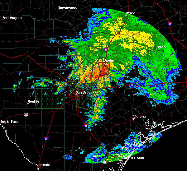 At 847 am cdt, a severe thunderstorm capable of producing a tornado was located over mustang ridge, or 9 miles southeast of tanglewood forest, moving north at 25 mph (radar indicated rotation). Hazards include tornado and quarter size hail. Flying debris will be dangerous to those caught without shelter. mobile homes will be damaged or destroyed. damage to roofs, windows and vehicles will occur. tree damage is likely. this dangerous storm will be near, austin and buda around 855 am cdt. onion creek around 905 am cdt. austin bergstrom int ap, tanglewood forest and shady hollow around 910 am cdt. west lake hills and rollingwood around 915 am cdt. Other locations impacted by this tornadic thunderstorm include del valle, maha, pilot knob, lost creek, sunset valley, mendoza, creedmoor, manchaca and san leanna. At 847 am cdt, a severe thunderstorm capable of producing a tornado was located over mustang ridge, or 9 miles southeast of tanglewood forest, moving north at 25 mph (radar indicated rotation). Hazards include tornado and quarter size hail. Flying debris will be dangerous to those caught without shelter. mobile homes will be damaged or destroyed. damage to roofs, windows and vehicles will occur. tree damage is likely. this dangerous storm will be near, austin and buda around 855 am cdt. onion creek around 905 am cdt. austin bergstrom int ap, tanglewood forest and shady hollow around 910 am cdt. west lake hills and rollingwood around 915 am cdt. Other locations impacted by this tornadic thunderstorm include del valle, maha, pilot knob, lost creek, sunset valley, mendoza, creedmoor, manchaca and san leanna.
|
| 10/30/2015 8:21 AM CDT |
 At 821 am cdt, a severe thunderstorm was located over san marcos, moving northeast at 25 mph (radar indicated). Hazards include 60 mph wind gusts. Expect damage to roofs. Siding and trees. At 821 am cdt, a severe thunderstorm was located over san marcos, moving northeast at 25 mph (radar indicated). Hazards include 60 mph wind gusts. Expect damage to roofs. Siding and trees.
|
| 10/30/2015 7:07 AM CDT |
 At 707 am cdt, a severe thunderstorm was located over geronimo, or near seguin, moving north at 40 mph (radar indicated). Hazards include 60 mph wind gusts and penny size hail. Expect damage to roofs. Siding and trees. At 707 am cdt, a severe thunderstorm was located over geronimo, or near seguin, moving north at 40 mph (radar indicated). Hazards include 60 mph wind gusts and penny size hail. Expect damage to roofs. Siding and trees.
|
| 5/29/2015 1:21 AM CDT | At 121 am cdt, severe thunderstorms were located along a line extending from near bartlett to near austin bergstrom int ap to near staples, moving east at 50 mph (radar indicated). Hazards include 60 mph wind gusts. Expect damage to roofs. siding and trees. Locations impacted include, austin, round rock, cedar park, georgetown, pflugerville, san marcos, taylor, elgin, wimberley, dripping springs, granger, windemere, tanglewood forest, anderson mill, serenada, austin bergstrom int ap, kyle, leander, hutto and lakeway. |
| 5/29/2015 12:45 AM CDT | Large tree down in williamson county TX, 12 miles SSE of Austin, TX |
| 5/29/2015 12:44 AM CDT | At 1244 am cdt, severe thunderstorms were located along a line extending from 6 miles northeast of florence to barton creek to near canyon lake dam, moving east at 40 mph (radar indicated). Hazards include 60 mph wind gusts. Expect damage to roofs. siding and trees. Locations impacted include, austin, round rock, cedar park, georgetown, pflugerville, san marcos, taylor, elgin, wimberley, dripping springs, granger, windemere, tanglewood forest, anderson mill, serenada, austin bergstrom int ap, kyle, leander, hutto and lakeway. |
| 5/29/2015 12:03 AM CDT | At 1203 am cdt, severe thunderstorms were located along a line extending from 6 miles southwest of kempner to near spicewood to near twin sisters, moving east at 50 mph (radar indicated). Hazards include 60 mph wind gusts and penny size hail. Expect damage to roofs. Siding and trees. |
| 5/28/2015 2:11 PM CDT | The severe thunderstorm warning for south central travis county will expire at 215 pm cdt, the storm which prompted the warning has weakened below severe limits and exited the warned area. therefore the warning will be allowed to expire. however gusty winds and heavy rain are still possible with this thunderstorm. |
| 5/28/2015 1:54 PM CDT | At 153 pm cdt, a severe thunderstorm was located over onion creek, or over tanglewood forest, moving north at 25 mph (radar indicated). Hazards include 60 mph wind gusts. Expect damage to roofs. siding and trees. Locations impacted include, austin, austin bergstrom int ap, tanglewood forest, onion creek, shady hollow, barton creek, sunset valley, san leanna, creedmoor, pilot knob and manchaca. |
| 5/28/2015 1:40 PM CDT | At 139 pm cdt, a severe thunderstorm was located over buda, or near tanglewood forest, moving north at 25 mph (radar indicated). Hazards include 60 mph wind gusts. Expect damage to roofs. siding and trees. Locations impacted include, austin, austin bergstrom int ap, tanglewood forest, buda, mustang ridge, niederwald, bear creek, shady hollow, onion creek, barton creek, sunset valley, mountain city, san leanna, hays, creedmoor, maha, pilot knob and manchaca. |
| 5/28/2015 1:24 PM CDT | At 124 pm cdt, a severe thunderstorm was located over kyle, or 8 miles north of san marcos, moving north at 25 mph (radar indicated). Hazards include 60 mph wind gusts. Expect damage to roofs. Siding and trees. |
| 5/27/2015 11:15 AM CDT | At 1114 am cdt, a severe thunderstorm was located near sunset valley, moving north at 5 mph (radar indicated). Hazards include quarter size hail. damage to vehicles is expected |
| 5/27/2015 11:08 AM CDT | At 1107 am cdt, a severe thunderstorm was located near barton creek, or near tanglewood forest, moving north at 5 mph (radar indicated). Hazards include quarter size hail. Damage to vehicles is expected. Locations impacted include, austin, tanglewood forest, lakeway, bee cave, west lake hills, the hills, rollingwood, bear creek, shady hollow, barton creek, onion creek, mansfield dam, hudson bend, sunset valley, san leanna, lost creek, manchaca and camp mabry. |
| 5/27/2015 10:45 AM CDT | At 1043 am cdt, a severe thunderstorm was located near barton creek, or near tanglewood forest, moving north at 10 mph (public reported quarter sized hail near tanglewood forest). Hazards include quarter size hail. Damage to vehicles is expected. Locations impacted include, austin, tanglewood forest, lakeway, bee cave, west lake hills, the hills, rollingwood, bear creek, shady hollow, barton creek, onion creek, mansfield dam, hudson bend, sunset valley, san leanna, lost creek, manchaca and camp mabry. |
| 5/27/2015 10:39 AM CDT | Quarter sized hail reported 10.1 miles NE of Austin, TX, quarter sized hail reported at the intersection of slaughter ln and escarpment blvd. |
| 5/27/2015 10:30 AM CDT | At 1030 am cdt, a severe thunderstorm was located over tanglewood forest, moving north at 10 mph (radar indicated). Hazards include quarter size hail. damage to vehicles is expected |
| 5/25/2015 4:30 PM CDT | At 429 pm cdt, a severe thunderstorm capable of producing a tornado was located over cedar creek, or 10 miles southeast of austin bergstrom int ap, moving northeast at 25 mph (radar indicated rotation). Hazards include tornado. Flying debris will be dangerous to those caught without shelter. mobile homes will be damaged or destroyed. damage to roofs, windows and vehicles will occur. tree damage is likely. Locations impacted include, wyldwood, cedar creek, camp swift, webberville and phelan. |
| 5/25/2015 4:21 PM CDT | At 421 pm cdt, a severe thunderstorm capable of producing a tornado was located near cedar creek, or 11 miles southeast of austin bergstrom int ap, moving northeast at 35 mph (radar indicated rotation). Hazards include tornado. Flying debris will be dangerous to those caught without shelter. mobile homes will be damaged or destroyed. damage to roofs, windows and vehicles will occur. Tree damage is likely. |
| 5/25/2015 4:10 PM CDT | At 410 pm cdt, a severe thunderstorm was located over pflugerville, moving northeast at 25 mph (radar indicated). Hazards include 60 mph wind gusts and quarter size hail. Hail damage to vehicles is expected. expect wind damage to roofs, siding and trees. locations impacted include, austin, pflugerville, taylor, elgin, windemere, hutto, manor, coupland, beyarsville, rices crossing and wells branch. A tornado watch remains in effect until 1000 pm cdt for south central texas. |
| 5/25/2015 3:58 PM CDT | Quarter sized hail reported 8.8 miles S of Austin, TX, nickel to quarter size hail |
| 5/25/2015 3:38 PM CDT | At 338 pm cdt, severe thunderstorms were located along a line extending from near thrall to near pflugerville, moving east at 15 mph (radar indicated). Hazards include 60 mph wind gusts and quarter size hail. Hail damage to vehicles is expected. Expect wind damage to roofs, siding and trees. |
| 5/25/2015 3:30 PM CDT | At 330 pm cdt, a severe thunderstorm capable of producing a tornado was located near west lake hills moving northeast at 30 mph (radar indicated rotation). Hazards include tornado. Flying debris will be dangerous to those caught without shelter. mobile homes will be damaged or destroyed. damage to roofs, windows and vehicles will occur. tree damage is likely. this dangerous storm will be near, cedar park and anderson mill around 335 pm cdt. windemere around 345 pm cdt. Other locations impacted by this tornadic thunderstorm include wells branch, lost creek, camp mabry and jollyville. |
| 5/25/2015 3:16 PM CDT | At 315 pm cdt, a severe thunderstorm capable of producing a tornado was located over mansfield dam, or 9 miles west of austin, moving northeast at 30 mph (radar indicated rotation). Hazards include tornado. Flying debris will be dangerous to those caught without shelter. mobile homes will be damaged or destroyed. damage to roofs, windows and vehicles will occur. tree damage is likely. this dangerous storm will be near, barton creek around 320 pm cdt. west lake hills and hudson bend around 325 pm cdt. rollingwood around 330 pm cdt. cedar park and anderson mill around 335 pm cdt. windemere around 345 pm cdt. Other locations impacted by this tornadic thunderstorm include wells branch, lost creek, camp mabry and jollyville. |
| 5/25/2015 3:05 PM CDT | At 305 pm cdt, a severe thunderstorm capable of producing a tornado was located near bee cave, or 7 miles northeast of dripping springs, moving northeast at 35 mph (radar indicated rotation). Hazards include tornado. Flying debris will be dangerous to those caught without shelter. mobile homes will be damaged or destroyed. damage to roofs, windows and vehicles will occur. tree damage is likely. this dangerous storm will be near, bee cave around 310 pm cdt. Lakeway and the hills around 315 pm cdt. |
| 5/25/2015 2:42 PM CDT | At 242 pm cdt, a severe thunderstorm capable of producing a tornado was located over georgetown dam, or near georgetown, moving northeast at 35 mph (radar indicated rotation). Hazards include tornado and quarter size hail. Flying debris will be dangerous to those caught without shelter. mobile homes will be damaged or destroyed. damage to roofs, windows and vehicles will occur. tree damage is likely. this dangerous storm will be near, georgetown dam and sun city around 245 pm cdt. serenada around 250 pm cdt. georgetown around 255 pm cdt. weir around 300 pm cdt. jarrell around 305 pm cdt. granger and bartlett around 315 pm cdt. Other locations impacted by this tornadic thunderstorm include sandoval, walburg, hoxie, jonah, schwertner, waterloo, theon and brushy creek. |
| 5/25/2015 2:38 PM CDT | At 238 pm cdt, a severe thunderstorm capable of producing a tornado was located near henly, or near dripping springs, moving northeast at 30 mph (radar indicated rotation). Hazards include tornado. Flying debris will be dangerous to those caught without shelter. mobile homes will be damaged or destroyed. damage to roofs, windows and vehicles will occur. tree damage is likely. this dangerous storm will be near, bee cave around 300 pm cdt. lakeway and the hills around 305 pm cdt. lago vista and mansfield dam around 310 pm cdt. hudson bend around 315 pm cdt. Other locations impacted by this tornadic thunderstorm include briarcliff and lost creek. |
| 5/25/2015 2:29 PM CDT | At 228 pm cdt, a severe thunderstorm capable of producing a tornado was located over henly, or 7 miles west of dripping springs, moving northeast at 30 mph (radar indicated rotation). Hazards include tornado. Flying debris will be dangerous to those caught without shelter. mobile homes will be damaged or destroyed. damage to roofs, windows and vehicles will occur. tree damage is likely. this dangerous storm will be near, dripping springs around 240 pm cdt. lakeway, bee cave and the hills around 300 pm cdt. mansfield dam and barton creek around 305 pm cdt. lago vista and hudson bend around 310 pm cdt. Other locations impacted by this tornadic thunderstorm include briarcliff and lost creek. |
| 5/25/2015 2:09 PM CDT | At 208 pm cdt, a severe thunderstorm capable of producing a tornado was located near lago vista, or 10 miles west of cedar park, moving northeast at 35 mph (radar indicated rotation). Hazards include tornado and golf ball size hail. Flying debris will be dangerous to those caught without shelter. mobile homes will be damaged or destroyed. damage to roofs, windows and vehicles will occur. tree damage is likely. this dangerous storm will be near, leander and liberty hill around 225 pm cdt. round rock around 240 pm cdt. georgetown, serenada, sun city and georgetown dam around 245 pm cdt. Other locations impacted by this tornadic thunderstorm include jonestown, seward junction and brushy creek. |
| 5/25/2015 1:59 PM CDT | At 159 pm cdt, a severe thunderstorm capable of producing a tornado was located near lago vista, or 13 miles west of cedar park, moving northeast at 35 mph (radar indicated rotation). Hazards include tornado and golf ball size hail. Flying debris will be dangerous to those caught without shelter. mobile homes will be damaged or destroyed. damage to roofs, windows and vehicles will occur. tree damage is likely. this dangerous storm will be near, liberty hill around 220 pm cdt. leander around 225 pm cdt. round rock, sun city and georgetown dam around 240 pm cdt. georgetown, serenada and weir around 245 pm cdt. Other locations impacted by this tornadic thunderstorm include jonestown, briarcliff, jonah, seward junction and brushy creek. |
| 5/25/2015 1:51 PM CDT | At 151 pm cdt, a severe thunderstorm was located near spicewood, or 12 miles southeast of marble falls, moving northeast at 20 mph (radar indicated). Hazards include golf ball size hail and 60 mph wind gusts. People and animals outdoors will be injured. expect hail damage to roofs, siding, windows and vehicles. Expect wind damage to roofs, siding and trees. |
| 5/23/2015 10:49 PM CDT | Trees blown down on old manor rd in travis county TX, 3.5 miles W of Austin, TX |
| 5/23/2015 9:45 PM CDT | At 944 pm cdt, severe thunderstorms were located along a line extending from windemere to 6 miles east of austin bergstrom int ap to near lockhart, moving northeast at 45 mph. at 933 pm a wind gust of 75 mph was reported at austin bergstrom international airport (trained weather spotters). Hazards include 70 mph wind gusts. Expect considerable tree damage. damage is likely to mobile homes, roofs and outbuildings. locations impacted include, austin, pflugerville, lockhart, elgin, bastrop, windemere, austin bergstrom int ap, tanglewood forest, buda, manor, west lake hills, rollingwood, martindale, uhland, mustang ridge, niederwald, cedar creek, barton creek, wyldwood and camp swift. A tornado watch remains in effect until 300 am cdt for south central texas. |
| 5/23/2015 9:43 PM CDT | Power lines blown down on rutherford ln near furnace drive in travis county TX, 5.7 miles SW of Austin, TX |
| 5/23/2015 9:43 PM CDT | There was a partial roof collapse at an apartment building near tech ridge blvd and i-3 in travis county TX, 8.8 miles SSW of Austin, TX |
| 5/23/2015 9:42 PM CDT | Power lines blown down in the 10200 block of north ih 35 service road in travis county TX, 6.6 miles SW of Austin, TX |
| 5/23/2015 9:39 PM CDT | At 939 pm cdt, severe thunderstorms were located along a line extending from florence to near anderson mill, moving east at 35 mph (radar indicated). Hazards include 70 mph wind gusts. Expect considerable tree damage. Damage is likely to mobile homes, roofs and outbuildings. |
| 5/23/2015 9:30 PM CDT | Damage to building. vans pushed across parking lo in travis county TX, 6.2 miles SW of Austin, TX |
| 5/23/2015 9:30 PM CDT | Storm damage reported in travis county TX, 7.9 miles NW of Austin, TX |
| 5/23/2015 9:30 PM CDT | Storm damage reported in travis county TX, 7.9 miles NW of Austin, TX |
| 5/23/2015 9:22 PM CDT | The tornado warning for west central travis county will expire at 930 pm cdt, the tornado threat has diminished, therefore the tornado warning has been cancelled. however, damaging winds remain likely and a severe thunderstorm warning remains in effect for the area. a tornado watch remains in effect until 300 am cdt for south central texas. |
| 5/23/2015 9:16 PM CDT | At 916 pm cdt, severe thunderstorms were located along a line extending from barton creek to near niederwald to near staples, moving northeast at 45 mph (radar indicated). Hazards include 60 mph wind gusts. Expect damage to roofs. Siding and trees. |
| 5/23/2015 9:08 PM CDT | At 908 pm cdt, a severe thunderstorm capable of producing a tornado was located near bee cave, or 8 miles northeast of dripping springs, moving northeast at 45 mph (radar indicated rotation). Hazards include tornado. Flying debris will be dangerous to those caught without shelter. mobile homes will be damaged or destroyed. damage to roofs, windows and vehicles will occur. tree damage is likely. this dangerous storm will be near, lakeway and mansfield dam around 915 pm cdt. Other locations impacted by this tornadic thunderstorm include lost creek. |
| 5/23/2015 8:59 PM CDT | At 859 pm cdt, a severe thunderstorm capable of producing a tornado was located near dripping springs, moving northeast at 40 mph (radar indicated rotation). Hazards include tornado. Flying debris will be dangerous to those caught without shelter. mobile homes will be damaged or destroyed. damage to roofs, windows and vehicles will occur. tree damage is likely. this dangerous storm will be near, bee cave around 910 pm cdt. lakeway, the hills, mansfield dam and barton creek around 915 pm cdt. west lake hills and rollingwood around 920 pm cdt. Other locations impacted by this tornadic thunderstorm include lost creek, sunset valley and camp mabry. |
| 5/23/2015 8:55 PM CDT | At 855 pm cdt, a severe thunderstorm capable of producing a tornado was located over dripping springs, moving northeast at 50 mph (radar indicated rotation). Hazards include tornado. Flying debris will be dangerous to those caught without shelter. mobile homes will be damaged or destroyed. damage to roofs, windows and vehicles will occur. tree damage is likely. this dangerous storm will be near, bee cave and bear creek around 905 pm cdt. tanglewood forest, lakeway, mansfield dam and shady hollow around 910 pm cdt. west lake hills, rollingwood and barton creek around 915 pm cdt. austin around 930 pm cdt. Other locations impacted by this tornadic thunderstorm include lost creek, sunset valley and camp mabry. |
| 5/23/2015 8:35 PM CDT | At 835 pm cdt, a severe thunderstorm was located near henly, or 8 miles west of dripping springs, moving northeast at 30 mph (radar indicated). Hazards include 60 mph wind gusts. Expect damage to roofs. siding and trees. locations impacted include, austin, cedar park, wimberley, dripping springs, tanglewood forest, lakeway, lago vista, bee cave, west lake hills, the hills, woodcreek, rollingwood, bear creek, pedernales falls state park, barton creek, driftwood, henly, hudson bend, shady hollow and mansfield dam. A tornado watch remains in effect until 300 am cdt for south central texas. |
| 5/23/2015 8:04 PM CDT | At 803 pm cdt, a severe thunderstorm was located near dripping springs, moving northeast at 20 mph (radar indicated). Hazards include 60 mph wind gusts and quarter size hail. Hail damage to vehicles is expected. Expect wind damage to roofs, siding and trees. |
| 5/13/2015 12:33 PM CDT | Wind gusts estimated at 30mph broke off small tree branches in travis county TX, 8 miles NNE of Austin, TX |
| 4/27/2015 2:30 AM CDT | At 230 am cdt, severe thunderstorms were located along a line extending from 8 miles northwest of fedor to rosanky to 8 miles east of gonzales, moving east at 50 mph (radar indicated). Hazards include 60 mph wind gusts. Expect damage to roofs. Siding and trees. |
| 4/27/2015 2:16 AM CDT | At 215 am cdt, severe thunderstorms were located along a line extending from 7 miles southeast of rogers to near palmeto to near stockdale to near floresville to near poteet to 6 miles west of schattel to 8 miles east of dilley, and are nearly stationary (radar indicated). Hazards include 60 mph wind gusts and penny size hail. Expect damage to roofs. siding and trees. locations impacted include, san antonio, austin, new braunfels, pflugerville, san marcos, seguin, taylor, lockhart, pearsall, pleasanton, elgin, gonzales, bastrop, crystal city, floresville, luling, giddings, dilley, jourdanton and smithville. a tornado watch remains in effect until 900 am cdt for south central texas. 0. 75in. |
| 4/27/2015 1:58 AM CDT | At 157 am cdt, severe thunderstorms were located along a line extending from near cameron to 9 miles south of cedar creek to near sutherland springs to near elmendorf to near bigfoot to pearsall to dilley, moving east at 55 mph (radar indicated). Hazards include 60 mph wind gusts and penny size hail. Expect damage to roofs. siding and trees. locations impacted include, san antonio, austin, round rock, new braunfels, cedar park, georgetown, pflugerville, san marcos, seguin, universal city, taylor, lockhart, pearsall, pleasanton, elgin, gonzales, bastrop, crystal city, floresville and luling. a tornado watch remains in effect until 900 am cdt for south central texas. 0. 75in. |
| 4/27/2015 1:40 AM CDT | Several 4 inch diameter tree limbs were blown down. reported by former nws employee. time estimated from rada in travis county TX, 1.2 miles S of Austin, TX |
| 4/27/2015 1:38 AM CDT | At 137 am cdt, severe thunderstorms were located along a line extending from near bartlett to zorn to near somerset to moore to 9 miles east of batesville to near brundage, moving east at 50 mph (radar indicated). Hazards include 60 mph wind gusts and penny size hail. Expect damage to roofs. Siding and trees. |
| 4/27/2015 1:33 AM CDT | Tree down blocking roadway near intersection of westgate blvd and cohoba dr. time estimated from radar in travis county TX, 8.9 miles NE of Austin, TX |
| 4/27/2015 1:05 AM CDT | At 103 am cdt, severe thunderstorms were located along a line extending from near watson to near canyon lake to near fair oaks ranch to near lacoste to near yancey, and are nearly stationary. these are very dangerous storms (radar indicated). Hazards include 80 mph wind gusts and penny size hail. the strongest winds will impact medina, bexar and comal counties. Flying debris will be dangerous to those caught without shelter. mobile homes will be heavily damaged. expect considerable damage to roofs, windows and vehicles. extensive tree damage and power outages are likely. locations impacted include, san antonio, austin, round rock, new braunfels, cedar park, georgetown, pflugerville, san marcos, seguin, universal city, taylor, boerne, hondo, kingsland, marble falls, burnet, castroville, comfort, wimberley and dripping springs. 0. 75in. |
| 4/27/2015 12:44 AM CDT | At 1243 am cdt, severe thunderstorms were located along a line extending from near lake victor to near guadalupe river state park to near pipe creek to quihi to 9 miles southeast of sabinal, moving east at 45 mph (radar indicated). Hazards include 70 mph wind gusts and penny size hail. Expect considerable tree damage. Damage is likely to mobile homes, roofs and outbuildings. |
| 4/18/2015 9:35 PM CDT | At 930 pm cdt, a severe thunderstorm was located near austin bergstrom int ap, moving east at 45 mph (trained weather spotters have reported estimated wind gusts up to 60 mph, with a 54 mph wind gust observed 2 miles se mansfield dam at 914 pm. hail up to one inch in diameter has been reported by several members of the public and media in the last 20 minutes). Hazards include 70 mph wind gusts and half dollar size hail. Hail damage to vehicles is expected. expect considerable tree damage. wind damage is also likely to mobile homes, roofs and outbuildings. locations impacted include, austin, austin bergstrom int ap, tanglewood forest, manor, west lake hills, rollingwood, mustang ridge, barton creek, onion creek, shady hollow, sunset valley, san leanna, creedmoor, del valle, maha, pilot knob, lost creek and camp mabry. 1. 25in. |
| 4/18/2015 9:26 PM CDT | Storm damage reported in travis county TX, 1.2 miles S of Austin, TX |
| 4/18/2015 9:25 PM CDT | Tree blown down on steck ave one quarter mile east of mopac blvd in travis county TX, 10.2 miles SSE of Austin, TX |
| 4/18/2015 9:13 PM CDT | At 912 pm cdt, a severe thunderstorm was located over barton creek, or near austin, moving east at 40 mph (trained weather spotters). Hazards include two inch hail and 60 mph wind gusts. two inch hail has been reported at steiner ranch in travis county. People and animals outdoors will be injured. expect hail damage to roofs, siding, windows and vehicles. Expect wind damage to roofs, siding and trees. |
| 4/18/2015 9:10 PM CDT | Hen Egg sized hail reported 10.2 miles ESE of Austin, TX |
| 4/18/2015 9:04 PM CDT | At 902 pm cdt, a severe thunderstorm was located over barton creek, or 8 miles northwest of tanglewood forest, moving east at 35 mph (trained weather spotters reported quarter size hail 5 miles east of cypress mill). Hazards include golf ball size hail and 60 mph wind gusts. People and animals outdoors will be injured. expect hail damage to roofs, siding, windows and vehicles. expect wind damage to roofs, siding and trees. locations impacted include, austin, dripping springs, tanglewood forest, lakeway, buda, lago vista, bee cave, west lake hills, the hills, rollingwood, bear creek, hudson bend, shady hollow, barton creek, mansfield dam, jonestown, briarcliff, sunset valley, hays and lost creek. 1. 75in. |
| 4/18/2015 8:44 PM CDT | At 840 pm cdt, a severe thunderstorm was located near pedernales falls state park, or 11 miles northwest of dripping springs, moving east at 35 mph (radar indicated. at 825 pm quarter size hail was reported 2 miles ese of sandy). Hazards include golf ball size hail and 60 mph wind gusts. People and animals outdoors will be injured. expect hail damage to roofs, siding, windows and vehicles. Expect wind damage to roofs, siding and trees. |
| 6/12/2014 10:00 PM CDT | Numerous trees blown down... rows of fences blown ove in travis county TX, 13.1 miles ENE of Austin, TX |
| 5/27/2014 8:35 PM CDT | Hen Egg sized hail reported 11.6 miles NNE of Austin, TX |
| 5/27/2014 8:26 PM CDT | Ping Pong Ball sized hail reported 9.3 miles ENE of Austin, TX |
| 5/27/2014 8:19 PM CDT | Golf Ball sized hail reported 10.1 miles ENE of Austin, TX |
| 5/27/2014 8:17 PM CDT | Quarter sized hail reported 9.8 miles E of Austin, TX |
| 5/27/2014 8:15 PM CDT | Ping Pong Ball sized hail reported 12.8 miles ENE of Austin, TX |
| 5/27/2014 8:02 PM CDT | Quarter sized hail reported 12.9 miles ESE of Austin, TX |
| 4/27/2014 6:18 PM CDT | Half Dollar sized hail reported 14.1 miles NW of Austin, TX, hail damaged plastic patio cover. |
| 4/14/2014 11:00 AM CDT | Half Dollar sized hail reported 6.8 miles NW of Austin, TX |
| 4/14/2014 10:58 AM CDT | Quarter sized hail reported 6.6 miles NNE of Austin, TX, nickel to quarter sized hail |
| 4/14/2014 10:54 AM CDT | Quarter sized hail reported 5.4 miles NW of Austin, TX, near del valle |
| 4/14/2014 10:54 AM CDT | Golf Ball sized hail reported 5.4 miles NW of Austin, TX, golf ball sized hail near del valle |
| 4/14/2014 10:51 AM CDT | Golf Ball sized hail reported 1.2 miles S of Austin, TX, near austin community college |
| 4/14/2014 10:44 AM CDT | Quarter sized hail reported 7.4 miles NNE of Austin, TX |
| 3/28/2014 4:52 PM CDT | Quarter sized hail reported 6.4 miles NW of Austin, TX |
| 3/28/2014 4:52 PM CDT | Quarter sized hail reported 5.3 miles WSW of Austin, TX |
| 3/28/2014 4:45 PM CDT | Quarter sized hail reported 5.7 miles SW of Austin, TX |
| 3/28/2014 4:45 PM CDT | Quarter sized hail reported 7.6 miles SW of Austin, TX |
| 3/28/2014 4:44 PM CDT | Golf Ball sized hail reported 5.5 miles SSW of Austin, TX |
| 3/28/2014 4:42 PM CDT | Golf Ball sized hail reported 4.4 miles SW of Austin, TX |
| 3/28/2014 4:38 PM CDT | Quarter sized hail reported 5.4 miles S of Austin, TX, nickel to quarter size hail |
| 3/28/2014 4:35 PM CDT | Quarter sized hail reported 5 miles SE of Austin, TX, 1 inch hail at spicewood springs and mopac |
| 3/28/2014 4:35 PM CDT | Quarter sized hail reported 8.2 miles S of Austin, TX, hail stones ranging from pea size to one inch occurring on and off for more than five minutes |
| 3/28/2014 4:33 PM CDT | Quarter sized hail reported 6.7 miles S of Austin, TX |
| 3/28/2014 4:30 PM CDT | Golf Ball sized hail reported 10.9 miles S of Austin, TX |
| 3/28/2014 4:30 PM CDT | Quarter sized hail reported 7.9 miles SSW of Austin, TX |
| 3/28/2014 4:30 PM CDT | Quarter sized hail reported 5.4 miles S of Austin, TX |
| 3/28/2014 4:15 PM CDT | Half Dollar sized hail reported 9.6 miles SE of Austin, TX |
| 9/4/2013 7:50 PM CDT | Public reports via twitter of trees and limbs down in the grand oaks neighborhood of south austin. trees and limbs varied in size from 6-12 inch diamete in travis county TX, 8.3 miles NNE of Austin, TX |
| 7/27/2013 12:25 AM CDT | Storm damage reported in travis county TX, 6.1 miles NW of Austin, TX |
| 5/10/2013 7:40 PM CDT | Quarter sized hail reported 6.1 miles NE of Austin, TX, nickel to quarter inch hail |
| 5/10/2013 7:35 PM CDT | Quarter sized hail reported 6.8 miles NNE of Austin, TX, quarter size hail |
| 4/2/2013 5:10 PM CDT | Storm damage reported in travis county TX, 9 miles ENE of Austin, TX |
| 3/20/2013 2:56 AM CDT | Ping Pong Ball sized hail reported 9.1 miles SSW of Austin, TX, relayed via partner social media page. |
| 3/20/2013 2:45 AM CDT | Ping Pong Ball sized hail reported 9.2 miles SSW of Austin, TX, nickel to ping pong ball sized hail. |
| 3/20/2013 2:40 AM CDT | Quarter sized hail reported 11.5 miles SSE of Austin, TX |
| 3/20/2013 2:35 AM CDT | Ping Pong Ball sized hail reported 10.9 miles S of Austin, TX |
| 7/13/2012 4:30 PM CDT | Delayed report from yesterday. high winds blew down 4 mature trees and snapped numerous limb in travis county TX, 10.4 miles SSE of Austin, TX |
| 7/9/2012 6:25 PM CDT | Ping Pong Ball sized hail reported 10.9 miles S of Austin, TX, wind gusts 60-70mph also reported |
| 5/7/2012 7:50 PM CDT | Nickel size hail and wind gusts from 50 mph to 60 mp in travis county TX, 7.4 miles S of Austin, TX |
| 1/1/0001 12:00 AM | Half Dollar sized hail reported 1.2 miles S of Austin, TX, half dollar hail... over 1.75 inches of rain in 30 mins... and small tree limbs broken in austin. |
| 1/1/0001 12:00 AM | Golf Ball sized hail reported 6.8 miles S of Austin, TX, golfball size hail near mopac and braker. |
| 1/1/0001 12:00 AM | Golf Ball sized hail reported 5.5 miles ESE of Austin, TX, golfball size hail near mopac and breaker. |
| 5/25/2011 5:07 AM CDT | Ping Pong Ball sized hail reported 4.9 miles SSW of Austin, TX, quarter to half dollar size hail |
| 5/25/2011 5:05 AM CDT | Quarter sized hail reported 4.9 miles SSW of Austin, TX |
| 1/1/0001 12:00 AM | Media relayed report from public of tree damage in the allendale neighborhoo in travis county TX, 8.1 miles S of Austin, TX |
| 1/1/0001 12:00 AM | Large tree limbs and branches blown down in travis county TX, 7.9 miles NE of Austin, TX |
| 1/1/0001 12:00 AM | Pea to nickel size hail in travis county TX, 11.7 miles WSW of Austin, TX |
| 5/12/2011 8:55 AM CDT | Quarter sized hail reported 9.5 miles NNE of Austin, TX |
Hail Maps for Austin, TX


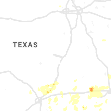


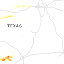


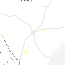


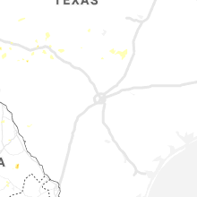


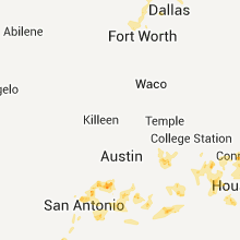


Connect with Interactive Hail Maps